



Lesson Planet
Search educational resources
  • Sign In Try It Free
  • AI Teacher Tools
    • Discover Resources Search reviewed educational resources by keyword, subject, grade, type, and more
    • Curriculum Manager (My Content) Manage saved and uploaded resources and folders To Access the Curriculum Manager Sign In or Join Now
    • Browse Resource Directory Browse educational resources by subject and topic
    • Curriculum Calendar Explore curriculum resources by date
    • Lesson Planning Articles Timely and inspiring teaching ideas that you can apply in your classroom
    • Our Story
    • Frequently Asked Questions
    • Testimonials
    • Contact Us
  • Pricing
  • School Access
    • Your school or district can sign up for Lesson Planet — with no cost to teachers
      Learn More
  • Sign In
  • Try It Free

Hi, what do you want to do?

Create a lesson plan
Generate resources with 80+ AI teacher tools
Search 200,000 instructional videos
Find a teaching resource
The Johns Hopkins University: New Mexico State Maps HandoutThe Johns Hopkins University: New Mexico State Maps Handout
Publisher
Johns Hopkins University
Resource Details
Curator Rating
Educator Rating
Not yet Rated
Grade
9th - 10th
Subjects
Social Studies & History
2 more...
Resource Type
Handouts & References
Audiences
For Administrator Use
2 more...
Lexile Measures
0L
Handout

The Johns Hopkins University: New Mexico State Maps

Curated by ACT

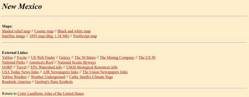
This site from The Johns Hopkins University Applied Physics Laboratory contains several New Mexico geographical maps. It is very informative. Use this site to view a historical perspective with the 1859 map.

3 Views 0 Downloads

Concepts

new mexico

Additional Tags

new mexico geography, new mexico map, geography and natural resources of new mexico

Classroom Considerations

  • This resource is only available on an unencrypted HTTP website.It should be fine for general use, but don’t use it to share any personally identifiable information

See similar resources:

Handout

The Johns Hopkins University: New Jersey State Maps

Johns Hopkins University
This site from The Johns Hopkins University Applied Physics Laboratory provides maps to the State of New Jersey. These New Jersey state maps are extremely informative.
9th - 10th Social Studies & History
Handout

The Johns Hopkins University: New York State Maps

Johns Hopkins University
This site on maps is provided for by The Johns Hopkins University Applied Physics Laboratory. Have you ever wondered what New York state looks like from a satellite image? Find out by using this website. There are several other maps to...
9th - 10th Social Studies & History
Handout

The Johns Hopkins University: South Carolina State Maps

Johns Hopkins University
At this site from The Johns Hopkins University Applied Physics Laboratory, you can learn more about this fascinating state through various types of maps. This site contains links to a shaded relief map, county map, black and white map,...
9th - 10th Social Studies & History
Handout

The Johns Hopkins University: North Carolina State Maps

Johns Hopkins University
Use this site from The Johns Hopkins University Applied Physics Laboratory that highlights several different map types. You can find anything from a shaded relief map to a North Carolina county map. Find out about North Carolina in 1859,...
9th - 10th Social Studies & History
Handout

The Johns Hopkins University: West Virginia State Maps

Johns Hopkins University
This site from The Johns Hopkins University Applied Physics Laboratory contains a black and white map, a county map, a satellite image map, a shaded relief map. Check out West Virginia's landforms.
9th - 10th Social Studies & History
Instructional Video

New Mexico and Las Gorras Blancas

PBS
Fence cutters, lost land, and cattle ranchers. The video explains the plight of Hispanic Americans when New Mexico became a state. The video also shows young historians why New Mexico's statehood was less violent than that of Texas.
7 mins 4th - 12th Social Studies & History
Handout

Johns Hopkins University: Rhode Island State Maps

Johns Hopkins University
This site from the Johns Hopkins University Applied Physics Laboratory contains links to a shaded relief map, county map, black and white map, satellite image, 1895 map, and a PostScript map.
9th - 10th Social Studies & History
Unit Plan

Enchanted Learning: New Mexico

Enchanted Learning
This site has a colorful display of information about New Mexico. It contains a map, pictures, a list of state symbols, and links to related information.
9th - 10th Social Studies & History
Handout

The Johns Hopkins University: Kansas State Maps

Johns Hopkins University
At this site from The Johns Hopkins University Applied Physics Laboratory, you can learn more about the great state of Kansas through its geography. You can learn a lot of information by studying maps. Different types of maps can give...
9th - 10th Social Studies & History
Handout

The Johns Hopkins University: Nebraska State Maps

Johns Hopkins University
At this site from The Johns Hopkins University Applied Physics Laboratory, you can learn more about Nebraska through these informative state maps. The 1895 map gives a historical perspective.
9th - 10th Social Studies & History
Try It Free
© 1999-2026 Learning Explorer, Inc.
Teacher Lesson Plans, Worksheets and Resources

Sign up for the Lesson Planet Monthly Newsletter

Open Educational Resources (OER)

  • Health
  • Language Arts
  • Languages
  • Math
  • Physical Education
  • Science
  • Social Studies
  • Special Education
  • Visual and Performing Arts
View All Lesson Plans

Discover Resources

  • Our Review Process
  • How it Works
  • How to Search
  • Create a Collection

Manage Curriculum

  • Edit a Collection
  • Assign to Students
  • Manage My Content
Contact Us Site Map Privacy Policy Terms of Use