Curated OER
German Cities Map Quiz
In this online interactive geography quiz activity, students examine the map that includes 12 German cities. Students identify the names of the cities in 3 minutes.
Curated OER
Regions of Countries Quiz
In this online interactive geography quiz worksheet, students examine the chart that includes details about 20 world regions. Students identify the names of the countries where the regions are located in 4 minutes.
Curated OER
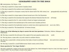
GEOGRAPHY GOES TO THE DOGS
Students use countries and dogs from around the world to answer the questions.
Curated OER
Literature
Students listen and respond to poems about rain. Then they review the continent of Asia and the country of Japan. They listen to a Japanese folktale about a peach boy. Next they listen to a story from Germany about musicians.
Curated OER
Which Country?
In this geography worksheet, students study the names of 60 countries. Students indicate their home country by coloring its name in the word grid puzzle. Students then answer 8 questions about their country concerning what language is...
Curated OER
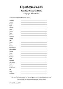
Languages of the World 2
In this geography worksheet, students investigate the languages spoken in different countries of the world. Students read the names of 20 countries and write the principal language of each country.
Curated OER
Rivers of the World
In this geography learning exercise, students match the name for each of 20 rivers of the world with the major city where it is located.
Curated OER
Where is the Water?
Pupils explore freshwater ecosystems. In this geography lesson, students brainstorm all the lakes and rivers they know then mark them on a map. Pupils will then mark all the major freshwater resources on each of the seven continents,...
Curated OER
Locating The Cold War
Students identify major players in the Cold War and place them on a world map. They identify the two superpowers location on the map as well as their allies. Students analyze how the world divided itself.
Curated OER
Europe Crossword
In this geography worksheet, students fill in twenty-two blanks about European countries. They identify the names of countries, capitals, and mountains.
Curated OER
Skyline Vocabulary Unit 2
In this ESL worksheet, students read four vocabulary lists in alphabetical order and organized by topics. The topics include occupations, countries and nationalities, the Internet, and geography.
Curated OER
Core Book Guide for The Upstairs Room
Students read "The Upstairs Room" and participate in literature analysis regarding justice. In this Holocaust Literature lesson, students read a short story and discuss critical thinking questions. Students write journal entries and...
Curated OER
Europe 1914
In this Europe 1914 map worksheet, students note the 9 regions of the Europe labeled on the map and their relevance to World War II.
Curated OER
An American Spy with Money To Spend
Sixth graders use their imagination, math, reading, computer, geography, and social studies skills in this unique, innovative, and fun instructional activity where students pretend to be international spies!
Curated OER
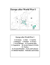
Europe after World War I
In this Europe after World War I map worksheet, students note the 11 regions of the Europe labeled on the map.
Curated OER
What Do I Know About Islands
In this island research worksheet, students fill in a graphic organizer about the island of their choice. Students fill in two tables with advantages and disadvantages of living on the Rathlin Island and Hallig Oland. They write a...
Curated OER
Europe Word Search
In this social studies worksheet, learners find the words that are related to the continent of Europe and the answers are found by clicking the button at the bottom of the page.
Boston University
Scramble for Africa
In this fantastic simulation, your young historians take on the roles of imperialistic European countries in the nineteenth century and then "scramble" to carve up the continent of Africa! This is a very hands-on activity that will help...
Curated OER
Identifying, Mapping, and Personifying Countries Involved in WWII
Get artsy with this WWII group activity, starting with a whole-class assignment. Create a map of Europe, Northern Africa, and the Pacific using geometric shapes cut from construction paper and placed on the floor. Consider splitting the...
Curated OER
Countries Involved in World War II
Students create their own floor map of Europe, Northern Africa, and the Pacific. They locate, identify, and speak for one of the countries involved. In addition, they classify the country they represent as an Axis Power or as an Allied...
Curated OER
Leaders, Laborers, and Other Perspectives of World War II
How did the women in France feel about their country’s involvement in World War II? Class groups are assigned a country involved in WWII, and individuals within the group adopt the point of view of leaders, laborers, businessmen, women,...
Curated OER
A Month of Mapping Literature
Explore the world through literature! With push pins to mark where each story came from, learners examine cultural differences, geographical location, and how those elements affect story content. This lesson could use deeper development,...
Curated OER
Food and Countries Match
Beijing duck? Italian pizza? Japanese sushi? Language learners match food words with their country of origin. An answer key is included with the colorfully illustrated worksheet.
Curated OER
A Passport to WWII and the Holocaust
Students explore the Holocaust. In this interdisciplinary lesson, students research Hitler's rise to power, the terror of concentration camps, and World War II. Students read The Diary of Anne Frank , listen to a Holocaust survivor, and...
Other popular searches
- Germany Geography Worksheets
- Germany Geography New
- Germany Geography Directions
- Germany Geography Map
- Germany Geography Pictures
- Germany Geography Nsew
- Geography of Germany


