Curated OER
Eastern Europe in 1989
Major political shifts occurred in Eastern Europe during the late 1980s. Locate, identify, and label 90 different areas on the provided map. A list of cities, countries, and water ways is provided.
Curated OER
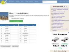
Most Livable Cities Quiz
In this online interactive geography quiz worksheet, students respond to 20 identification questions about the most livable cities in the world. Students have 4 minutes to complete the quiz.
Curated OER
Europe Map Quiz
For this online interactive geography quiz worksheet, learners respond to 45 identification questions about the countries located in Europe. Students have 5 minutes to complete the quiz.
Curated OER
Eastern European Studies
One worksheet, three projects. Learners explore Eastern Europe and mark Eastern European countries on a map. They then collect and record census data on thirteen different countries, and write a 3-5 page expository essay on one of the...
Curated OER
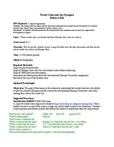
World Cities and the Olympics
Students examine the various cities in which Olympics have been held. Using a map, they describe the reasons why those cities were chosen and choose their own city for the Olympics and state the reasons why. They examine information...
Curated OER
Europe To The Max DVD: Four Great Cities of Europe Questions
In this geography skills worksheet, students watch the video "Europe to the Max." Students then respond to 18 short answer questions about London, Amsterdam, Brussels, and Paris.
Curated OER
Understanding Europe: A Cultural Mosaic (Theme 1)
Students discuss the cultural similarities and differences found in Northen Europe, Southern Europe, Western Europe, and Eastern Europe and create daily journal entries charting their discoveries. This lesson is the First Part in a Four...
Curated OER
Eastern Europe: Passport to Understanding
Seventh graders explore Eastern Europe. They analyze data on select countries. Students prepare a short oral presentation on the country they researched. They locate their country using an interactive map.
Curated OER
Getting To Know Germany
In this getting to know Germany learning exercise, students use map skills (map not included) to answer 14 questions, then draw a map of Germany labeling the capital and major cities.
Curated OER
Learning European Geography
Sixth graders discover locations and countries in Europe by identifying them on a map. In this European geography lesson plan, 6th graders read the book The Lost Little Elephant, with their class and discuss the geography referenced in...
Curated OER
Silk Roads Big Map
Students create an oversized map from Europe to East Asia. They include information such as Silk Roads, geographical features, major cities and cultural information on their map.
Curated OER
City Life In Europe
Students explore Paris. In this geography skills instructional activity, students watch "City Life in Europe," and conduct further research on the city of Paris and the country of France. Students create postcards that feature Parisian...
Curated OER
China - the Geography of European Imperialism - Spheres of Influence in China
Ninth graders create a map of China. They identify the various spheres of influence carved out by the Imperialist powers of Europe as well as locating geographical features of china and major cities. They explain the global impact of...
Curated OER
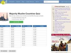
Majority Muslim Countries Quiz
In this online interactive geography quiz activity, students respond to 47 identification questions about Muslim cities. Students have 4 minutes to complete the quiz.
Curated OER
Number the Stars
Students read Number the Stars. In this social studies lesson, students read the story and use a map of western Europe and identify the countries involved in the war. Students locate the cities of Denmark that are discussed in the story.
Houghton Mifflin Harcourt
Renaissance and Reformation Chapter Test
This simple textbook assessment begins with a series of five short answer questions on major ideas from the Renaissance and Reformation. Then, young historians use their knowledge of artistic styles and developments from the period to...
Curated OER
Getting to Know France
In this map skills worksheet, students answer 14 questions about the geography of France. Students then draw a rough map of France. It is assumed that access to an atlas is available.
PBS
Make a Balloon Globe
"We've got the whole world in our hands," is what your students will be singing after completing this fun geography activity. Using the included templates for the seven continents and a balloon, they create their very own globes.
Curated OER
Regional identities in Italy
In this Italy map activity worksheet, students complete 2 map activities that require them to identify major cities and landforms in the country.
Curated OER
We've got the whole world in our hands
Students explore spatial sense in regards to maps about the globe. In this maps lesson plan, students label oceans, locate the continents and poles, follow directions, and explain the symbols on a map.
Curated OER
The Science of Weather: Hurricanes
Students use this USA today activity to learn about hurricane season. In this hurricane lesson, students study the map of the earth and hurricane science. Students complete discuss questions. Students draw a map of the United States and...
Curated OER
Touring Western Europe
High schoolers are assigned a Western European country to "tour." They select four cities to plan an itinerary of which places to tour. They research the country and the four selected cities within the country.
Curated OER
Classic Columns
Sixth graders present a PowerPoint presentation on Greek columns. They realize that Greek culture is centered around religion. Students create a model of one of the columns. Also they find examples of Greek architecture in major Greek...
Ms. Catsos
Ancient Rome Map Worksheet
It wasn't just the great leaders of ancient Rome that shaped their civilization—the geography of the region played a major role as well. After first identifying major land masses, bodies of water, and city states on a map of Europe,...


