Curated OER
Community Through Northwest Coast Art & Traditions
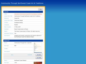
Students view video and watch an artist create a potlatch (gift necklace). In this community and resources lesson, students understand the culture of Northwest Coast Art & Traditions . Students create their own necklaces and bent...
Curated OER
Indians of the Pacific Northwest
Students organize acquired information and make inferences as to the kind of habitat and its probable location. They identify and replicate art forms characteristic of the Pacific Northwest coast involving the use of ovoids and "u forms".
Curated OER
War of 1812 in the Old Northwest Territory
Students write 1-4 sentence answers to the Time Travel worksheet (available online). They design period costumes, orally present their perspectives to the rest of the class, and explain why this war played an important role in the...
Curated OER
Northwest Ordinance
Middle schoolers examine the area where the Northwest Territory was located. They discover the steps territories need to follow to become states. They create a map of the Northwest Territory and label the states that came out of that...
Curated OER
Northwest coast Button Blanket Art
Students explore artistic design by viewing video clips on the Internet. In this blanket making lesson, students view tutorial videos in which they discover the creative process in button blanket designing. Students create their designs...
Curated OER
Discovering the Northwest Territories Through the Five Themes of Geography
Students use the Atlas of Canada to find basic geographical information about the Northwest Territories.
Curated OER
A Five-Step Plan for the Ohio Country and the Northwest Territory
Students complete five worksheets which correspond to the five problems the American government faced and the five solutions they instituted, accompany this lesson. They select and research one of the steps in this plan and write a...
Curated OER
The Treaty Trail: US Indian Treaty Councils in the Northwest
Students research and examine primary sources concerning the Washington Territory. In this Native American removal instructional activity, students view portrait images created by Gustav Sohon. Students then read several biographies that...
Curated OER
Stories That Go with the Territory
Students investigate various expeditions throughout history to new and/or uncharted territories. They work in groups to develop and 'produce' television news magazine segments about some of these historic expeditions.
Curated OER
Declaration of Independence
Young scholars define the words: republic, Articles of Condederation, survey, Northwest Ordinance, republicanism, ordinance, ratified, and Northwest Territory. They view the video Charlie Brown Constitution.
Curated OER
Breaking the Ice: Who Controls the Northwest Passage?
High schoolers consider the global climate issue. In this Northwest Passage lesson, students examine who has sovereignty of the passage and discuss the importance of the Law of the Seas and its impact on the global climate issue. High...
Curated OER
US Emergence of Power in the Pacific Northwest: General Howard and the Nez Perce Tribe War
Students discuss the role of the military in acquiring territory in the Pacific Northwest. Using a map, they locate the areas in which the Nez Perce were prominent and the routes used by the military to chase them. They discuss whether...
Curated OER
States and Territories
In this United states worksheet, 5th graders read a short script pertaining to the states and territories. Students complete 10 fill in the blank questions and self check this online interactive worksheet.
San Antonio Independent School District
The Not So Big Book of Westward Expansion
From the thirteen colonies to the Mexican cession, your learners will track the territorial acquisitions made by the United States during eighteenth and nineteenth centuries with this printable booklet.
Alabama Department of Archives and History
Alabama's Steps to Statehood
To demonstrate their understanding of the steps Alabama took to become a state, groups create a poster that identifies what the United States Constitution and the Northwest Ordinance required of a territory to become a state.
Richmond Community Schools
Map Skills
Young geographers will need to use a variety of map skills to complete the tasks required on this worksheet. Examples of activities include using references to label a map of Mexico, identify Canadian territories and European countries,...
Curated OER
The Kanaka Village at Fort Vancouver: Crossroads of the Columbia River
Students study the interaction between Native American and European cultures in the Pacific Northwest in the 1800s. They focus their study on the Hudson's Bay Company and Fort Vancouver.
Curated OER
Canada Map Quiz
In this online interactive geography quiz instructional activity, students examine the map that includes 13 Canadian provinces and territories. Students identify the names of the provinces and territories in 2 minutes, 30 seconds.
Curated OER
Influences of Black Oregon Trail Settlers
Pupils discuss reasons settlers settled in the Oregon Territory. Then, through the examination of primary documents, they compare the influences upon black settlers and how those influences were important to the settlement of the...
Curated OER
The Three Faces of Isaac Stevens
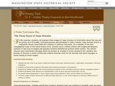
Eighth graders examine three images of Isaac Stevens for information about the man and his activity as a US soldier, territorial governor and participant in treaty councils. Students are also shown Union Army pictures with different...
Curated OER
The Kansas-Nebraska Act of 1854: Popular Sovereignty and the Political Polarization over Slavery
Students read selections from the Declaration of Independence, Northwest Ordinance of 1787, and the Wilmot Proviso of 1846. They contrast the maps of 1820 and 1854 to analyze developments in the national debate over slavery. They...
Curated OER
Capitals of Ohio
Fourth graders construct timelines of historic Ohio events and explain how it progressed from territory to state. They locate points of interest on a state map.
DocsTeach
Lewis and Clark's Expedition to the Complex West
Lewis and Clark's famous expedition is a prime example of the United States' westward expansion. Aspiring historians examine maps from Lewis and Clark's journey, as well as discuss their interactions with Native American tribes. The...
Curated OER
Exploring a Map of Canada
In this exploring a map of Canada worksheet, students find and label the capital city, bodies of water, the U.S., the provinces and the territories of Canada.


