Curated OER
A Different Point of View
Fourth graders imagine what North Carolina looks like from the air. Looking at a map, they list the different kinds of views we might find, (i.e., beach, mountains, cities, farms, etc.) then attempt to draw their own version of a map.
Curated OER
Explore Point of View Through Aerial Photography
Read the story Amelia the Pigeon and discuss perspective. Since Amelia is a pigeon with a bird's eye view, use aerial photography to enhance your learners' understanding. Have fun connecting art and literature while talking about...
Curated OER
Where's the Point?: Two-Point Perspective in Texas Bird's-Eye Views
Students investigate how the Texas bird's-eye-view artists used two-point perspective to create their aerial views and consider the directions from which the artists oriented their views. They produce two drawings in tow-point perspective.
Curated OER
A VIEW FROM THE TOP
Students explore the idea of aerial photography through the story of Amelia the Pigeon. They view an actual aerial photograph of their school or home, and then write a story describing what Amelia would see if she flew over their school...
PBS
Reading Adventure Pack: Gardening
A Reading Adventure Pack invites scholars to start gardening. Following a reading of two books—fiction and nonfiction—young green thumbs repurpose food containers to grow an herb garden in their kitchen, plant seeds in starter pots out...
Curated OER
ExplorA-Pond:3rd Grade Shapes & Fractions
Students, using a map, drawing or aerial view of a pond, represent the shape of the pond using simple geometric shapes or fractions of those shapes. They identify the numerator and denominator in each fraction created.
Curated OER
Scenes from Aztec Society
Analyzing an image depicting a scene from the past can be as effective as reading (for some learners). Here, they analyze two drawings showing an Aztec ceremony and an aerial view of Tenochtitlan. They answer 4 questions about each picture.
Curated OER
Bronze Age Life
In this architectural learning exercise, students design their own hut by using the template provided. They must draw an aerial view and cross-sectional view.
Curated OER
Interpreting Aerial Photographs
Pupils interpret aerial photographs. They view aerial photographs or satellite-produced images to locate and identify physical and human features. They study satellite images and label their images for bodies of water, clouds,...
Curated OER
A Shuttle's Eye View
Students explore the goals of the Shuttle Radar Topography Mission as a springboard to exploring the topographical features of their own state or region. They synthesize their understanding of landforms and topography by mapping their...
Cornell University
Constructing and Visualizing Topographic Profiles
Militaries throughout history have used topography information to plan strategies, yet many pupils today don't understand it. Scholars use Legos and a contour gauge to understand how to construct and visualize topographic profiles. This...
ProCon
Drone Strikes Overseas
Should the United States continue the practice of using drone strikes abroad? Readers explore the top pro and con arguments in preparation for a debate or discussion about the topic. They read about the history of drone strikes, view a...
Curated OER
COME INTO MY PARLOR
Students interpret a map scale to measure the space in a milking parlor. They reveiw the process of using a map scale to calculate distances. Students are given worksheets, they read the information in the box together. They draw an...
Curated OER
Forest Canopies: View from the Top
Students examine the economic and ecological benefits of forest canopies. They read and discuss an article, answer questions, conduct research, draw field sketches of a canopy ecosystem, conduct a feasibility study, or prepare tourist...
Curated OER
Exploring the Design Process
Students analyze the design process and architecture of Ludwig van der Rohe. In this architecture and art analysis lesson, students explore the design process through photographic documentation and architectural plans. Students use...
Curated OER
ExplorA-Pond:2nd Grade Shapes & Fractions
Second graders, in groups, using a map, drawing or aerial view of a pond, represent the shape of the pond using simple geometric shapes or fractions of those shapes.
Curated OER
Land Use Change Introduction
Students discuss the major changes that have taken place in the Hudson Valley over the past 400 years. They use aerial photos to describe major trends in Dutchess County. Students view a PowerPoint presentation. They work in small groups...
Curated OER
Churches Project: Useful Illustrations 4
In this churches illustration instructional activity, students examine a black-line drawing and schematic of a church altar. They see the labels of the altar parts in the aerial view. There are no questions associated with this...
Curated OER
Schoolyard Geology
Discover that maps show information about an area and that they have common features like scales and legends. View an aerial map of your school and find features on the map such as the playground, roads, and trees. Trace the outline of...
Curated OER
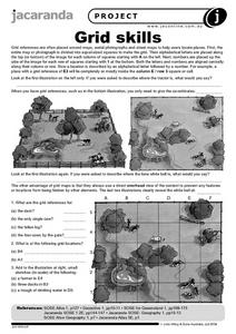
Grid Skills
In this geography worksheet, students use grid references on a map to locate places in the pictures given. They also identify another advantage of using a grid map, which they have an overhead view of the content to prevent any features...
Curated OER
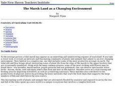
The Marsh Land as a Changing Environment
Sixth graders continue their examination of the state of Connecticut. After taking a field trip, they identify the types of birds, plants, invertebrates and vertebrates who make their home in the salt marshes. In groups, they identify...
Curated OER
Cherishing the Water of Life
Students work in small groups to brainstorm a list of all creatures, plants, natural, and artificial processes that use or depend on fresh water. The class views an aquarium filled with water representing all the water in the world. The...
Curated OER
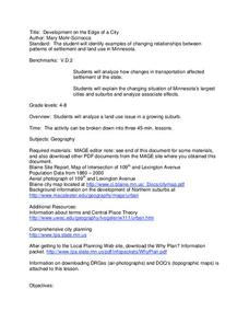
Development on the Edge of a City
Students explore and analyze examples of changing relationships between patterns of settlement and land use in the state of Minnesota. They view different avenues of transportation, cities, suburbs, city planners and suburbanization.
Curated OER
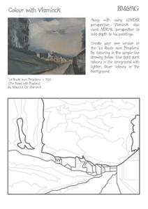
Colour with Vlaminck
In this perspective worksheet, students view a painting by De Vlaminck. They create their own version of the painting by coloring an included line drawing. Students are challenged to use dark colors in the foreground and lighter, bluer...


