Curated OER
Atlantic Ocean Map Quiz
In this online interactive geography quiz worksheet, students respond to 7 identification questions regarding the Atlantic Ocean.
Curated OER
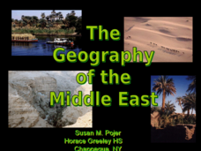
The Geography of the Middle East
Topographic, political, and satellite maps establish the world of the Middle East for your class- a land about which they have heard quite a lot, but might not really understand. This presentation would be a good introduction into a unit...
NOAA
Into the Deep
Take young scientists into the depths of the world's ocean with the second lesson of this three-part earth science series. After first drawing pictures representing how they imagine the bottom of the ocean to appear, students investigate...
Curated OER
The Geography & Peoples of Europe
Extremely throrough and informative, this presentation details many aspects of European geography and demographics, including natural resources, climate, topography, and population distribution. This slideshow would be an excellent...
World Maps Online
Introduction to the World Map
Learners identify the differences between maps and globes. For this map skills instructional activity, students are shown a globe and a map and recognize the differences. Learners use post-it notes to locate several locations on the...
NOAA
A Watery World
With about 70% of the earth's surface covered in oceans, it's fair to say that we live in a very wet world. Young scientists gain a better appreciation of this fact as they use maps to identify the world's ocean basins in the first...
Curated OER
Maps and Globes: Where in the World are We?
Students explore maps and globes. In this introduction to map and globe concepts lesson, students identify features of physical maps, political maps, and globes. Students locate land and water, and recite a poem about the names of the...
Curated OER
The Geography of Africa
Hop a flight to Africa in this presentation, which includes brilliant and appealing photographs of the continent as well as maps and graphs about its geography, topography, and climate. Those who are researching Africa for a project or...
New York State Education Department
US History and Government Examination: August 2010
Geography has played a complex role in America history. The Atlantic Ocean has served as a buffer to protect the United States from European Wars, but its proximity to Cuba, however, left it vulnerable to nuclear war during the Cuban...
Curated OER
Physical Geography of Africa
Fifth graders investigate the topography of Africa. In this physical geography lesson, 5th graders research the six regions of Africa and complete a physical map. Students locate various landforms in Africa. Students use their...
Curated OER
Pacific Ocean Map Quiz
In this online interactive geography quiz worksheet, students respond to 5 identification questions regarding the Pacific Ocean.
Curated OER
World Map
For this world map worksheet, learners practice their geography skills as they label the 7 continents and 5 oceans. A word bank in included.
Curated OER
Ocean Currents
Fourth graders work in groups to research ocean currents and create posters with their findings. They locate the patterns and names of major ocean currents and identify them on a map. Students also use red pencil to show ocean currents...
Curated OER
Florida: U.S. Geography for Kids
In this Florida geography worksheet, students locate and label the important features of Florida and create icons for the economy and culture of Florida.
Institute for Geophysics
Understanding Maps of Earth
Here is your go-to student resource on primary geography concepts, including facts about the surface of the earth and its hemispheres, latitude and longitude, globes, types of maps, and identifying continents and oceans.
Core Knowledge Foundation
Columbus Sailed the Ocean Blue
Young adventurers embark on a journey, setting sail along the blue ocean with Christopher Columbus. Teachers will find that this unit makes their lesson planning smooth sailing!
Curated OER
Geography
Introduce your second graders to geography with this 13-slide PowerPoint. Students discover the names of the 7 different continents, as well as review the four oceans on the Earth. This presentation contains fabulous graphics on each slide.
Global Oneness Project
Highways and Change
What is the cost of change? Roberto Guerra's photo essay "La Carretera: Life and Change Along Peru's Interoceanic Highway" asks viewers to consider the impacts of the 1,600 mile-long highway through Peru and Brazil that connects Pacific...
Curated OER
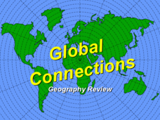
Global Connections Geography Review
In this beginning world geography PowerPoint, students answer basic questions about continents and oceans, as well as land and water that surround or can be found in the United States. Correct responses earn a mark on the interactive...
Curated OER
Geography of South America
Students explore South America. In this geography skills instructional activity, students watch a video about the geographical features of the continent. Students complete worksheets on the topic.
Curated OER
The Ocean Floor
Fifth graders discuss the process of sedimentation and the continental drift theory. They locate major structures on the ocean floor and they identify life forms at each level of the ocean.
Curated OER
Capitals, Oceans, And Border States
Students investigate geography by completing games with classmates. In this United States of America activity, students examine a map of North America and identify the borders of Mexico and Canada as well as the Pacific and Atlantic....
Curated OER
The Motions of the Oceans
Students examine the topics of ocean waves, currents, and tides. They locate and label ocean currents on a world map, conduct experiments, analyze key vocabulary, view demonstrations and record the data, and complete handouts.
Curated OER
World Geography Quiz
In this world geography learning exercise, students answer several questions based on world geography and landmarks. Students answer 10 multiple choice questions.


