Curated OER
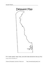
Delaware Map
In this state maps worksheet, students identify the state of Delaware, and fill in the state capital, major cities, and other attractions in the state.
Curated OER
Delaware Outline Map
In this Delaware outline map learning exercise, students examine political boundaries of the state and the placement its capital city as well as its major cities. This map is not labeled.
Curated OER
Label the Southern States
During your study of the United States, challenge your class to label the seventeen Southern states. Can they do it without the key? The answer sheet is included.
Curated OER
Delaware State Map
In this geography of Delaware worksheet, students color the map and label major cities and physical features. Students also study a second map showing the location of the state of Delaware in the United States.
Curated OER
State to State Scavenger Hunt
For this states worksheet, learners utilize the Internet to access one specific website to locate the answers to five fill in the blank statements about the states found on a United States map.
Curated OER
A State By Any Other Name
Learning about the fifty states can be motivating. After listening to books, pupils discuss and learn about the nicknames of various states. This is an interesting way to review the locations and characteristics of the states.
Curated OER
Why Does Delaware Have Such A StrangeShape?
Students examine the events and history surrounding the boundaries of Delaware. They participate in a class discussion and analyze a map, then create a floor map using masking tape. Students also participate in a play about the...
Curated OER
Mystery State #22
In this mystery state worksheet, students answer five clues to identify the state in question. They then locate that state on a map.
Curated OER
States in the USA Quiz
In this online interactive geography quiz worksheet, students respond to 50 identification questions about the states in the United States of America. Students have 4 minutes to complete the quiz.
Curated OER
The United States in 1790
In this geography skills worksheet, students study the provided map of the United States in 1790 and then complete the provided quiz over the 17 states and territories.
Curated OER
By George, I Think We Have It: Bicentennial quarter reverse
Voting is one of the major reasons the US adopted public education. Educate your class populace, they will analyze the images on a bicentennial quarter and think about the contributions George Washington made to the United States. They...
Curated OER
The Underground Railroad
Students discuss how slaves fought against their situation and how did they escape. They discover what the Underground Railroad was and how it slaves used it to reach freedom. They then play a game focusing on the Underground Railroad in...
Curated OER
The American Revolution: 1775 - 1783
Track the ins and outs and wartime strategies used by both the British and the Americans during the Revolutionary War. Multiple comparisons are made between both factions, maps, statistical data, images, and light text is used throughout...
Curated OER
Winter at Valley Forge
Students assess the events leading up to the American Revolution. In this United States History lesson plan, students read "Crossing the Delaware: George Washington Fights in the Battle of Trenton," then discuss the highlights in the...
Curated OER
Lets Put Delaware On The Map
Young scholars compare and contrast historical and modern maps of Delaware. Through class discussion and group activities, students analyze maps and make comparisons. Each group participates in a game to aid in discerning the...
American Battlefield Trust
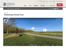
Gettysburg Virtual Tour
Step into one of the most iconic battlefields of the American Civil War with an educational interactive resource. Young historians learn about key moments, locations, soldiers, and turning points in the battle with a clickable map and...
Curated OER
Map of Pennsylvania's Waters
In this labeling bodies of water in Pennsylvania learning exercise, students observe a map outline of the state with water sources and use the word bank of names of creeks, lakes, reservoirs, and rivers to identify them. Students label...
Curated OER
Let the Music Play: Bicentennial quarter reverse
To better understand who George Washington was and why we celebrated the bicentennial, pupils read a story and complete a worksheet. They sing and talk about the song, "Yankee Doodle Dandy" as they march around the room.
Curated OER
This Land is Your Land - Delaware
Students determine how land was divided and marked for boundaries in the early days of settlement in Delaware. Students mark out land on the playground according to the methods used by the early settlers. Students write a description of...
Curated OER
Lesson L - Hit The Road Jack (or Jill)
Students discuss forms of transportation in Delaware during 18th Century, find approximate area of court order on current map of state, draw layout of their school, and decide where new hallway or outside pathway would be most needed.
ReadWriteThink
Biography Project: Research and Class Presentation
I Have A Dream ... that after the lesson, all individuals master the reading, writing, researching, listening, and speaking skills the biography project helps them develop. Martin Luther King, Jr. serves as a topic example for a model...
Curated OER
States of Fitness
Young scholars participate in physical activities coordinating to divisions on a map.
Curated OER
Scaling the Map
Students practice determining map distances using the map scales. They discover how much an area represents on the map in relation to the actual area. They decide on the best place to build their cavern.
Curated OER
State Report
Students create a state report/ presentation. They research U.S. state information using the Internet and retrieve information about specific topics (Individual States in the USA) using technology resources.


