It's About Time
Plate Boundaries and Plate Interactions
How does the Earth continually repair itself? Explore the answer to this question, and others, with a unit on plate boundaries and interaction. Pupils classify the types of movement at plate boundaries and identify the distribution of...
Curated OER
Proper Nouns: Person, Place, or Thing
Learners recognize proper nouns in sentences and print them on the lines. They write twelve short answers.
Curated OER
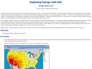
Exploring Energy with GIS
Students examine GIS technology as it is used to locate energy sources. In this GIS lesson, student access an assigned website to locate a series of lessons using the GIS software. They use the maps that are located on the primary lesson...
Curated OER
Geography and Climate
Students investigate geographical locations and their own personal experiences with the environment. In this environmental identification lesson plan, students participate in a match game using certain environmental and geographical...
Desert Discoveries
The Sonoran Desert
Elementary schoolers study the geographic location of the Sonoran Desert. They pay close attention to the characteristics of the plants and animals found in this desert environment. The student handouts embedded in this plan are...
Curated OER
Name That Town
Students explore geographic locations and locate towns on a map using map coordinates.
Curated OER
Leapin' Landmarks: Locating 10 man-made landmarks around the world
Third graders engage in a lesson which addresses their curiosity about some of the outstanding people-made landmarks of the world. They explore the geographical themes of location and place through literature.
Teach Engineering
Searching for Bigfoot and Others Like Him
Individuals create a GIS data layer in Google Earth that displays information about where one might find seven different cryptids. The class members research to find data on cryptid sightings they can include in their data layer.
Orange County Water Atlas
Location, Location, Location…
Young geographers discover not only how to read and recognize coordinates on a map, but also gain a deeper understanding of latitude and longitude and how climate changes can vary significantly across latitudes.
Owl Teacher
Five Themes of Geography Book Project
Young geographers choose a country to research and design a book explaining how their country applies to the five themes of geography, including three facts or details for each of the themes.
Curated OER
Indus Valley Geography and Civilization
Students study the geographical features of the Indus Valley to determine how the location of this valley contributed to the growth of an ancient civilization. They work in groups to research the area before completing map work that...
Curated OER
What's For Dinner?
Eighth graders discover how the location of restaurants affects the future location of different restaurants. Using a fictionous town, they map the locations of all current restaurants and analyze the data to determine what type of...
Owl Teacher
Creating a Map to My House
Here is a simple assignment that will introduce your young geographers to location, one of the five themes of geography, through an activity in which they map the directions and lines of latitude/longitude of where they live.
Curated OER
Virginia Geographic Regions
Third graders observe the five geographic regions of Virginia which have distinctive characteristics based on their landforms and bodies of water. They then describe the types of landforms and bodies of water in the region where they live.
Curated OER
Biomes Summary-Temperature, Precipitation, and Location
Students examine the weather conditions of the various biomes on a world map. In this geographical weather activity, students identify the seven biomes and color each biome a specific color. Students view a list of the average...
Curated OER
Geography With Dr. Seuss
Students read the book, The King's Stilts by Dr. Seuss and discuss the geographical information given in the book. Then they discuss and locate on a map the physical features that make up the continent of Africa. They create an original...
Curated OER
Magical Maps
Second graders discuss the importance of using maps and how they are used. After they listen to a folktale, they develop their own story line maps and write their own folktale to accompany a map. They also identify and locate the seven...
Curated OER
Cause and Effect: Light Clusters and Geography
After viewing a map of lights at night over a variety of geographic formations, young topographers connect the location of light clusters to geographic features that encourage human settlement. They list causes and effects of large...
Curated OER
Oh, the Regions
Focus on the geography of Oklahoma. In this activity, learners compare different geographic regions in Oklahoma, create a collage to share their results, and identify important landforms throughout the United States, such as the Rocky...
Curated OER
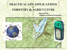
Practical GPS Applications in Forestry & Agriculture
An explanation of the Global Positioning System (GPS) and the Geographic Information System (GIS) is given in this presentation. Uses and applications are considered. How it works and sources of error are also touched upon. A large...
Curated OER
Where in the United States Are We?
Students spend the lesson identifying the location of the fifty states and the capitals. Using a software program, they retrace te outline of each state numerous times. To end the lesson, they write a story about a state and city of...
Curated OER
Interdependence in a Global Community
Learners locate the geographic origin of a variety of products used in our society. They find countries in an atlas or on a wall map. They define the term imports and emphasize the theme of MOVEMENT and use it to explain interdependence.
Curated OER
The Mind Map
Learners form a mental map of their residence in relation to school and recreate it on paper showing distance, direction, location and symbols. This lesson is designed to introduce students to geographic thinking.
Curated OER
Regions of Virginia
In this geography worksheet, 5th graders identify the regions of the state of Virginia and sort them according to location. Then 10 questions focus upon the specifics of different regions.
Other popular searches
- Esl the Geographic Location
- Iceland Geographic Location
- Geographic Location Clues
- Major Geographic Locations


