Curated OER
Water Quality and Watersheds: A GIS Investigation
Requiring more than one class period, this resource takes earth science learners on a journey through a watershed. Using ArcGIS Explorer, an online geographic information system, they view maps of watersheds and surrounding landscapes....
Curated OER
Indus Valley Geography and Civilization
Students study the geographical features of the Indus Valley to determine how the location of this valley contributed to the growth of an ancient civilization. They work in groups to research the area before completing map work that...
Curated OER
Just an Ordinary Day
Young sociologists identify how technology has impacted the traditional culture of Romania as they read and discuss "Just an Ordinary Day'" by Nina Porzucki. A lesson encourages learners to study Romania's history and present, including...
Curated OER
Leapin' Landmarks: Locating 10 man-made landmarks around the world
Third graders engage in a lesson which addresses their curiosity about some of the outstanding people-made landmarks of the world. They explore the geographical themes of location and place through literature.
Curated OER
Biomes Summary-Temperature, Precipitation, and Location
Students examine the weather conditions of the various biomes on a world map. In this geographical weather activity, students identify the seven biomes and color each biome a specific color. Students view a list of the average...
Curated OER
Magical Maps
Second graders discuss the importance of using maps and how they are used. After they listen to a folktale, they develop their own story line maps and write their own folktale to accompany a map. They also identify and locate the seven...
Curated OER
Cruisin' the Counties: Learning Counties and Major Roads in Arizona
Young scholars examine Arizona counties and use the themes of location and movement to develop an Arizona map.
Foreign Policy Research Institute
Defining Democracy and Freedom
This is a simple but effective introduction to democracy. It requires the class to generate working definitions of key terms (provided) and to determine the degree of democracy in various geographic locations today. After they conduct...
Curated OER
States and Capitals, Mountains and Rivers
Students identify geographical locations in the midwestern United States. In this geography instructional activity, students identify 12 states and capitals and geographical features in the region by using U.S. maps. Students use blank...
Curated OER
Dalai Lama
Sixth graders use skills and knowledge that they gained from their Tibet unit to formulate a final product of their Tibet journey. This study covers topics such as Tibet's geographical location, religious beliefs, customs, dress, and way...
Curated OER
Fostering Geospatial Thinking: Space to Earth: Earth to Space (SEES)
Students locate and access data to help them with their science inquiry. In this geographical positioning lesson students evaluate and compare data sets.
Curated OER
The Seven Continents Scavenger Hunt
Who doesn't enjoy an engaging scavenger hunt? Here, scholars listen to, and discuss, the informative text, Where is my Continent? by Robin Nelson. They then explore the seven continents and four major oceans using Google Earth.
Curated OER
Overland Trails To The West
Consider the political, physical, and geographical factors that led to and marked the Westward Expansion. Learners will track the various routes developed during the 1800's. They create a first person journal describing what they see,...
Curated OER
GIS and Agriculture
Students are introduced GIS systems and how they operate. Using a GIS system, they locate and map the various types of agricultural products grown in Oregon. They rank each county based on the amount of agricultural products produced and...
Curated OER
Why Is ______ Located Where It Is?
High schoolers discuss the reasons why cities are located where the are. In groups, they identify the physical features that support a city. They determine if those features help or hinder the city to become a major world city. They...
NOAA
Climate Is Our Friend…Isn’t It?: Make an Extinction Polyhedron
Climate affects populations in different ways. Scholars research extinct organisms and mass extinctions in part three of the 10-installment Discover Your Changing World series. They create graphic organizers, then fill in the information...
Curated OER
Exploring Canadian Cities - a Day To Remember
Students research information on the geographical features, climate, and cultural activities of a Canadian city. They plan a day in the city with a schedule of activities. They synthesize information and create a large poster about the...
Curated OER
New Hampshire and the Five Themes of Geography
Students explore the location, place, human-environmental interactions, movement, and regions of the New Hampshire landscape through the use of visual representations.
New York City Department of Education
Geography and Early Peoples of the Western Hemisphere
Young historians discover the early people of the western hemisphere. The unit explores how the land changed, how it was used and homes of early Americans such as Incas, Mayans, Inuits, Aztecs, and Pueblos. Individuals also examine these...
Curated OER
Geography of Southeast Asia
Ninth graders study the geography and culture in ten Southeast Asian countries. They examine the development of the culture of these countries and how it is affected by their geographic locations.
Curated OER
Take Me Out To the Ball Game
Students use a map to graph and locate major league teams of different sports. In groups, they analyze the population data of the United States and compare it with the amount and location of the major league teams. They share their...
Curated OER
Mapping Lab and Lead Poisoning
High schoolers are introduced to GIS and its uses. They make predictions before viewing the actual lead poisoning cases by location of Dade County. Pupils use actual Miami-Dade County spatial data to explore basic principals. Students
Curated OER
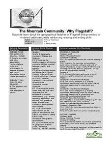
The Mountain Community: Why Flagstaff?
Students identify geographical features that hindered or promoted settlement in the city of Flagstaff, Arizona. In this settlement lesson plan, students write a summary of what they learned and identify geographical features on a map.
Curated OER
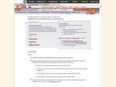
Middle East: Land, Resouces, and Economics
Students identify and describe major geographical features of the Middle East and explain how these features and other natural resources influence the economy of the area. Then they research one of the middle-eastern countries listed,...


