Curated OER
Things w/ Geographic Names Quiz
For this online interactive geography quiz worksheet, learners respond to 31 identification questions about products or things with geographic names. Students have 4 minutes to complete the quiz.
Curated OER
Analyzing Hurricanes Using Web and Desktop GIS
Young scholars analyze hurricanes. In hurricanes lesson, students use the Internet and GIS to analyze hurricanes. Young scholars view the National Atlas of Maps to discuss the direction hurricanes move. Students study the wind and...
Curated OER
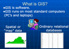
Applications of GIS
Don't be concerned that the title slide of this presentation mentions Virginia's Geospatial Extension Program; this slide show is very informative for any technology-focused curriculum when considering global information systems. It...
Parkwood Hill Intermediate
Map Skills Project
Young pupils develop their mapping skills and knowledge by designing their own islands, using geographic terms and physical features they have learned as features of their work.
Curated OER
What's In a Name?
Students examine the origins of the names of U.S. states, focusing on names that were derived from Native American words. They are provided with lists of the names of the 50 states, and then research online or in library resources the...
PBS
What's In a Name?
What is in a name? Eager historians trace the geographical history of places in the United States with Spanish names. Using a worksheet activity, clues, and web research developed in conjunction with the PBS "Latinos in America" series,...
Owl Teacher
Five Themes of Geography Book Project
Young geographers choose a country to research and design a book explaining how their country applies to the five themes of geography, including three facts or details for each of the themes.
Curated OER
Nature and Place Names in Arkansas
Middle schoolers examine the way that many place names in Arkansas came to be. By looking at Arkansas highway maps, they find names that come from the characteristics of each of the state's six geographical divisions. This interesting...
Curated OER
Mapping National and Geographic Identity
Students analyze geographic maps. In this map analysis lesson, students analyze the symbols in geographic maps and the impact of cultural, historical, and political concepts. Students compare and contrast maps in various mediums by...
Curated OER
Place Names
Students investigate the meaning of various Native American names. In this Native American language lesson, students locate state names that come from Native American descriptions and mark them on a map. Students then suggest a name for...
Curated OER
Virginia Geographic Regions
Third graders observe the five geographic regions of Virginia which have distinctive characteristics based on their landforms and bodies of water. They then describe the types of landforms and bodies of water in the region where they live.
Curated OER
Map of Africa
Using a completed map (not provided), pupils will use this map to fill in the geographic features of Africa. An appropriate map can be printed using the Internet and placed under a document camera for the class to reference.
Curated OER
Geographic Regions of Africa
In this African geography worksheet, students complete a graphic organizer that requires them to note rainfall, temperature, vegetation, and human needs about the 6 geographic regions of Africa.
Curated OER
Using Articles with Names of Countries
In this using articles with names of countries worksheet, students read the explanations and examples of using the with names of countries, then interactively select the correct article for 20 countries with immediate online feedback and...
Curated OER
Proper Nouns
Elementary schoolers analyze correct usage of proper nouns. They correct six sentences and rewrite them on the lines provided correctly capitalizing all proper nouns.
Curated OER
Locate and Name the bodies of water and the continents
Second graders locate the equator, bodies of water, and different continents on a globe. In this globe lesson plan, 2nd graders recall geographical information on a globe.
Curated OER
Physical Geography Wordsearch
In this physical geography word search learning exercise, students find the hidden geographical features listed in the word bank. Students locate twelve words.
Curated OER
Exploring California
While incomplete, this lesson could be used as a starting point for an exploration of the geographic features of California. Learners describe the four regions of California and discuss population and economic development. Then, they use...
Curated OER
Name That Town
Students demonstrate how to locate places on a map using coordinates. In this map skills instructional activity, students work in small groups and select a name from a map index to locate. Students use coordinates to identify the...
Curated OER
Sentence Based Capitalization
Second graders demonstrate their command of Standard English conventions of capitalization by circling all the letters that should be capitalized in the sentences provided. In addition, they rewrite two sentences in which all the letters...
Curated OER
Name That Town
Students explore geographic locations and locate towns on a map using map coordinates.
Curated OER
GIS: Mapping Watersheds of the Edwards Aquifer in Travis County
Students manipulate existing GIS data to create and map a new layer of information that shows that watersheds in Travis County that are on top of Edwards Aquifer. They create and map that shows the watersheds in Travis County that are on...
Curated OER
GIS Mapping: Special Instructions for Using Digital Orthophotos
Students practice cartography using GIS technology. They create a map of Austin using GIS and aerial photos.
Curated OER
The Classification Station
Second graders identify proper nouns and categorize them by subject. They apply correct principles of grammar: they write complete sentences, use correct capital letters, use correct punctuation and apply correct rules of usage and...


