Curated OER
Using Old Maps as Tools to Explore Our World
Students explore historical maps. In this primary source analysis lesson plan, students uncover the meanings in selected historical maps as they use them to enhance lessons on historical events. Samples for classroom use are provided in...
Curated OER
Transportation and Mapping
Students view murals that depict various modes of transportation. They discuss the importance of maps to navigation and create a map. They compare and contrast transportation of the past with modes of transportation used today.
Scholastic
Perfect Postcards: Illinois
Connect the geography and history of Illinois using an art-centered lesson on the railroads. The railroad connected once-distant places, particularly in the Midwest. Using research, class members create postcards of fictional cross-state...
NASA
Tools to Study Tornadoes and Galaxies
Take your class on an intergalactic journey as they explore the galaxy and various meteorological events taking place in our atmosphere each day. Learners investigate electromagnetic waves and the Doppler Effect before gathering radar...
Curated OER
Lesson 11: Illinois History 1800's Dual Timeline
Students identify and research key event in the history of Illinois during the 1800's and create a dramatic skit or oral report based on the event.
Curated OER
Multiple Intelligences and The Illinois & Michigan Canal
Third graders engage in a wide variety of cross-curricular activities designed to give them a thorough understanding of the history of the Illinois & Michigan Canal. There are a very nice set of activities included in this plan!
Curated OER
Illinois State Map
In this Illinois geography worksheet, students color and label a map of Illinois. Students study the location of the capital and where Illinois is situated in the United States. There is a black line map of the state with a grey US map...
Curated OER
Take a Hike
In this geography skills worksheet, students respond to 9 questions that require them to read topographic maps and interpret them. The topographic maps are not included.
Curated OER
Aquatic Exotics
Students identify and describe the aquatic exotic species found in Illinois. Using the internet, they research the species origins and discover their effects on native species in the area. They discuss how appropriate it is to introduce...
Curated OER
Rock River Watershed
Students discover what a watershed is and which one they live in. Using the internet, they research why watersheds are important to an ecosystem and how to keep them from getting polluted. They use a map to locate various items within a...
ProCon
Israeli - Palestinian Conflict
Many people think the best solution to the Israeli-Palestinian conflict is a two-state solution. After reviewing the available resources, scholars determine whether they agree with that approach. They analyze graphs and charts about...
Curated OER
A Road Map for the Roman Empire, Ca. 250 CE
Students consider how empires are created and sustained, examine Peutinger Table as a whole and in detail as tool of empire for Rome, c. 250 CE, create ancient time-distance travel chart that synthesizes series of strip maps, and...
Curated OER
Geology Rocks
Middle schoolers discuss information relating to Illinois geology. They examine top mineral resources in Illinois to find detailed information about geodes and where they can be found. Students complete geode lab to explore external...
Curated OER
Mapping the Prairie
Fifth graders study maps of the Chicago area looking at defining characteristics and place names. They investigate settlement patterns by looking at the maps.
Curated OER
Do You Know Your 50 States?
Learners use the names and abbreviations of the 50 states to label a blank map of the United States.
Curated OER
Exploring the Illinois and Michigan Canal
Seventh graders locate the Illinois & Michigan Canal and related landmarks on various maps. They explain the challenges associated with building a canal. They access websites imbedded in this plan and watch a video to aid their...
Curated OER
Beaver, or not?
Students study the role of the beaver in Illinois during the 1800's and how overtrapping cause the near extinction of the beaver colonies in Illinois by 1900. Students role play various people in 1945 who have an opinion about the...
Curated OER
Lost Illinois History
Students discuss "The Trail of Tears," why it happened, what it is, and where it began and ended. They work in groups to complete a reading section and answer a series of questions then share the answers with the class. Students take a...
Curated OER
Animals from Afar
Young scholars visualize the scope of the Roman empire by illustrating the geographic origins of various imported animals. They study how exotic animals were imported into Rome from the farthest regions of the empire.
Curated OER
American Journeys: Learn About Illinois
Fourth graders explore the state of Illinois. They use maps and research the state of Illinois. Students track their trip through the state and they create a travel narrative of their journey. Students use maps to identify geographical...
American Battlefield Trust
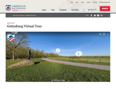
Gettysburg Virtual Tour
Step into one of the most iconic battlefields of the American Civil War with an educational interactive resource. Young historians learn about key moments, locations, soldiers, and turning points in the battle with a clickable map and...
Curated OER
Hemingway Hangouts
Students use printed maps and websites to estimate driving distances and plan routes to Hemingway's home. They visit several locations online and record facts about each location.They calculate, distances, driving time, and other factors.
Curated OER
The Hopi Indians
Fourth graders read and look at maps of the Hopi Indians and compare and contrast their lives with the Hopi Indians. For this Hopi Indians lesson plan, 4th graders learn about different cultures and answer short answer questions.
Curated OER
From Hypothesis to Conclusion...Reading Maps to Understand Proofs
Tenth graders explore the concept of proof. In this proof lesson, 10th graders work in groups to collectively write proofs for directions to places on a map. Students give directions to specific places in big cities such as from the New...


