Curated OER
IDP Introduction
Fourth graders examine the three regions of North Carolina through class discussion of favorite places in the state and a review game based on the game of twister. The different colors on the twister sheet represent the different...
Curated OER
4th Grade Geography Multiple Choice
In this grade 4 geography worksheet, 4th graders complete a total of 25 multiple choice questions relating to 4th grade geography concepts. An answer key is provided.
Curated OER
African Safari
Seventh graders examine different countries in Africa to research. They choose one to concentrate their research on using the five themes of geography. They design a multimedia presentation that will make up the African safari.
Curated OER
The Desert Alphabet Book
Students explore world geography by researching a science book with their classmates. In this desert identification lesson, students utilize a U.S. map to locate the geographical locations of deserts. Students create an oral report based...
Curated OER
Hottest, Coldest, Highest, Deepest: Science, 4th Grade
Fourth graders investigate weather patterns in their home state of Utah. After creating KWL charts, they research weather and geographical data to locate the state's extremes. As an extension, 4th graders write and illustrate books about...
Curated OER
Geography of the Study of the Spanish-speaking People of Texas
Young scholars identify the physical features, demographic characteristics, and history of the four Texas towns featured in Russell Lee's photo essay, "The Spanish-Speaking People of Texas." They conduct Internet research, and create a...
Curated OER
Discovering the Local Community
Third graders create a mini-atlas of the human and physical characteristics of their local community, which includes landforms, climate, vegetation, population, and economics. They use nonfiction map-related resources to obtain ...
Curated OER
Landform Dictionary
Third graders use a word processing program to create a working dictionary, including definitions and pictures, of physical land forms used in the study of different regions of the world.
Curated OER
The Great Continental Drift Mystery
Pupils stud the concept of Pangaea by using Wegener's clues to construct a map of the continents joined together. They determine how fossil distribution can be used to enhance the study of continental drift. They locate the...
Curated OER
Opening Doors to Social Studies with Children's Literature: The Desert Alphabet Book
Students explore the geography of the United States. For this social studies lesson, students identify the major deserts on a map of the United States.
Curated OER
The Desert Alphabet Book
Learners use a book to discover an interesting fact from the desert using each letter of the alphabet. Using a United States map, they identify the meanings of symbols and locate deserts within the U.S. In groups, they participate in...
Curated OER
Settlement Patterns of the United States
Learners examine the conditions that affected the way people settled in the United States. Using maps, they examine the topography and climate of different locations and determine the factors that do and do not allow settlement to occur....
Curated OER
Tooling Around Arizona: Reading Arizona Maps
Learners research Arizona maps. In this map lesson, students discuss map titles, scales, directions, elevation, and symbols. The class will examine topography, landforms, and rivers found on an Arizona map.
Curated OER
Getting to the Core of World and State Geography
Students create topography relief maps. In this geography skills lesson, students review geography core knowledge skills, design and make a state relief map, and compile a student atlas.
Curated OER
Exploring Nations
Students, in groups, research countries in East and Southeast Asia. The group designs an oral presentation and PowerPoint slideshow to showcase research on landforms, political and economic issues, global interaction and special-purpose...
Curated OER
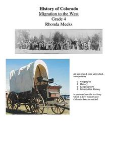
History of Colorado-Migration to the West
Fourth graders identify reasons for people moving to the Colorado Territory and examine how moving in the 1800's is different than moving today. They also practice reading maps and gathering information from maps, as well as, describe...
Curated OER
Wright Brothers Centennial: North Carolina, Creation and Development of the State
Eighth graders examine technological advances and how they influenced the quality of life in North Carolina. Using maps, they locate the city of Kitty Hawk and discuss why it was chosen for the first flight. They read primary source...
Curated OER
Mapping La Salle's Travels
Students use the internet to create a map showing the path of La Salle through North America and the Caribbean. They identify the main geographic features of the two areas and the main French forts. They also complete a timeline.
Curated OER
Lewis and Clark
Ninth graders study the plants and animals Lewis and Clark discovered on their expedition. There is a plant illustrator, a plant recorder, an animal illustrator, and an animal recorder. They research the plants and animals and the ...


