Curated OER
'Tis a Long, Long Way to Tipperary!
Students practice finding the location of cities across the world by using an interactive Web site, and figure out the world's time and the value of time zones the world over.
Curated OER
The Geophysics And Cultural Aspects of the Greater Antilles
Learners determine location by using longitude and latitude. They measure to the minute longitude and latitude of a place and select a body of land and determine its location. They approximate time zones by using every 15 degrees of...
Curated OER
Math with Maps and Globes
Young scholars round out their math skills with these ‘round the world' ideas. In this math and geography lesson, students try out time zone sticks, a polar race, and tic-tac-globe to engage them in learning more about globes and the...
Curated OER
Exploring Marine Ecosystems in the Caribbean and Maine
Students compare the marine habitats of Maine and the Caribbean using temperature, tides, ocean currents, latitude and longitude. In this marine ecosystems lesson, students analyze maps to complete graphic organizers that evaluate the...
Curated OER
Location of Cities 201
Students work in pairs to locate the ancient cities on a world atlas using the longitude and latitude measurements. They examine the physical and human futures that explain their locations.
Curated OER
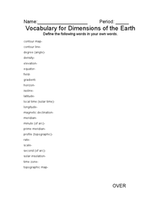
Vocabulary for Dimensions of the Earth
In this Earth dimensions worksheet, students define 24 terms associated with contour maps, latitude, longitude, and time zones.
California Academy of Science
Discovering Rainforest Locations
How many rainforests are there, where are they, and do global factors effect their locations? These are great questions that have great answers. Children in grades four through eight use several different maps to determine why...
Glynn County School System
The Outer Planets
Are outer planets just like inner planets? Nope! The outer planets are much more spread apart than the inner planets. An informative PowerPoint presentation shows why this is true as well as facts about the individual planets in the...
Curated OER
Early Russian History
While not heavy in text, the vivid images, maps, and key information in this slide show, are sure to hold an audience. They'll view images of geography, buildings, and people who are apart of early Russian History. Use the presentation...
It's About Time
Present-Day Climate in Your Community
So what exactly is climate? This first installment of a six-part series introduces the concept of climate using real-world data tables and topographic maps. The timely lesson includes a comprehensive overview of climate, as well as...
Curated OER
The United States and Canada: Climate and Vegetation
Display U.S. and Canadian climate and vegetation through this text-companion learning exercise. Learners read about the geography of these regions, take notes, and answer 3 comprehension questions as they read the selection. A graphic...
Curated OER
Earth's Biomes
Tenth graders examine characteristics and animals of terrestrial biomes. For this Earth's biomes lesson, 10th graders view a PowerPoint, take noes, sort pictures, research biomes, and create a diorama of a biome for presentation.
Curated OER
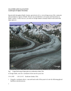
Landscapes of Alpine Glaciation
In this glaciers worksheet, students use Google Earth to look for examples of different glacial landforms and phenomena. Students complete 2 short answer questions.
Curated OER
Tectonic Plates, Earthquakes, and Volcanoes
Challenge geography classes to locate the major volcanoes and earthquake faults on a world map. In groups, they identify the pattern made and examine the relationship between the locations of the faults and volcanoes and tectonic plates....
Curated OER
Rainfall Mapping
Students explore rainfall and habitats. In this rainfall lesson, students explore the relationships among rainfall, vegetation, and animal habitats. Resources are provided.
Curated OER
Wind Circulation, Surface Currents and Climate
High schoolers describe connections between wind patterns, surface currents, and ocean climate zones. In small groups, they color the ocean climate zones in four different shades of blue. Students then answer questions like what four...
Curated OER
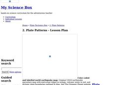
Plate Patterns
Students review the patterns they discovered from a previous activity. In this investigative instructional activity students plot data as a class and color a map.
Curated OER
Mapping China
Learners identify cities in China on a map. In this map skills lesson, students locate the continent of Asia and the country of China. Learners use a blank map to label China and bordering countries.
Curated OER
Hurricane Strength: Spatial Association of Wind Speed and Water Temperature
In this hurricane worksheet, students read and analyze satellite images of hurricane Rita. They complete 4 short answer questions about it.
Curated OER
Native Americans and Topography at Rose Bay
Young scholars visit a wetland ecosystem. While they are there, students explore how to read topography maps of Rose Bay.
Curated OER
Climate Types
In this weather instructional activity, learners describe the rainfall distribution found in two different areas of the world. Then they compare the various types of climates found around the world using the graphs shown on the sheet.
Curated OER
Bellwork for Week 16-Climate
In this bellwork activity, students answer a variety of questions about the climate, climographs, biomes and factors that control climate.
Curated OER
Lesson Design Archaeology- World Map
Learners practice locating positions on the world map. In this map skills lesson, students explore the world map and items such as the compass rose, Equator, mountains, cities, etc. The learners practice locating positions on the world...
Curated OER
Locating Patterns of Volcano Distribution
Students examine patterns of volcanic distribution worldwide, use tables to plot and label location of each volcano on map, lightly shade areas where volcanoes are found, and complete open-ended worksheet based on their findings.


