American Museum of Natural History
Map Your Own World
Young archaeologists practice their mapping skills by creating a detailed site map of their room or another room in their home. After indicating walls, windows, doors, and closets, they add furniture and objects, labeling each item.
Curated OER
Map Your School
Learners participate in a project to map their school. They measure and graph various areas around the school. Students find the longitude and latitude of the school and research the school's history, and highlight special important areas.
Curated OER
Mapping It Out: Social Studies Online
A great way to introduce 2nd graders to map skills would be to use this presentation. The visuals are inviting and the layout is easy to understand. This would be a terrific way to cover the basics on how to read a map. There is also a...
Curated OER
Introduction to Field Mapping with a Compass and Pace
Students practice using compass and calibrate their own pace, take field measurements of pre-set course with compass and pace, convert measurements into map, using angles and vectors, and make composite class map by adjusting different...
Curated OER
Play Doh Map of Your State
Students create a state map using Playdoh. In this hands-on state geography lesson, students work in groups to form a three-dimensional map of their state using Playdoh made at home following a (given) recipe. Students use four colors...
Curated OER
Mapping the Library
Students compare their school library with another library such as: town library, for example, or a virtual library and identify the most important features. Students use their observations to create a map of the school library that can...
Curated OER
Finding Your Way Using Maps and Globes
Students identify the similarities and differences between different maps and globes. Individually, they create a map of their classroom along with a compass rose. They also practice reading maps as a class and finding specific locations.
Curated OER
Bronx Zoo
Pupils prepare for a field trip to the Bronx Zoo. They use maps and descriptions of animal exhibits to give and interpret directions on how to navigate the zoo. They play games, participate in pairwork and whole class discussion.
Curated OER
Draw an Inch, Walk a Mile
Learners work in small groups to solve the problems presented. The main project, mapping the classroom, use these discussions to collaborate in creating a tangible demonstration of their understanding.
Teach Engineering
Who Can Make the Best Coordinate System?
Working with a map that does not have a coordinate system on it, small, collaborative teams must come up with a coordinate system for their map. Groups then explain their coordinate structure to the class.
US Holocaust Museum
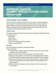
Ripples of Genocide: Journey through Eastern Congo
Could you locate the Democratic Republic of Congo on a map? Scholars investigate the genocide taking place in Eastern Congo. Groups explore web-based evidence as well as the Ripples in Genocide source to take a closer look at the issue....
Curated OER
Chancellorsville 360
Experience a Civil War battlefield up close. Chancellorsville 360 allows scholars to explore the battlefield in an interactive format. The site demonstrates the layout of the battlefield, strategies, and key events. Created for high...
Curated OER
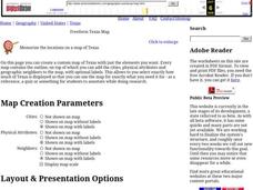
Freeform Texas Map
In this Texas map worksheet, students research, label and discuss the most important cities in Texas, its physical attributes and the states that surround Texas.
Curated OER
Freeform Pennsylvania Map
In this Pennsylvania map worksheet, students research, study and label twenty important cities, physical attributes and the neighbors that surround Pennsylvania on a Pennsylvania map.
Curated OER
Grid it, Map it
Students participate in designing a city layout using grids and coordinates. They work on a city space and create a grid on a life size layout on the gym floor.
Curated OER
Mush! Tracking Travelers on the Trail
Learners get to know Alaska and the Iditarod route that is run by dogs as they track the mushers' progress on a map that they create specifically for the race. They learn about latitude, longitude, plotting on a map, checkpoints, and...
Curated OER
The Writing Process
In this writing as a process worksheet, students explore how writing is a process instead of a finished piece of work. Students also test out how to mind map a story.
Curated OER
ABC Scavenger Map
Students explore phonetics by participating in a class game. In this alphabet sounds lesson, students collaborate in a ABC's activity where they identify a random letter, the sound it makes, and place it in it's correct spot on a mat....
Curated OER
Determining Cutting Site Locations
Students explore DNA restriction mapping. They cut pieces of paper into lengths representing those produced when specific enzymes are used to cut a strand of DNA.
Curated OER
Where in the World? The Basics of Latitude and Longitude
Students are introduced to the concepts of latitude and longitude. In groups, they identify the Earth's magnetic field and the disadvantages of using compasses for navigation. They identify the major lines of latitude and longitude on a...
Curated OER
Freeform Rhode Island Map
In this free form Rhode Island map learning exercise, students study, locate and memorize key cities, physical attributes and surrounding states for a quiz. Students fill out the major cities on a blank map of Rhode Island.
Ontario
Reading Graphic Text
Do learners really need to be taught how to read cartoons, comic books, and comic strips? Yes. Just as they need to learn how to read other forms of graphic text such as diagrams, photos, timetables, maps, charts, and tables. Young...
Curated OER
McLean Train Yard
Students conduct online research and incorporate graphics and maps into a Powerpoint presentation that details life at the McLean train yard in its heyday.
Curated OER
Cartography
Students follow directions to draw a map of an island. They complete the island map adding their own details using symbols and a legend.


