Curated OER
Idaho Map
In this outline state map of Idaho worksheet, students fill in the map with the state capital, major cities, and other state attractions or teacher created directions. Students draw at least 7 answers.
Curated OER
My Own Private Idaho; Using Social Studies to Explore Idaho
Students engage in several activities to explore Idaho and Social Studies themes. Using an variety of media, students become familiar with Idaho's geography and geology.
Curated OER
Agriculture in Idaho: Its Importance And Development From Historical Times To the Present
Fourth graders examine importance agriculture is in their own lives and about its importance in the history of Idaho from its beginnings through the present.
Curated OER
History of the West using the Digital Atlas
Students navigate the digital atlas of Idaho. They research the unique features of south central Idaho and the geological events which have shaped it over the past 17 million years. Afterward, they write an essay on an aspect of changes...
Curated OER
Idaho Outline Map
In this Idaho outline map instructional activity, students examine political boundaries of the state and the placement its capital city as well as its major cities. This map is not labeled.
Curated OER
Idaho State Map
In this Idaho state map worksheet, learners color and label important physical features and cities. Students also study the background map to learn the location of Idaho as related to the rest of the U.S.
Curated OER
Idaho Earthquakes
Students examine the types of earthquakes that occur in Idaho. In groups, they compare and contrast the types of energy released and how they affect the movement of the Earth. To end the lesson plan, they analyze a map showing the...
Curated OER
Topographic Maps Worksheet
In this geography skills worksheet, students respond to 37 multi-part questions that require them to read and interpret topographic maps.
Curated OER
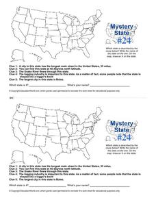
Mystery State # 24
Prepare those brains for a rousing day of learning with a fun geography activity. Your pupils use five different clues to determine the name of mystery state number 24. Where do all those potatoes come from? Idaho!
Curated OER
Geography of Idaho Trees
Students discuss the variety of trees in Idaho and their specific locations. Working in groups, they draw pictures of the tree species and place them on a map of Idaho where they are prevalent.
Curated OER
Mystery State #24
In this mystery state worksheet, students answer five clues to identify the state in question. They then locate that state on a map.
Curated OER
Draw an Inch, Walk a Mile
Learners work in small groups to solve the problems presented. The main project, mapping the classroom, use these discussions to collaborate in creating a tangible demonstration of their understanding.
Curated OER
The Oregon Trail
Students use maps and diagrams to examine the Oregon Trail. In groups, they create their own poster of the trail showing the different types of artifacts found along the way. To end the lesson, they identify the sources of water and...
Curated OER
Mapping Animal Behavior
Students discuss the value of sampling in science. They, in groups, map cricket movement in response to various stimuli and graph their results.
Curated OER
Active Faulting in Idaho
Students use CAD maps to explore active faults in Idaho. Through observation of maps, they explore the layers of the Quaternary and Holocene faults. Individually, or in groups, they identify characteristics of faults such as scarps,...
Curated OER
Path Map for the Lake Bonneville Flood
Students use a digital atlas of Idaho to explore the effects of the Lake Bonneville Flood. They become familiar with how floods shape our earth and change landscapes. Students graph a a timeline of the rise and fall of Lake Bonneville.
Curated OER
Farming Idaho
Students use a digital atlas to explore areas in the Western United States that depend heavily upon water. They explore the type of soil and the farming that is compatible with the soil. As a class, students explore Idaho's economic...
Curated OER
The Oregon Trail
For this Oregon Trail worksheet, learners practice their map skills while they explore the states of Oregon, Missouri, Idaho, Nebraska, and Wyoming. Students us a map of the US to plot six points on the map that show the Oregon Trail.
Curated OER
Illustrated Beauty
Learners examine images and inscriptions on Idaho quarter reverse, discuss peregrine falcon's importance to state of Idaho, read and research about peregrine falcon to gather information, and create picture book about falcon.
Curated OER
The Gold Rush
Students identify the routes involved in the Gold Rush on a map. In this map skills lesson, students use a United States map to locate the routes used to travel to California during the Gold Rush. Students demonstrate how to use the map...
Curated OER
Hemingway Hangouts
Students use printed maps and websites to estimate driving distances and plan routes to Hemingway's home. They visit several locations online and record facts about each location.They calculate, distances, driving time, and other factors.
Curated OER
State to State Scavenger Hunt
In this states worksheet, students utilize the Internet to access one specific website to locate the answers to five fill in the blank statements about the states found on a United States map.


