Curated OER
Do You Know Your 50 States?
Learners use the names and abbreviations of the 50 states to label a blank map of the United States.
American Battlefield Trust
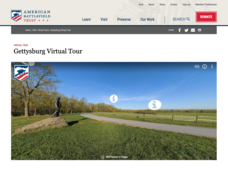
Gettysburg Virtual Tour
Step into one of the most iconic battlefields of the American Civil War with an educational interactive resource. Young historians learn about key moments, locations, soldiers, and turning points in the battle with a clickable map and...
ReadWriteThink
Biography Project: Research and Class Presentation
I Have A Dream ... that after the lesson, all individuals master the reading, writing, researching, listening, and speaking skills the biography project helps them develop. Martin Luther King, Jr. serves as a topic example for a model...
Curated OER
States and Capitals of the United States
Students label states and capitals on a United States map and complete research on one of the states. In this states lesson plan, students fill in the states on blank maps.
Curated OER
Geologic Maps
Students explore geologic maps. They locate specified mountain ranges and faults on maps. Students compare and contrast the characteristics of mountain ranges and faults. They identify rivers, mountains and locate Z rocks.
Curated OER
The Trail
Students identify major geographical features shown on the core map, explain map symbols used on the core map, create a picture of the condition of the trail in the 1840s, and construct a chart of average temperatures and rainfall.
Curated OER
Scaling the Map
Learners practice determining map distances using the map scales. They discover how much an area represents on the map in relation to the actual area. They decide on the best place to build their cavern.
Curated OER
Borah Peak Earthquake
learners use the internet, an atlas map, and other sources to explore a map of Idaho. They locate the Lost River Range and Mt. Borah. Students read the atlas map to locate earthquake faults, find the magnitude, fault, and epicenter of...
ReadWriteThink
Dear Librarian: Writing a Persuasive Letter
Everyone deserves to read a great book! Here, pupils write a persuasive letter to the school's librarian detailing their favorite story and why it should be found on the shelves. Class members' persuasive reading passages are shared with...
Curated OER
The Oregon Trail
Fourth graders discover the significance of the Oregon Trail in Idaho history. In addition, 4th graders conceptualize the Oregon Trail in relation to their own lives. They engage in a wide variety of curricular activities, culminating in...
Curated OER
Name the States Worksheet 1
In this name the states worksheet, learners examine 6 state map outlines and identify each of them by writing the state names and postal abbreviations.
Curated OER
The Formation and Value of Temperate Grasslands
Young scholars study the Temperate Grasslands biome of North America. They explain that it is an endangered ecosystem because the rich soils have been converted to farming in most areas. They view videos imbedded in this plan, then...
Teach Engineering
Air Pollution in the Pacific Northwest
Scholars investigate levels of nitrogen dioxide in the Pacific Northwest by examining the role of nitrogen in air pollution and how remote sensing can be used to measure nitrogen levels. An Excel spreadsheet calculates the difference...
Curated OER
Thermal Waters & Geologic Provinces
Students investigate thermal waters and geologic provinces. They examine provided maps of geothermal springs and thermal wells in the state of Idaho and their locations relative to Idaho's geologic provinces. Afterward, they use the maps...
Curated OER
Water, Rivers & Topography
Students explore the topography of Idaho and the importance of surface water and drainage. using digital maps, they inspect the courses of major rivers, Yellowstone Hot Spots, and the natural landscaping of Pocatello. Students explore...
Curated OER
My Happy Habitat
Learners observe and discuss the Idaho state quarter to begin an activity in which they define and draw different types of habitats. They discuss the habitats that the migrating Peregrine falcon, which appears on the Idaho quarter,...
Curated OER
Where Did Everyone Go?
Fifth graders view a video, and perform related activities on prehistoric archaeology to gain an understanding about the importance of careful data collection. They develop a system of cataloging objects using coordinate mapping to...
Curated OER
Journey of the Nez Perce
Students study the retreat of the Nez Perce Native Americans into Montana while tracing their journey on a map. They use the law of cosines to solve problems based on the navigational methods of the Nez Perce. They work with both the law...
Curated OER
Volcanoes:How Safe Are They?
Young scholars explore volcanoes, locate them on maps, record general information about volcanoes, and organize information on a fact sheet.
Curated OER
Communications: To the Rescue!
Young scholars role-play as soldiers rescuing lost mountain climbers. Working in teams, they interpret maps to locate the climbers and use flashlights to send and receive coded messages about the rescue. Their goal is to complete the...
Curated OER
General Information on Accreted Terrane
Students use the Idaho Digital Atlas. They look at the map on the main page and determine where the coast of the Pacific Ocean was before the Jurassic time period and how the coast has moved from its previous position to its present...
Curated OER
Poetry To My Ears
Students investigate the 50 States Quarters Program. They use the state of Idaho as a basis for creating context for the lesson plan. The image on the coin becomes the subject. They differentiate between the reverse and obverse side of...
Curated OER
The Hot Spot Hypothesis
Students use a digital atlas, geologic maps, and topography maps to explore geologic regions of Yellow Stone National Park. They locate evidence that support the theory of hot spots. Students research and explore the movements of Hot...
Curated OER
The Wave - A Science Lesson Plan
Young scholars investigate the geography surrounding the Great Salt Lake and the three main benches in the area. In this Great Salt Lake lesson, students read a background for the areas geography and make their own beach to analyze wave...


