Curated OER
Eastern Europe in 1989
Major political shifts occurred in Eastern Europe during the late 1980s. Locate, identify, and label 90 different areas on the provided map. A list of cities, countries, and water ways is provided.
Curated OER
The Netherlands: map
Use the provided list to label a map of Europe and the Netherlands. There are 77 locations to label. You have to know your stuff to fill out this challenging map.
Curated OER
Western Civilizations, Chapter 12: The Civilization of the Renaissance
If you can't take your western civilization class to the Renaissance Faire, try this online resource to give them an idea of this era and others! While designed to accompany the Western Civilizations text, this tool can be utilized...
Curated OER
Globe Skills Lesson 4 The Colonial Period
Students practice their map skills. In this Colonial geography lesson, students complete an activity that requires them to locate English colonial locations using latitude and longitude coordinates.
Curated OER
European Language Groups, 1850
Document the linguistic diversity and major language groups common to Europe in 1850. A map and a list of regions, countries, and water ways is provided.
Curated OER
Western Civilizations, Chapter 23: Modern Industry and Mass Politics, 1870-1914
Looking for an interactive way to supplement your western civilization course? Check out this comprehensive website, designed to accompany the Western Civilizations text (although it is valuable independently). Scholars investigate...
NASA
Outline Maps
Don't miss this gold mine of blank maps for your next geography lesson! Regions include traditional continents such as Asia, Europe, and Africa, as well as other major world areas such as the Pacific Rim and the Middle East.
Beverly Hills High School
Congress of Vienna 1815
Europe was changing in the early nineteenth century, and the Congress of Vienna largely sought to slow and contain those sweeping changes. A slideshow presentation illustrates the details of the Congress of Vienna, including its three...
Curated OER
Western Europe Map Quiz
In this online interactive geography quiz worksheet, learners respond to 35 identification questions regarding the countries of Europe.
Curated OER
The Ancient Civilization of Mali
Students explore the ancient civilization of Mali and examine various historical and cultural aspects of the civilization. In this ancient civilization of Mali lesson, students examine trade with respect to geographic locations, discover...
EngageNY
Grade 9 ELA Module 4, Unit 1, Lesson 5
What did the Crusades and plantations do with the global sugar spread? As class members continue their study of Sugar Changed the World, they examine how Crusaders brought sugar to Western Europe and how cultivating sugar led to the...
Curated OER
Globe Skills Lesson 2: Paving the Way for Columbus
Students explore the expedition of Christopher Columbus. In this geography skills lesson, students consider the technological advances that made Columbus's expedition possible as they complete a latitude and longitude activity.
Curated OER
Victory in Europe, 1944-1945
Students examine the overall strategy pursued by the Allies in the final moths of World War II in Europe by examining military documents and consulting an interactive map of the European theater.
Curated OER
Getting to the Core of World and State Geography
Students create topography relief maps. In this geography skills lesson, students review geography core knowledge skills, design and make a state relief map, and compile a student atlas.
Curated OER
Learning European Geography
Sixth graders discover locations and countries in Europe by identifying them on a map. In this European geography lesson plan, 6th graders read the book The Lost Little Elephant, with their class and discuss the geography referenced in...
Curated OER
All Quiet on the Western Front
Learners use unitedstreaming and Google Earth to investigate World War II and All Quiet on the Western Front. In this novel and technology lesson, students view a video about the novel using unitedstreaming video, visit the given...
Curated OER
The Influence of The Byzantine Empire on Russia and Eastern Europe
Students examine the influence on Russian and Eastern European language, religion, art, and architecture by the Byzantine Empire. They define key vocabulary terms, listen to a lecture and participate in a class discussion, and label a map.
Curated OER
NATO Geography & Language
The class receives background information on NATO, an atlas, and a blank world map. They color the original 1949 countries in red, the 1952 additions in green, and the 1990 additions in blue. This exercise would be a good starting point...
Delegation of the European Union to the United States
The Founding and Development of the European Union
How did Europe transition from a period of conflict to a period of sustained peace? As class members continue their study of the history and development of the European Union, groups examine the events in six time periods, from the EU's...
The New York Times
Kiev in Chaos: Teaching About the Crisis in Ukraine
Provide a historical context for the political unrest between Russia and Ukraine that began in late 2013. Learners review their prior knowledge and chronicle new understandings with a KWL chart, watch a video explaining the Ukrainian...
Curated OER
People Power
Students view a television program that explores many Eastern European residents' discontentment with communism. They work in groups to research living conditions in an Eastern European country before communism, under communism and...
Curated OER
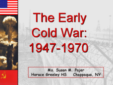
The Early Cold War: 1947-1970
With a combination of images, maps, and valuable information, this presentation is a strong resource for a history class that is coming out of a WWII unit and into a Cold War unit. Some points are outlined for students, while others are...
Curated OER
Four Immigrant Groups: Their Lives and Music
Fourth graders examine the experiences of four immigrant groups. Class members brainstorm a list of misconceptions of those groups and discuss if these perceptions are still present today. Using maps, groups locate the countries of...
Curated OER
The Inventions and Effects of the Industrial Revolution
Students understand that the Industrial Revolution began in England, spreading to the rest of Western Europe and the United States and with it came an increased demand for raw materials from the Americans, Asia, and Africa.


