Curated OER
The Interconnectedness of Ancient Peoples Map Study
Seventh graders begin this lesson by viewing various maps of the Ancient World. As a class, they take notes on the changes of different areas in Europe and Asia as their teacher lectures to them. They answer questions about the...
Curated OER
Rivers Run Through It
Using a relief map of New York State, learners answer questions about the distance between different cities, identify bodies of water, and more. First, they discuss vocabulary related to the Hudson River area. Then, they complete a...
Curated OER
River Run Through It
With vocabulary lists, worksheets, and more, this lesson sets learners on an exploration of the Hudson River area. They read an essay about the area, analyze a relief map of New York State, and complete a worksheet.
Curated OER
Mapping a Stream
Students map an actual local waterway. They create full color scale drawings that include windfalls, plant cover, streambed composition, and landmarks such as trees, boulders, and slumps. This is a long-term project that involves...
Curated OER
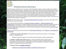
Wetland Inventory and Map Project
In this wetlands inventory and map project worksheet, students do research on the wetlands and complete a map project about it. Students follow 6 sets of directions with Internet links.
Curated OER
Tree Inventory and Map Project
In this tree inventory and map project worksheet, students follow the directions on how to take inventories of trees and create a map from it. Students follow 4 sets of directions.
Curated OER
The Water Nearby
Learners explore water located near where they live. In this map skills maritime lesson, students use Google Maps to find their school and the body of water closest to them. Learners research the body of water and answer questions about it.
Curated OER
African Lakes, Rivers, Bays, and Seas Map Quiz
In this online interactive geography quiz worksheet, students examine the map that includes 25 African lakes, river, bays, and seas. Students match the names of the bodies of water and waterways to the appropriate locations.
Curated OER
Mapping My Trip to the 2002 Winter Olympics!
Eighth graders map their route from their local community to Salt Lake City, Utah for the Winter Olympics. Using atlases, they gather topographical information and use the internet to research any landmarks they might pass on the way....
Syracuse University
Erie Canal
While canals are not the way to travel today, in the first half of the nineteenth century, they were sometimes the best way to move goods and people. Scholars examine primary sources, including maps and pictures, to investigate the role...
Curated OER
Where Do Canadians Live?
Students investigate Canadian people by researching the geography of the country. In this world geography instructional activity, students identify locations within Canada with large populations based on their access to waterways....
Curated OER
The Water Around Us
Students discuss importance of reading maps and knowing about the geography of the United States, and locate bodies of water on different types of maps and examine how they are used in the state or local community.
Curated OER
Sixth Grade Social Studies Quiz
In this social studies worksheet, 6th graders complete multiple choice questions about economics, climate, maps, and more. Students complete 15 questions.
Curated OER
Lets Put Delaware On The Map
Learners compare and contrast historical and modern maps of Delaware. Through class discussion and group activities, students analyze maps and make comparisons. Each group participates in a game to aid in discerning the similarities...
Curated OER
Journey of Discovery and Rivers
Students investigate the rivers encountered and mapped by the Corps of Discovery. They analyze maps, outline and label rivers on a blank map, complete a chart, and answer discussion questions while watching a National Geographic video,...
Curated OER
Our 50 States
Students identify the location of the 50 states using an interactive map. They practice geography skills by playing a fun game. Pupils become familiar with the state abbreviations for the US states. Students become familiar with the...
Desert Discoveries
The Sonoran Desert
Elementary schoolers study the geographic location of the Sonoran Desert. They pay close attention to the characteristics of the plants and animals found in this desert environment. The student handouts embedded in this plan are...
Curated OER
Water - Our Future
How is it that water that falls as rain ends up coming out of the tap on our sinks? Learners trace water's journey and examine how along the way pollutants make their way into the water supply. They conduct experiments, use the Internet...
Curated OER
Lesson on GPS
Students investigate global positioning systems. In this technology and mapping lesson plan, students view a PowerPoint presentation in which they identify the features of a GPS, state its uses, and follow steps to find a waypoint.
Curated OER
Where is the Trail? The Journey of Lewis and Clark
Students explore the trail followed by Lewis and Clark on their journey across the United States. In this United States History instructional activity, students complete several activities to establish the Lewis and Clark Expedition,...
Indian Land Tenure Foundation
Respect for Land
Youngsters examine how people show respect and care for the land. Specifically, learners see how the Native Americans truly did care for and respect the land, and still do so to this day! They also explore how they themselves can care...
Curated OER
World Geography: Who am I?
Students are able to provide a basic description of one country that has arsenic in its water supply. They are able to locate these countries on a map. Students explore the majors countries that have been affected by arsenic...
Curated OER
U.S. Geography: The Northeast
Students investigate U.S. Geography by creating a map in class. In this natural resource lesson, students create a map of the United States and research the Northeast based on their resources and recyclable materials. Students utilize...
Curated OER
Natural Resources and Transportation in the United States
Students study thematic maps (included with the lesson) to determine possible relationships. They develop three hypotheses about the relationship. Students choose one of their hypotheses to explain. The explanation is to include reasons...


