Curated OER
Flags as Tools to Share Identity
Students compare flags, locate states on map with flag picture or miniature. Read a newspaper article outlining five vexillology standards for rating flags. They develop a personal flag with an essay interpreting their flag to the reader.
Curated OER
Exploring National Flags
Sixth graders examine the importance of flags throughout the world. Examining different countries, they determine the geographical and historical contributions in the past and modern times. They compare and contrast the flags of five...
Curated OER
Finding Your Spot in The World; Geography, Maps, Multi-Culturalism
Young scholars use a variety of maps to locate their home, their school and the origin of their ancestors.
Seterra
Northern Europe: Countries - Map Quiz Game
Remembering geography is a tiring and tedious task to many scholars. Change it up by assigning the map quiz game. Elementary and middle schoolers alike test their knowledge and compete with the clock to match as many countries as...
Curated OER
North Carolina Salt Dough Map Social Studies Project
In this lesson, North Carolina Salt Dough Map, 4th graders create a salt dough map of North Carolina, Students use dough to form the shape of the state of North Carolina. Students label the three regions of North Carolina and all of...
Curated OER
Determining Direction With A Map- Online Interactive
In this map skills worksheet, students analyze a city map and study the compass rose. Students answer 10 questions about the map. This is an online interactive worksheet.
Curated OER
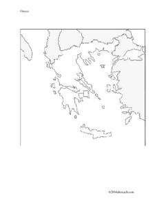
Map And Flag of Greece
For this Greece worksheet, students color and study a Greek flag. Students also color and label a map of Greece. This could be used in writing a report.
Curated OER
Country Flags Quiz
In this online interactive country flag quiz worksheet, students examine the 20 pictured country flags and try to name all of the countries represented in 4 minutes.
Curated OER
Waldseemuller's Map: World 1507
Students investigate the 1507 word map. In this world geography lesson, students examine the details of each section of the map and then draw conclusions about how the people of 1507 understood the world. Students are evalated on...
Curated OER
Flags and Freedom
Students create their own flag with symbols and colors that each have specific meanings. In this flags lesson plan, students review the American Flag and what the symbols and colors of it mean.
Curated OER
Waldseemüller’s Map: World 1507
Students take a closer look at historical maps. In this primary source analysis lesson, students examine the first world map produced by Martin Waldseemuller. Students complete the included map analysis worksheet and then write letters...
Curated OER
Labeling a Map of Australia
Third graders label a map of Australia. Using the internet, they research the history and maps of the continent and print a blank map. They review on how to use a compass rose and legend. In groups, they create a brochure to share...
Curated OER
Production of the Lunar Relief Map Project
Young scholars replicate the lunar surface. For this mapping skills lesson, students study the topography of the moon. Young scholars then use craft materials to create topographic maps of the lunar surface where the Eagle landed.
Curated OER
The Eagle Has Landed: Aztecs Find a Home
Students investigate the Aztec civilization and locate it on a map. They explain the legend of the city of Tenochtitan and investigate the symbolism of the Mexican flag.
Curated OER
El Mundo Hispano
Welcome to the Spanish-speaking world! Show your learners which countries declare Spanish as their primary language. Included are maps and flags for each Hispanophone country.
Curated OER
Where in the World War? Mapping the Geography of D-Day
Pupils examine how to read maps for historical information. They listen to a lecture on the history of D-Day, analyze a historical map of the invasion of Normandy, and answer discussion questions.
Curated OER
Cinderella Map Key
Young scholars design a map key in order to show where the different Cinderella stories have taken place. In this map key lesson plan, students place symbols on a map to show the diversity of the stories.
Curated OER
Australia
Students research Australia using the Internet. They draw a flag, identify and label Australia's major cities. They discover facts about Australia's tourists attractions and culture. They design a travel brochure using the facts.
Curated OER
The Flag Contest
Young scholars, in groups, discuss the different parts of the Arkansas flag. They are given fabric of their own to design a flag to represent their family.
Curated OER
Waldseemuller's Map: World 1507
Seventh graders analyze various maps. In this Geography instructional activity, 7th graders create a large map as a whole class. Students write a letter to Mr. Waldseemuller.
Core Knowledge Foundation
Year 2: Northern Europe
How is life in Northern Europe different from other areas of the world? Historians journey through the various regions of Northern Europe discovering what type of climate, animals, and lifestyles exist in that section of the world. They...
Curated OER
Malta: The Landscape
Students work in small groups to create a topographic map of Malta. They must include labeled line drawings of bordering countries and bodies of water. Students use salt and flour clay to make Malta three dimensional, showing the nearest...
Curated OER
Create a Math Road Trip
Learners create a Road Trip. They work in small groups. Students are given a road map for each group. They plan a road trip between two cities on opposite edges of the map, estimating a reasonable distance to travel each day. Learners...
Other popular searches
- Australian Maps and Flags
- Thai Maps and Flags
- Maps and Flags Caribbean
- Maps and Flags Mexico
- Area Studies Maps and Flags
- Illinois Maps and Flags


