Curated OER
Customized Topographic Maps and Models
Students explore the information depicted on topographic maps. They construct a 3-D topographic map of a local area. They go on a field trip to the depicted area and compare the 'real world' with their models.
Curated OER
Mapping Your Schoolyard Habitat
Students explore the terrain, structures, plants and signs of habitats around their schoolyard. They draw a sketch map showing the different areas around the schoolyard. Students identify the location of weeds and native plants on their...
Curated OER
Word Wall Activity List
Second graders perform a variety of activities with a dynamic, ever-changing classroom word wall as outlined in these lessons. They become less dependent on the word wall as the school year progresses.
Mesa Public Schools
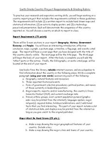
Country Project
Give your young learners the chance to discover more about countries in their world community with a research project. Class members write reports on an assigned country and include such major features as geography, important historical...
Center Science Education
Tracking Hurricane News
Here is a unique twist for your instructional activity on hurricanes. After examining extreme weather news headlines, your storm chasers view a PowerPoint about hurricanes and then zoom in on Hurricane Irene. They map a timeline of her...
Cornell University
Constructing and Visualizing Topographic Profiles
Militaries throughout history have used topography information to plan strategies, yet many pupils today don't understand it. Scholars use Legos and a contour gauge to understand how to construct and visualize topographic profiles. This...
Discovery Education
Sonar & Echolocation
A well-designed, comprehensive, and attractive slide show supports direct instruction on how sonar and echolocation work. Contained within the slides are links to interactive websites and instructions for using apps on a mobile device to...
Teaching Tolerance
Identity Artifacts Museum
Who are you? It's a simple question, but younger learners have the opportunity to express their complex identities by making artifacts that represent parts of their identities. After engaging in the activity, they share who they are with...
Curated OER
Navigating Your Community
Students draw a map from memory describing the route between their classroom and the gym including a legend, a compass rose, a map scale, symbols, and a landmark at every change of direction. They then retrace their steps in their maps...
Teach Engineering
Complex Networks and Graphs
Show your class how engineers use graphs to understand large and complex systems. The resource provides the beginnings of graph theory by introducing the class to set theory, graphs, and degree distributions of a graph.
Curated OER
Eager to Get to Ancient Egypt
Seventh graders explore the geography of Ancient Egypt, read a story and answer questions on a web site.
Curated OER
The Acadian Odyssey
The dispersion of the Acadians is outlined in this informative PowerPoint. Colorful maps help show where different Acadians settled throughout the United States. Tip: After viewing this slideshow, have students create a timeline of the...
Curated OER
Culminating Activities for Sharon Draper’s Novel Copper Sun
Student examine the elements of literature. In this literature lesson, students follow the provided procedures to review the novel Copper Sun by Sharon Draper.
Curated OER
Plate Patterns
Students read about a volcano and use the latitude and longitude information to plot and describe the volcano on the map. They discuss patterns seen on the map. In addition, they color code a map according to zones, plates, etc.
Curated OER
We the People
Students create a map illustrating the three branches of goverment. They identify the branches of government and the shared or exclusive powers of each. Students use mapping as a prewriting stategy. They discuss our national...
Curated OER
Flags as Tools to Share Identity
Students compare flags, locate states on map with flag picture or miniature. Read a newspaper article outlining five vexillology standards for rating flags. They develop a personal flag with an essay interpreting their flag to the reader.
Curated OER
High Five Burger
Fifth graders investigate agricultural sources. In this agricultural lesson, 5th graders read the book Have a Hamburger and See the U.S.A. and record each component of a hamburger. Students use a map of the U.S.A. to locate the...
Curated OER
The Shapes of Our World
Young scholars utilize shapes and spatial relationships in a practical context by creating maps and writing a critical essay.
Curated OER
Sum of Angles on a Triangle
Use this lesson for a basic review of angles. While the activities discussed are outlined, there are no materials provided to make implementation possible. When using this resource, it is necessary to create worksheets and other...
University of California
The Civil War: Secession of the South
Was the Southern states' decision to secede from the Union protected by the United States Constitution? Eighth graders discuss the constitutionality of the South's justification for secession, particularly the secession of South...
Curated OER
Plate Patterns
Students review the patterns they discovered from a previous activity. In this investigative lesson students plot data as a class and color a map.
Curated OER
Virginia: The Land and its First Inhabitants
Students review the five geographical regions of the state of Virginia. Using a map, they locate and label Virginia, surrounding states and the crops grown in the area. They present their map to the class and complete a worksheet to end...
Curated OER
The Distribution of Earthquakes
Learners determine the rate of seismicity by determining the frequency of aftershocks following a major earthquake. They incorporate the use of the Internet, Excel 2000, a map of their area with latitude and longitude markers, and paper...
Curated OER
The Southeast Region
Students write a song about the southeast region. In this southeast region lesson plan, students view pictures of landforms, hear music, look at maps of states, and more.


