Curated OER
Political Legends and Map Symbols
Students identify the legend and map symbols. For this map skills lesson, students use a world map to find various locations using a map key.
Curated OER
Asia and the South Pacific: Political Map
In this Asia and the South Pacific map worksheet, students examine national political boundaries and national capitals in this region of the world.
Curated OER
U.S. Political Map
Students explore the symbols found in a map legend. In this map skills lesson, students locate the legend on a political map and explain what each of the symbols mean. Students locate and identify several symbols on the map.
Curated OER
Mapping the News
Students explore cartography. For this map skills and map making lesson, Students work in groups to create wall size world maps including legends, compass roses, latitude and longitude, and physical features. Students collect current...
Curated OER
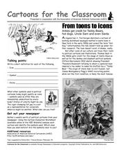
Cartoons for the Classroom: From Toons to Icons
In this current events activity, students analyze political cartoons that feature icons like the hot dog and the teddy bear. Students respond to 3 talking point questions.
Curated OER
Asthma Legends- Researching Famous People
In this asthma legends research worksheet, students read a list of famous people who suffer with or suffered with asthma. They use resources including the internet to research information about these people and classify them into three...
Curated OER
Designing A Mythical Creature
Students study mythology and why human cultures require them. For this investigating myths lesson students design a creature that fits an explanation of a natural phenomena then demonstrate the concept of "myth" and "legend".
Curated OER
USA Capitals Map
In this United States political map instructional activity, students examine state boundaries and locations of each of the state capitals.
Curated OER
Bob Marley - Legend Episode #3 - Lesson 2
Learners perform using rhythm instruments with accurate tempo a given syncopated ostinato pattern to accompany a played audio recording of reggae music. They discuss the use of music to express religious and political beliefs.
Curated OER
United States Map- Map Legend/City Symbols
Students investigate the United States map. In this map skills geography lesson, students explore city symbols on the map legend and identify them. Students use post-it notes to mark various symbols.
Annenberg Foundation
Native Voices
The Navajo people build their dwellings with the doors facing the rising sun in the east to welcome wealth and fortune. Pupils learn about the traditions of the Navajo people in the first part of a 16-part unit. They explore American...
Curated OER
Map It!
Fourth graders collect and explore different maps and their uses before using the program Pixie to create maps of geographic features, political features, and economic information for the state in which they live.
Curated OER
Sam Houston for President...Again
Fourth graders discover the political career of Sam Houston. For this Texas history lesson, 4th graders research primary resources and create a modern-day version of Sam Houston's political campaign of the 1840s.
Curated OER
Country Capitals
Students locate country capitals on a world map. For this map skills lesson, students review the definition of the word country and discuss what a capital is. Students locate and label capital cities on a world map using a map marker.
Curated OER
Asia and the South Pacific : Political Map
For this Asia and the South Pacific map worksheet, students examine the boundaries of the nations in this region of the world. Students also note the location of capital cities as they are denoted by stars. Major bodies of water are...
Curated OER
Pre-Columbian Settlements and People
Fourth graders describe the social, political, cultural and economic life and interactions among the people of California from the pre-Columbian societies to the Spanish mission and Mexican rancho periods.
Curated OER
The Kennedy Years
Eighth graders read text and view films about the Kennedy administration. In this preseidential administration lesson, 8th graders interview someone who lived during Sputnik, write summaries of lectures, and create posters demonstrating...
Curated OER
Cities of the World
Students identify the symbol for cities on a political map. In this world map lesson, students identify specific cities on the World Political Map. Students should identify the country in which the city is located. Students discuss the...
Curated OER
United States Map- State Capitals
Students explore the state capitals. In this geography instructional activity, students use a political map to identify the state capitals and place post-it notes on various capitals.
Curated OER
United States Map- State Capitals
Students explore map skills. For this state capital lesson, students view a United States Political Map and identify and use post-it notes to label the state capitals.
Curated OER
California Indians
Fourth graders discuss the major nations of California Indians, their geographic distribution, economic activities, legends and religious beliefs. They describe the function of Spanish missions and the influence of Catholicism. In...
Curated OER
African Art is Alive: Drum, Dance, Storytelling....
Students investigate and experience African culture through various art forms. Students explore the physical and political geographies of Africa through mapping activities. Students, in groups, prepare presentations about different...
Curated OER
Mapping Your Community
Middle schoolers define the boundaries of their community by comparing the community's official boundaries with other historical, political, physical, and perceived boundaries of the area and create a community map.
Curated OER
United States of America Map: Capitals
In this United States outline map worksheet, students note the political boundaries of the states that are labeled with postal abbreviation codes as well the labeled state capitals.


