Curated OER
Lakes of Methane on Titan
In this methane lakes worksheet, learners read about the false-color synthetic radar map taken by the Cassini spacecraft indicating methane lakes on Titan. Students solve 4 problems about the surface area of the lakes from the image, and...
DiscoverE
LIDAR: Mapping with Lasers
We would be lost without maps! How are they made? Introduce junior topographers to LIDAR technology with a fascinating activity. Set up a mock city, then have learners operate a laser measure to determine the shape of the landscape using...
Curated OER
Seeing What You Cannot See--RADAR
Student imitate mapping the ocean floor using the basic concepts of radar. Then they explain what radar is and how it workds. All of their measurements are recorded on a data sheet. Then the data is entered into a spreadsheet program. A...
Curated OER
Weaving Weather Maps with the World Wide Web
High schoolers access the Internet and use real time data from the American Meteorological Society to create a detailed weather map. They make weather predictions based on the data collected.
Curated OER
Weather Lesson Five
Young scholars define a weather forecast, make a forecast using a weather map, identify three prediction guidelines, and explain how computers help to make forecasts. Students make a 24-hour forecast for each of the thirteen states...
Curated OER
A Shuttle's Eye View
Students explore the goals of the Shuttle Radar Topography Mission as a springboard to exploring the topographical features of their own state or region. They synthesize their understanding of landforms and topography by mapping their...
Space Awareness
Valleys Deep and Mountains High
Sometimes the best view is from the farthest distance. Satellite imaging makes it possible to create altitude maps from far above the earth. A three-part activity has your young scientists play the role of the satellite and then use...
Curated OER
The Science of Weather: How Doppler Radar reads weather
Students read about how radar detects changes in the weather. In this lesson on weather reporting, students read a diagram that shows how radar reads weather. This lesson includes discussion questions and an individual activity that can...
Office of the New Jersey State Climatologist
Play Ball! – Or Not…Making a Decision Using Weather Data
Should the game go on or not? An engaging lesson asks small groups to make a decision using weather data. After analyzing a map, an updated forecast, and radar information, groups have to decide whether to cancel a baseball game. They...
Curated OER
Probes, Exploration and Application
Students examine the benefits of the space program to our life on earth. In this space exploration lesson students participate in a lab, answer questions and study radar mapping.
NASA
Tools to Study Tornadoes and Galaxies
Take your class on an intergalactic journey as they explore the galaxy and various meteorological events taking place in our atmosphere each day. Learners investigate electromagnetic waves and the Doppler Effect before gathering radar...
National Wildlife Federation
It's All in the Name: Weather Versus Climate
What goes up when rain comes down? An umbrella! Activity eight in the series of 12 explores weather and climate. In pairs, participants analyze maps, watch a short video, create a weather forecast, and complete a reading to determine the...
Curated OER
A Comparison Study of Water Vapor Data to Precipitation over North America
Students use NASA satellite data to compare water vapor over the United States. In this data analysis instructional activity students use an Excel spreadsheet to map their data.
Curated OER
Seeing Sound and Sonar
Students grasp how underwater animals can "see" using sound waves. They practice making inferences, and build a conceptual understanding of sonar radar.
Curated OER
Weather Reporting
Students locate a weather map on the internet and explain or predict the weather for the following day. Students interpret the information on the weather map and pick the correct clothing to wear for that day. Students chart and graph...
Curated OER
Drop Zone Challenge
For this physics worksheet, students construct a parachute using the materials listed on the sheet that will have the longest and closest target when dropped from a specific height. Then they record their results after three trials.
Curated OER
National Marine Sanctuaries Shipwrecks
Junior oceanographers access the Channel Islands National Marine Sanctuary Shipwreck Database and plot the locations of several shipwrecks. Shipwrecks are always an enthralling subject and this activity allows your learners to act as...
Curated OER
Hurricane Katrina's Floods
In this ecology instructional activity, learners analyze and interpret flood maps of Hurricane Katrina and complete 8 short answer questions about them.
University of Washington
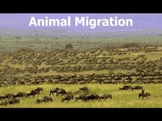
Animal Migration
Here is a unique resource to use with middle and high schoolers that deals with animal migration. Viewers discover the reasons for, types of, and animals that practice this behavioral adaptation. Specific animals that are introduced...
Maths Revisions
Scaled Drawings
Your carpenters will enjoy learning scaled drawing techniques and applying their new knowledge to make some real-life scale drawings of gardens. Your carpenter scholars will be reviewing some basic skills in a warm-up section of problems...
Curated OER
Seeing Sound & Sonar
Students make inferences based on different sounds that they hear. In this inferences lesson plan, students will hear sounds of different objects and describe the sounds based on what they hear. They will answer various questions about...
Curated OER
Weather Prediction
In this weather learning exercise, students review vocabulary words and concepts associated with predicting the weather. Students understand what a meteorologist studies. This learning exercise has 7 matching, 10 fill in the blank, and 5...
Curated OER
Tracking the Weather Using Technology
Fourth graders explore the use of technology to monitor and forecast weather. They investigate the different types of weather monitoring and forecast tools. Students interpret radar images and discuss the traditional types of weather...
Curated OER
Lost Roman Treasure
Students simulate what it would be like to be archeologists. They evaluate a quadrant area of a lost Roman treasure map. They generate their findings on the map into specific categorizes.


