Curated OER
Way to Go! Create a Road Map Game
Students create a travel game of one of the United States. They research a state of their choice and create a travel game using a common road map. They interpret map symbols as they calculate map mileage for their games. They create...
Curated OER
Road Map to Success
Using three different graphic organizers, learners create a road map describing how they'll meet their future career goals. They research the career they are interested in, then use their findings to construct a time line, road map, and...
Curated OER
What Do Maps Show?
This teaching packet is for grades five through eight, and it is organized around geographic themes: location, place, relationships, movement, and regions. There are four full lessons that are complete with posters, weblinks, and...
Novelinks
The Giver: Reading Road Map
Sometimes it's helpful to read certain passages in a novel slowly and carefully, and to read other parts more quickly to move the plot along. Learners tread carefully through Chapter 20 of Lois Lowry's The Giver, noting which parts need...
Space Awareness
Let's Map the Earth
Before maps went mobile, people actually had to learn how to read maps. Pupils look at map elements in order to understand how to read them and locate specific locations. Finally, young cartographers discover how to make aerial maps.
National Endowment for the Humanities
Lesson 3: On the Road with Marco Polo: From Hormuz to Kashgar
Young explorers examine the route that Marco Polo and his father traveled to reach China. They examine online maps of the Silk Road and harsh terrain of Afghanistan to determine challenges that may have been encountered during travel.
Scholastic
Volleyball Road Trip
Review coordinate mapping with your young geographers by matching cities on a volleyball team's road trip itinerary to their appropriate coordinate locations.
Curated OER
Story Mapping
Fill-out a story map to help your scholars with pre-writing. They will use a story map template to pre-write. They also organize their ideas into steps which become the foundation for their first draft. Concrete objects are brought in to...
American Museum of Natural History
Silk Road Fables
Talk about rabbit holes! With just this one resource, learners can travel the Silk Road listening to fables, meet a scientist who studies poisons (and whose favorite book is Alice in Wonderland), and listen to a video interview of an...
Curated OER
Use Google Maps to Teach Math
Capture the engagement of young mathematicians with this upper-elementary math lesson on measuring time and distance. Using Google Maps, students first measure and compare the distance and time it takes to travel between different...
National Endowment for the Humanities
On This Day With Lewis and Clark
Walk in the footsteps of Lewis and Clark as they discover the wonders, beauty, and dangers of the American frontier. After gaining background knowledge about Thomas Jefferson and the Louisiana Purchase, young explorers use primary...
Curated OER
Mt. Whitney to Death Valley
This is an intriguing problem that brings together real-world data, technology, and mathematical problem solving. If visibility wasn't an issue, could you see from the highest point in the lower 48 states, Mt. Whitney, to the lowest...
Curated OER
Mapping the Aegean Seafloor
Earth science learners create a two-dimensional topographic map of the floor of the Aegean Sea. They use it to then create a three-dimensional model of the ocean floor features. This comprehensive resource delivers strong background...
Texas State Energy Conservation Office
Investigation: Concept Mapping Fuels
After reading an article, "Fuels for Everything," collaborative groups create a concept map poster of the transportation and non-transportation fuels. This makes a strong introduction to the different types of fuels used for transportion...
NASA
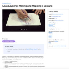
Lava Layering: Making and Mapping a Volcano
Looking for an out-of-this-world volcanic activity? Geologists study Earth's volcanic history and the neighboring planet Mars by modeling volcanic eruptions, lava flows, and building a shield volcano. Participants use graph paper and...
Curated OER
Belief Systems Along the Silk Roads
Learners examine cultural diffusion. In this Silk Road lesson plan, learners research primary sources to compare and contrast the religious beliefs encountered and shared by those who traded along the Silk Road route.
Curated OER
What Do Maps Show?: Lesson 1 Introduction to Maps
Learners brainstorm a list of the different types of maps they have seen or used. Using the activity sheet, they look through a social studies book to find all the maps and to determine what they are used for. Using a poster, they review...
Curated OER
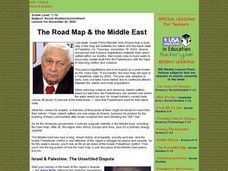
The Road Map & the Middle East
Will walls help? Read to learn how Prime Minister Ariel Sharon proposes to build walls around Isreal in hopes of isolation from Palestine. Complete an online Webquest, analyze maps, listen to audio clips, answer discussion questions, and...
Curated OER
Silk Road Caravan
Students determine how the geographic features of the Silk Road trade route contributed to the economic development and diffusion of culture in both Eastern and Western Civilizations.
Royal Geographical Society
An Introduction to Maps
First graders are introduced to a variety of maps such as globes, street maps, atlases, and different types of floor plans. The focus of the lesson plan requires individuals to create their own plan of the classroom using the PowerPoint...
Curated OER
A Road Map for the Roman Empire, Ca. 250 CE
Students consider how empires are created and sustained, examine Peutinger Table as a whole and in detail as tool of empire for Rome, c. 250 CE, create ancient time-distance travel chart that synthesizes series of strip maps, and...
Curated OER
What You Can Learn From a Map
Students investigate the use of road maps, shadeded relief maps, and topographic maps.
Curated OER
Kinds of Maps
In this map worksheet, students match a set of descriptions with the names of different types of maps and answer true/false questions and short answer questions about using maps.
Curated OER
What's a Map
In this mapping activity activity, students color the pictures and then cut them out. Students paste the pictures into the correct map section of city, water, land, and roads.


