Curated OER
Our Eye in the Sky: The TIROS Weather Satellite
Students investigate the political context of the creation of a weather satellite. In this technology and society lesson plan, students explore the historical, technological, and political context of the TIROS weather satellite. They...
Curated OER
Google Earth Scavenger Hunt
Students complete activities to learn how to use Google Earth and study Alaska. In this Google Earth lesson, students complete a Google Earth scavenger hunt to find facts about Alaska. Students complete two worksheets for the topic.
Curated OER
The Hinode Satellite Views the Sun
In this sun's magnetic field lines worksheet, students use a photograph taken by the Hinode Satellite that shows the complex magnetic structure of the sun over a sunspot. Student predict the magnetic field lines and draw them on a...
Curated OER
The STEREO Mission: Getting The Message Across
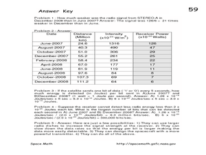
In this STEREO satellites worksheet, students are given a chart with the intensity of the signals from the satellites received on Earth and the distances of the satellite from Earth. Students convert the intensity at each distance to...
Curated OER
Eyes in the Sky
Middle schoolers examine the use of satellites. For this research lesson, students discuss the history of satellites and how we use the information today. They will conduct interviews with older adults who have lived in the changing...
Curated OER
How Do Satellites Work?
Students model how satellites transmit data by using numbers not images.
Curated OER
Science Excursion: Cover Mapping Land
Young scholars study remotely sensed images and topographic maps to classify land cover types in their watershed area. They take samples in the watershed area to interpret the images.
Curated OER
A High-Resolution Satellite Photo
In this high resolution satellite photograph worksheet, high schoolers observe a photograph taken by the Lunar Reconnaissance Orbiter of the Tennessee Court House. Students use the photograph to solve 4 problems about the scale of the...
Mr. E. Science
Our Solar System
The presentation starts with the scientists who made discoveries about our solar system: Ptolemy, Copernicus, Galileo, Brahe, Kepler, and Newton. It also covers the planets, inner, outer, and Pluto, satellites, and an in-depth discussion...
NASA
Earth's Global Energy Budget
Introduce your earth science enthusiasts to the earth's energy budget. Teach them using an informative set of slides that include illuminating lecturer's notes, relevant vocabulary, embedded animations, colorful satellite maps, and a...
Curated OER
Aruba Cloud Cover Measured by Satellite
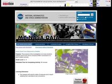
Students analyze cloud cover and to compose written conclusions to a given related scenario. They submit a letter of response and a report detailing their calculations and conclusions.
Curated OER
Satellite Mobiles
Students discuss satellites and their functions. They design and construct their own satellite out of readily available materials. Students are taught the definition of a satellite. They discuss the two main purposes of satellites:...
Curated OER
FILLING IN THE GAPS - Acquiring and Analyzing Satellite and Ground-Based Data
Students monitor rainfall, compute daily averages, and compare their methods of computation to those used by actual researchers using satellite observations.
Curated OER
Phytoplankton and Ocean Color
Fifth graders identify function of phytoplankton in the biospere by conducting experiments and simulations and reading for information. They detect the presence of phytoplankton in bodies of water by examining ocean in satellite images...
Curated OER
Storm Clouds-- Fly over a Late Winter Storm onboard a NASA Earth Observing Satellite
Students study cloud data and weather maps to explore cloud activity. In this cloud data lesson students locate latitude and longitude coordinates and determine cloud cover percentages.
American Museum of Natural History
Field Trip Mars
Fly around the Martian surface. Pupils view a presentation on the planet Mars featuring a flyover that shows different views of the surface where rovers have landed and explored on different missions. As individuals watch the images, the...
Curated OER
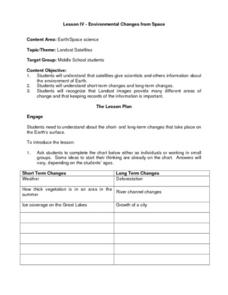
Environmental Changes from Space
Students discuss Landsat Satellites and the use of the images they provide as well as the purpose of keeping records of the information from the satellites. The class works in groups to complete a worksheet on short term and long term...
Curated OER
Mare Nubium and Las Vegas
In this satellite images worksheet, learners observe two photographs taken by the LRO Satellite of downtown Las Vegas and the moon. They solve 3 problems including determining the size of craters in the images, comparing the craters to...
Curated OER
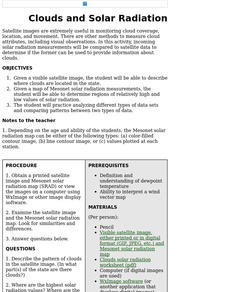
Clouds and Solar Radiation
Learners examine how clouds affect incoming solar radiation. They compare and contrast satellite images and incoming solar radiation measurements as methods to provide information about clouds.
Curated OER
The Adventure of Echo the Bat
Students compare different habitats based on satellite imagery. They identify land features in the satellite imagery.
Curated OER
Global Greenup
Students utilize satellite images to track the life cycle of vegetational growth over a large area. Animal migratory patterns are compared to this cycle.
Curated OER
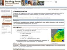
Ocean Circulation
Students view and analyze buoy, satellite, temperature vs depth data to study about ocean circulation and how is related to atmospheric circulation. They read and interpret satellite image data related to: Surface wind speeds, Wave...
Curated OER
Geography: examining the Glacial Features of Cape Cod
Students examine satellite images of the glacial features of Cape Cod. They analyze where human activity is located in terms of those features. Students make models of the features, including kettle holes. They also use contour maps...
Curated OER
Water Resources
High schoolers study water resources that are important to the people of North American and Africa. They use satellite images and data to explore how human actions can degrade, improve, or maintain water resources. They analyze and...


