Curated OER
Reading distance on maps
Eighth graders complete worksheets on reading the distance on maps in miles or kilometers. In this maps lesson plan, 8th graders use a calculator and ruler.
Teach Engineering
Using Map Scales to Figure Distances and Areas
The asteroid is getting closer and the question is whether the state of Alabraska is large enough for the shelter calculated in the previous activity. Teams determine the scale of their project and then use the scale on the map to...
Laboratory for Atmospheric and Space Physics
Planetary Distances on the Playground
There's no need to stay inside; get out of the classroom and create a scaled map of the solar system on your playground field! In collaborative groups, scholars identify the distance between the sun and other planets, place planet...
PBS
Map a Model Solar System
Creating a solar system map is a snap thanks to a hands-on activity! Science scholars explore the solar system by building it wherever they choose during an interactive from PBS's Space series. Users pick both the location and scale for...
Curated OER
Use Google Maps to Teach Math
Capture the engagement of young mathematicians with this upper-elementary math lesson on measuring time and distance. Using Google Maps, students first measure and compare the distance and time it takes to travel between different...
Curated OER
Scale Skills
In this mapping skills activity, students read an excerpt that describes three different types of scales and how to calculate distance on a map. They respond to two short answer questions using the map provided on the sheet and to...
Curated OER
Scaling it Down: Caves Have Maps, Too
Measurement and map skills are the focus of this lesson, where students crawl through a "cave" made out of boxes, desks and chairs, observing the dimensions. Your young geographers measure various aspects of the cave and practice math...
abcteach
Street Mapping
What's around the block? Or down the street? Ask your pupils to tap into their map skills by drafting the area around their home and school.
Journey Through the Universe
A Scale Model Solar System
Between the time scientists discovered Pluto and reclassified it as a dwarf planet, it did not even make one full revolution around the sun. In two activities, scholars investigate scale models and their properties. Pupils find that it...
Corbett Maths
Enlargements with Fractional Scale Factors
Enlargements make it bigger, right? A video shows viewers how to perform a basic dilation with a fractional scale factor. They learn how to use the scale factor to find the location of the transformed vertex by multiplying the horizontal...
Curated OER
Our Solar System - Comparing Planetary Travel Distances
NASA presents a mini-unit on distances in our solar system. It incorporates scientific concepts of gravity, mass, density, and payload while your aspiring astronauts also employ mathematics skills. They calculate speed, they determine...
Curated OER
Playground Mapping
Students convert their physical models of a playground from a previous lesson into a map of the playground that includes a scale and key. They examine and discuss examples of maps, view an image to map photo essay, and create a map using...
Curated OER
The History of Life on Earth
Using meters as years, your class works together to map out the geologic time scale on a football field. Plenty of background information is included in this lesson plan as well as several resource links and a student worksheet. Your...
Exploratorium
Measuring and Mapping the Playground
The school playground is a great place to learn about math. Pupils measure the dimensions of a playground using baby steps and individual strides. They use their measurements to create a scale drawing of the playground by applying an...
Curated OER
Estimate Distances on a Map
In this estimation worksheet, students estimate the distance on a city map based on the scale given to them. Students answer 4 short answer questions.
Curated OER
Proportions and Scale Factor for Measurement
Learners explore the concept of proportion. In this proportion lesson, students use google maps to find the distance the their school is from home. Learners discuss what a scale factor is through teacher led discussion. Students...
Curated OER
Designing a Hiking Trail
Put your students' map skills to the test with this engaging cross-curricular project. Given the task of developing new hiking trails for their local community, young cartographers must map out beginner and intermediate paths that meet a...
Curated OER
Stadiums in America
Let's play ball! A great springtime activity to learn about ratios. This activity challenges learners to draw stadiums to scale on standard letter paper and also on construction paper. This three-day lesson plan includes a pre-assessment...
Curated OER
Map Scale
Students investigate the purpose of map scale and how it is used to measure the distance and the size of objects.
Curated OER
Some Things You Need to Know to Read a Map
Learners study things the you need to know to read a map and explain location.
Curated OER
Orienteering - Lesson 4 - Distance and Height
Pretend that you've been dropped onto a mountain, in the middle of nowhere, and all you have to find your way is a topographical map and a compass. Could you find your way to the nearest town? Orienteering teaches the skills of map...
Curated OER
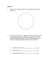
Measuring Distance
In this measurement activity, learners practice drawing 7 specific geometrical lines in a circle. Students problem solve 1 word problem with 3 measurements involving distance.
Balanced Assessment
School Zone
Find the right house within walking distance from school. The short assessment has pupils determine the houses that are a given maximum distance from a school. Individuals then determine the shortest and longest walks from the homes that...
Curated OER
Orienteering - Lesson 8 - Map and Compass
Put your students' orienteering skills together. Reading a compass and reading a map. In this assignment the class will use their compass and the map scale to determine the distance of a given route. If they finish their assignment,...


