Curated OER
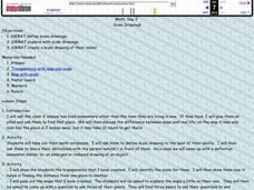
Scale Drawings
Learners explore scale drawings. They use maps to investigate scale drawings. Learners create a scale drawing of their own island.
Curated OER
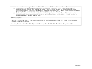
The Distance Formula and Marching Nonviolently for Social Change
Students explore the distance formula using real world data from nonviolent marches for social change. In this secondary mathematics lesson, students investigate the marches of Gandhi and King using maps overlaid with a coordinate...
Curated OER
Magical Maps
Second graders discuss the importance of using maps and how they are used. After they listen to a folktale, they develop their own story line maps and write their own folktale to accompany a map. They also identify and locate the seven...
Curated OER
Calculating Distance On Maps
Fourth graders determine the mileage from the local community to various scenic attractions in the Four-Corners-Region. They receive direct instruction and carry out activities in cooperative group settings.
Civil War Trust
Map the Civil War
Mapmaking was a very important element in successfully planning attacks on enemies during the Civil War. Guide pupils through the process of pacing to find the average length of their steps, measure the distance between one object to the...
Royal Geographical Society
An Introduction to Maps
First graders are introduced to a variety of maps such as globes, street maps, atlases, and different types of floor plans. The focus of the lesson plan requires individuals to create their own plan of the classroom using the PowerPoint...
Curated OER
Geography of South America
Student's identify geographic features of a South American map. They use the scale of the map to calculate distances between points. They identify examples of the five geographic themes on the map of South America.
101 Questions
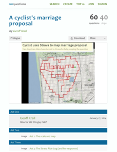
A Cyclist's Marriage Proposal
One cyclist goes to great lengths to make his proposal! Your classes must figure out just what length that is. Using a map with a bike route that spells out Marry Me, learners calculate the total distance of the ride. They base their...
Curated OER
Where Am I: How to Read a Map
Third graders develop an understanding of maps. They explore what a map is, who uses maps, and how to use maps. Students investigate the compas rose. They create a compose rose which illustrates the cardinal directions. Students practice...
Curated OER
China Quest
Read and research information on China. Young researchers complete a knowledge hunt about China then locate and describe each location using directional words. They recognize the word meaning through context clues and application practice.
Curated OER
Map Adventures
Students explore the relationship between a scale drawing and actual distance. In this mapping lesson, students use an amusement park map to determine distances and what they would be like in real life.
Curated OER
Maps- Looking at Map Scales
In this map scale worksheet, learners examine how to convert measurements on a map. They read 5 examples before completing 8 multi-step conversion problems. They insert the answers in an online version of the worksheet to determine if...
Curated OER
Three Scale Drawing Activities
In this scale drawing worksheet, students complete three different scale drawing activities. One activity is making a scale drawing, one involves answering questions from a given scale drawing, and one is a cross-number puzzle. The...
Curated OER
Make a Classroom Map
Students map the items in their classroom to explain the importance of coordinate systems.
Curated OER
Map Scale
Third and fourth graders are introduced to the concept of map scale. Using an illustration, they discuss if it shows the actual size of the object and why scale is used to represent areas. They use some items in the illustration to...
Curated OER
Maps Reinforcement
For this map worksheet, middle schoolers complete 6 multiple choice questions and 5 short answer questions about 3 different map figures.
Curated OER
How To Read A Map
In this map skills worksheet, students view a map and answer five short answer questions by using the map key as a guide.
Curated OER
Orienteering
Everything you wanted to know about orienteering, and more! Take your class on an adventure with this creative activity. You will need to gather some supplies and materials and maps for your specific location, but the unit sounds like it...
Curated OER
Africa: Introduction, Geography and Mapping
Students study the geography of Africa through the use of maps. They locate, distinguish, and describe the relationships among varying regional and global patterns of geographic phenomena such as landforms, climate, and natural resources.
Curated OER
Scale Drawing
In this measuring lengths learning exercise, students determine which units to use when measuring lengths, estimating lengths, and the errors made when measuring, Students estimate the lengths of each of the lines illustrate to the...
Curated OER
Map Work: How Far?
In this map scale activity, students analyze a map of an area with several towns marked. Students use the scale (1 cm = 1 km) to answer 6 questions about the distances between towns.
Curated OER
Zipping Through Our Solar System and Beyond
Launch your class on an exploration of the solar system. Learners construct solar system models to scale and get a better understanding of our place in the vast void of space. This is a great way for them to cement their understanding of...
Curated OER
Map the Civil War
Students explore the Civil War through original maps. In this mapping lesson, students calculate distance and show it on an original map. Students examine the type of landscape and its landmarks and draw symbols on the map.
Curated OER
Where Am I? Navigating Around the Globe
Third graders review spatial sense learned in grades one and two. They measure distances using map scales. They use atlases, and on-line sources to find geographical information.


