Curated OER
Label the Southern States
During your study of the United States, challenge your class to label the seventeen Southern states. Can they do it without the key? The answer sheet is included.
Curated OER
Size It Up: Map Skills
Compare information from a US population cartogram and a standard US map. Learners draw conclusions about population density by analyzing census data a population distribution. They discover that census data is used to apportion seats in...
Curated OER
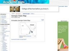
Georgia State Map
In this geography of Georgia worksheet, students color the map and label major cities and physical features. Students also study a second map showing the location of the state of Georgia in the United States.
Curated OER
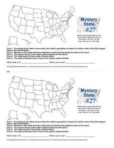
Mystery State #27
For this mystery state worksheet, students answer five clues to identify the state in question. They then locate that state on a map.
Curated OER
Mystery State #18
In this mystery state worksheet, students answer five clues to identify the state in question. They then locate that state on a map.
Curated OER
States and Capitals
This map skills PowerPoint features an interactive states and capitals game. The object of the game is to identify the capital cities of each of the 50 states. The excellent presentation includes United States maps, game directions, and...
Curated OER
Do You Know Your 50 States?
Learners use the names and abbreviations of the 50 states to label a blank map of the United States.
Curated OER
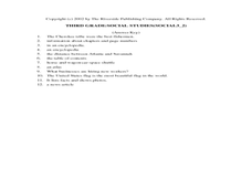
Social Studies Review Third Grade
In this review of various skills worksheet, students answer multiple choice questions about Georgia history, references, fiction and nonfiction, and U.S. history. Students answer 12 questions.
Curated OER
Civil War Prison Camps
Fourth graders work with a partner to create a puppet show that demonstrates the condition of the prisoners in Andersonville, Georgia during the Civil War.
Curated OER
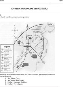
Fourth Grade Social Studies
In this social studies worksheet, 4th graders answer multiple choice questions on state maps, city maps, road maps, political maps, and more. Students complete 25 multiple choice questions.
Curated OER
Georgia Outline Map
In this Georgia outline map activity, learners examine political boundaries of the state and the placement its capital city as well as its major cities. This map is not labeled.
Curated OER
States in the USA Quiz
In this online interactive geography quiz worksheet, students respond to 50 identification questions about the states in the United States of America. Students have 4 minutes to complete the quiz.
Curated OER
Mystery State # 51
In this United States mystery worksheet, pupils determine which state is described by the 5 clues listed on the sheet and then mark it on the outline map of the United States.
Curated OER
State to State Scavenger Hunt
For this states worksheet, learners utilize the Internet to access one specific website to locate the answers to five fill in the blank statements about the states found on a United States map.
Curated OER
Native Lands: Indians in Georgia , Losing Ground: Removal, 1802-1838
Students investigate the removal of the Creek Indians from Georgia. Students read the story of the Creek removal from Georgia, locate sites mentioned on a map, and create a related timeline. Students share their thoughts on the Creek...
Curated OER
Mapping the Civil War
Students identify the locations of pivotal American Civil War battles. In this map skills lesson, students label Fort Sumter, Antietam, Vicksburg, Gettysburg, and the Battle for Atlanta on an outline map. The map is not included.
Curated OER
The United States in 1790
In this geography skills worksheet, students study the provided map of the United States in 1790 and then complete the provided quiz over the 17 states and territories.
Curated OER
The Civil War (1861-1865) Through Maps, Charts, Graphs, & Pictures
True to its titles, this engaging and appealing presentation brings the 1860's into close focus with a number of images and statistics that would delight any Civil War buff. A few graphs allow for pupil input, such as listing the...
Curated OER
Community, State, Country
First graders identify the town, county, state, and country in which they reside and the places where people work. They draw a picture of one of the places where people work.
Student Handouts
Geography of Dr. Martin Luther King, Jr.
Young geographers follow Dr. Martin Luther King's journey during the civil rights movement by identifying major events on a map of the eastern United States, such as his birth in Atlanta, Georgia and his famous "I Have a Dream" speech in...
ProCon
Sanctuary Cities
Should sanctuary cities receive federal funding, or do they defy federal laws? That is precisely the question scholars attempt to answer as they prepare for a class discussion or debate. After reading some brief background information,...
Curated OER
A Shuttle's Eye View
Students explore the goals of the Shuttle Radar Topography Mission as a springboard to exploring the topographical features of their own state or region. They synthesize their understanding of landforms and topography by mapping their...
American Battlefield Trust
Gettysburg Virtual Tour
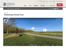
Step into one of the most iconic battlefields of the American Civil War with an educational interactive resource. Young historians learn about key moments, locations, soldiers, and turning points in the battle with a clickable map and...
Curated OER
Migration of the African American Family
Students investigate the influence Africa has had on African-American families as they have migrated from Africa to various sections of the United States. They utilize map skills to locate regions in Africa and in the United States.


