US Mint
Symbols in My Eyes
Explore the hidden meanings behind the images on US currency with this elementary school lesson on symbolism. Starting with a class discussion about symbols, children go on to brainstorm different objects that represent the Unites States...
Curated OER
What Do Maps Show?: Lesson 4 How to Read a Topographic Map
Students examine the use of topographic maps as two dimensional representations that show elevations and slopes with contour lines. They read maps of the Salt Lake City, Utah area and complete the associated worksheets that show map...
Curated OER
Maps and Globes
First graders complete a unit on map skills and the globe. They label maps, create a styrofoam ball globe, create a map of their community, sing a continent song, and complete a map and globe assessment worksheet.
Curated OER
Map Exploration
Are you looking for a terrific lesson on map activities for your second graders? Then, this resource is for you! The activities range from decoding, to fill-in-the-blank, to read-and-search. There is a website activity related to maps...
Curated OER
As the Kids Come and Go: Mapping a Classroom
Map the classroom with your kids to help them understand how maps work and how to read them. The lesson starts off with a story about animals living and moving around the globe, and then kids create maps of their classroom to show how...
Curated OER
Signs and Symbols
Sixth graders carefully analyze a triptych of the nativity, paying close attention to the lines, shapes and symbols included in the artwork. They explore the role of the Catholic church in society at the time the piece was created and...
School District of Palm Beach County
Framed Paragraphs characterization, problem and solution, symbolism, conflict
Support your learners as they work on writing paragraphs by providing graphic organizers, outlines, and frames. Sift through this packet to find the perfect organizers and templates to prepare pupils for writing. The resource...
Curated OER
Mapping Your Way Around
First graders identify a map, symbols on a map, and locate places on a map. Finally, they construct a map
University of Wisconsin
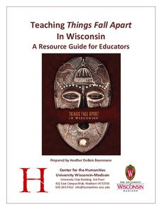
Teaching Things Fall Apart in Wisconsin: A Resource Guide for Educators
“There is no story that is not true, . . .” And uncovering the truths in Things Fall Apart is the focus of a 68-page resource packet designed to provide instructors with a wealth of materials that enhance understanding of Chinua Achebe’s...
Curated OER
Meet You at the Midden: Map Game
Students examine sketch map of Burrets' Trail at the Nightengale Archaeological Center, interpret map symbols to play game, and identify reasons people modify environment to meet their basic needs.
Curated OER
Meet You at the Midden: Map Game
Fourth graders use a sketch map to interpret map symbols in order to participate in a game. Using the game cards, they identify reasons why people modify their environment to meet their needs. They compare and contrast how people lived...
Curated OER
Learning to Read a Map
First graders identify the map and globe symbols: Cardinal Directions; Compass Rose; Mountains; Rivers; Lakes; Towns; Roads.
Curated OER
Maps! Maps! Maps!
Third graders examine and identify different types of maps. They review the types of projections and which maps are better for different information. They answer comprehension questions at the end of the lesson.
Curated OER
Learning to Read a Regional Map
Students locate the local community, surrounding communities and major geographic features of the SE Utah and the Four-Corners region on a map, after receiving direct instruction.
Curated OER
The Landscape of a Novel
Students, after reading a novel, utilize geographic skills to map out the places described in the novel. They collect data, envision spatial features and then design a map to work off of to complete their assignment. Each student also...
Curated OER
Celebrate Hanukkah in Israel
Explore Hanukkah and its origins with a social studies instructional activity. Learners discover the history of Hanukkah and its traditions. They locate Israel on a map, hear the story of the menorah and create their own dreidel....
Curated OER
Tortoise and Hare Races
Practice basic map skills with the story of The Tortoise and the Hare. After listening to the story, class members create a map that indicates the starting line, the path the animals took, where they stopped to rest, and the finish line....
American Institute of Physics
The Tuskegee Weathermen: African-American Meteorologists during World War II
Chances are good that young scholars have heard of the Tuskegee Airmen but few would predict that these pilots had their own support in the form of the Tuskegee Weathermen. These Black meteorologists were recruited and trained to provide...
Curated OER
Using Picture Mapping to Improve Student Comprehension
Pupils draw pictoral representations of a reading selection they read in order to recall information. For this picture mapping lesson plan, students use pictures to comprehend what they read and sequence the pictures as well.
Curated OER
Map your Schoolyard
Students practice their mapping skills by creating an accurate map of their schoolyard using an aerial photo from the National Map web site. Students include legends, a scale, and a north arrow on their maps.
Curated OER
Topographic Map Unit Plan
Students examine topographic maps and discover how to decipher contour intervals, use contour lines and apply information to complete a topographic map lab. Working in groups, they identify the scale of the map, latitude and longitude,...
Curated OER
Louisiana
Third graders study factual information about Louisiana including the state flag, bird, tree, and important geographical points using the Internet and maps. They explain the different groups that settled the state in this mini-unit.
Curated OER
We're Gonna Have A Party
First graders explore map skills. They discuss the map vocabulary and use directions to find a location on a map. Students discuss and use the components of a map to answer a variety of questions. They use the map and directions to find...


