Curated OER
What do Maps Show: How to Read a Topographic Map
Middle schoolers identify the characteristics of topographical maps. Using examples, they practice reading them and describing the information they gather from them. They also discover how to use the website from the U.S. Geological Survey.
Midnight Martian
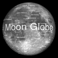
Moon Globe
Not just a simple globe of the moon, this interactive version allows you to choose lighting according to the location of the sun, views from different positions on Earth, and more! Satellite images and topographic data have been combined...
Curated OER
Tall as a Mountain, Flat as a Plain
Students examine a variety of landforms that are found on the Earth and compare and contrast the distinguishing qualities of these forms. A topographical model of the landforms is made.
Midnight Martian
Mars Globe HD
Explore the surface of Mars without leaving the comforts of your home or classroom! Learn about volcanoes, missions to the red planet, view the topography, and more.
Curated OER
A Contouring We Go
Students examine the built environment and infrastructures of their community by constructing contour equipment, using the equipment, and comparing their results to current topographical maps of the same area
It's About Time
Taking a Ride on a Lithospheric Plate
Assist your pupils and broaden their horizons with several activities that determine the exact positioning of various communities over the globe. Pupils use data from the Global Positioning System to determine the position and rate of...
Curated OER
Edible Maps
First graders, in groups, identify major geographical features of Texas. They form a topographical map of Texas using edible dough, candy, etc. They present and then eat their maps.
Curated OER
Welcome to My World!
Second graders increase their usage of maps and understand how maps are important in their lives. Students define what an atlas is, and to enforce the students' definition of what an atlas is, they also make their own atlas.
Curated OER
Geography and Culture in South Carolina
Students explore South Carolina. In this cultural heritage instructional activity, students investigate the topography of South Carolina using maps. Students are engaged in identifying the different regions of the state and examine the...
Curated OER
Maps Reinforcement
In this map learning exercise, students complete 6 multiple choice questions and 5 short answer questions about 3 different map figures.
Curated OER
Land Use Over Time
High schoolers view aerial photos and topographic maps of their local area. They compare and contrast major land use patterns over time by comparing these images to maps that are at least 50 years old. They analyze them using the four...
Curated OER
Science: Draining the Land - the Mississippi River
Students use topographic maps to identify parts of rivers. In addition, they discover gradient and predict changes in the channels caused by variations in water flow. Other activities include sketching a river model with a new channel...
Curated OER
The Geography of Maine Tourism
Students study topographical maps of Maine to identify the important physical features. They work in groups to create tourism pamphlet highlighting a region of the state.
Curated OER
Finding the Mother Lode
Students engage in a paper treasure hunt to find a lode deposit of gold using the placer deposit concentrations of metals found in stream sediments. They use topographic maps and metal concentrations to assist them. Students discuss the...
Curated OER
You Are Here
Students map local places and learn to use scale and distance. In this mapping lesson plan, students map their school and a favorite place. Students recreate their maps showing distance and scale sizes. Students locate their location...
National Endowment for the Humanities
Lesson 1: On the Road with Marco Polo: A Boy in 13th Century Venice
Learners investigate Marco Polo's life as a young boy in 13th century Venice. They analyze maps, explore various websites, complete a chart and answer discussion questions, and create a travel brochure about visiting 13th century Venice.
Curated OER
Plate Tectonics Day 3 Sea Floor Spreading: Evidence for Continental Drift
Young scholars are introduced to Sea Floor Spreading and how it provides evidence for Hess's and Deitz's theory of Continental Drift. They use paleomagnetic data to calculate the rate of Sea Floor Spreading.
Curated OER
Build a Model Watershed
Collaborative earth science groups create a working model of a watershed. Once it has been developed, you come along and introduce a change in land use, impacting the quality of water throughout their watershed. Model making is an...
Chicago Botanic Garden
Albedo, Reflectivity, and Absorption
What is reflectivity, and what does it have to do with the Earth's climate? As reflectivity is measured by albedo, scientists can gather information on Earth's energy balances that relate to global warming or climate change. Budding...
Curated OER
GEOGRAPHY: SPACE CENTERS
Students examine the descriptive science dealing with the surface of Earth, its division into continents and countries, climate, natural resources, inhabitants and industries of the various divisions and analyze the political geography...
Curated OER
Welcome to My World!
Learners use maps to locate information. They read the story, "It Looked Like Spilt Milk", view images of the continents and discuss the various continents. Afterward, they make their own Atlas to record information that they can later...
Curated OER
My Own Private Idaho; Using Social Studies to Explore Idaho
Students engage in several activities to explore Idaho and Social Studies themes. Using an variety of media, students become familiar with Idaho's geography and geology.
Curated OER
Landforms: Geomorphology of Arkansas
Second graders create large, salt dough maps of Arkansas and the natural regions in the state created by geographical and morphological features.
Curated OER
Analysis of Atmospheric Conditions for a High Mountain Retreat
Students examine the relationship between altitude, atmospheric pressure, temperature and humidity at a particular location. They practice science and math in real world applications. They write reports detailing their scientific...


