Anti-Defamation League
Impact of the U.S. Expansion on Indigenous People and Stereotypes About Native American People
The 2004 U.S. bicentennial sparks a discussion about its meaning and importance to United States history. Readings, maps, tables, and reflective writing prompt small groups to explore the westward expansion, Lewis and Clark, and how...
Curated OER
U.S. State Reports
Students conduct Internet research on a chosen U.S. state. They include information about the history, climate, geography, symbols, and tourist attractions of their state, and write an original poem.
Curated OER
Mapmaker, Make Me a Map!
Here is a well-designed, very thorough lesson plan on mapping for very young children. Within the six-page plan, you will find everything you need to implement the lesson. They will identify various landforms found in Colorado on a map,...
Curated OER
Basic U.S. Geography
Provide your 11th graders with a basic understanding of U.S. Geography. They label the state, regions, and boundaries found in the contiguous U.S. as well as Hawaii and Alaska. Then, they complete two Internet related activities.
K20 LEARN
Manifest Destiny: U.S. Territorial Expansion
A close examination of John Gast's painting "American Progress" launches a study of the concept of Manifest Destiny used to justify United States' policy of westward expansion. Young historians read statements from persons with different...
Curated OER
Our States, My State
Here is a very nice lesson on the shape of the United States, and the shapes of the individual states for your young geographers. They utilize worksheets embedded in the plan to color in a variety of states and to become familiar with...
Curated OER
Colorful Colorado
Learners investigate the components of white light as viewed through a prism. The multiple colors of the spectrum produced are related to wavelengths and experienced through the creation of a color wheel.
Happy Housewife
State Notebooking Pages
When learning about US geography, it can hard to remember facts about 50 different states. Help your young scholars organize all of this information with a collection of easy-to-use note-taking guides.
Curated OER
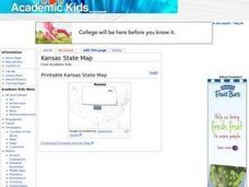
Kansas State Map
In this map of Kansas worksheet, students color and label major cities and physical features of this state. Students also study the location of Kansas in relation to the other states in the U.S. by studying the background map.
Curated OER
Tennessee State Map
In this Tennessee state geography worksheet, students color and label major cities and physical features on the map. Students also study a second map of the U.S. that shows the location of the state of Tennessee.
Curated OER
Utah State Map
In this geography of Utah worksheet, students color and label a map of the state of Utah. Students also study a second map that shows the location of this state in the U.S.
Curated OER
Indiana State Map
For this Indiana state map worksheet, students color and label the important cities and physical features on this outline map. Students also learn of Indiana's location in the U.S. by studying the background map.
Curated OER
Idaho State Map
In this Idaho state map worksheet, learners color and label important physical features and cities. Students also study the background map to learn the location of Idaho as related to the rest of the U.S.
Curated OER
Lesson 2: Mapping Our Home
Students recognize the importance of community participation in the census. In this U. S. Census lesson plan, students use map-reading skills to find answers and learn the difference between senators and members of Congress.
Curated OER
Mapping the Census
Students learn why the census makes a difference. In this U.S. Census lesson plan, students learn the key elements of cartography, examine the difference between data and their representation, and create a map using census data.
Curated OER
Flower Power
An engaging, multi-session art and science lesson awaits your class. Within this lesson, you'll find everything you need to implement the plan. They go on a nature walk around their school, and must identify many living and non-living...
Curated OER
South Carolina State Map
In this map of South Carolina worksheet, learners color and label major cities and physical features in South Carolina. There is also a map showing the location of the state in the U.S.
Curated OER
What State Are You In?
Students identify the major U.S. cities. In this U.S. geography lesson, students work in pairs and use game cards to name various cities in the United States.
Curated OER
The Fifty States
Students research to find information about the U.S. States. In this fifty states lesson, students choose a state to research and locate it on the map. Students research to find the population of that state and record by color coding on...
Curated OER
USA State Tag / Mississippi River Shuffle
Students reinforce the geographic location of the states of the U.S.A.
Curated OER
Amazing metals: Nevada quarter reverse
Nevada's nickname is "The Silver State" and metal is what this lesson is all about. Pupils will make a T-chart to discuss the differences between metals and minerals, then write and explain the properties of metal. They will get into...
Curated OER
Exploring a Map of Canada
In this exploring a map of Canada worksheet, students find and label the capital city, bodies of water, the U.S., the provinces and the territories of Canada.
Curated OER
Rhode Island State Map
In this geography of Rhode Island worksheet, students color and label a map with the major cities and physical features. Students also study a U.S. map to learn the location of the state of Rhode Island.
Curated OER
North American Biomes
In this Science worksheet, students color a biome map of North America. Students color the map by solving the clues listed on a separate sheet of paper.


