Curated OER
Weather Patterns and Acid Rain (or What is Chicago's acid rain doing in the Adirondacks?)
Pupils examine a color-coded map of U.S. acid rain precipitation intensity. Using EPA data table and the blank U.S. map, they record state-by-state values for magnitude of emissions and compare areas of emissions to areas with the most...
Federal Reserve Bank
Piggy Bank Primer: 25 Cents Worth of History
It's all about money. Here's a resource that introduces kids to the Federal Reserve System, different coins produced by the mints, and fun facts about state coins.
Curated OER
What is the connection between rice and estimation?
Sixth graders investigate estimating. In this estimating lesson, 6th graders estimate how much rice is eaten around the world. Students estimate the percentages of rice eaten by other countries. Students compare rice production to other...
Curated OER
Weather Watchers
Students conduct Internet research of their community's weather and compare it to the weather in another location. After conducting research, students become weather reporters by reporting their findings to the class by using a...
Curated OER
Geography: Why Is the Sacremento Valley a Good Place to Grow Rice?
Third graders locate the Sacramento Valley in California where rice is grown. In this rice growing location lesson, 3rd graders locate the Sacremento Valley, California on a map, and color the mountain ranges and terrain that is around...
Curated OER
Coin Connections
Young scholars examine the Illinois state quarter and review Lincoln and the fact that he is also on the penny. They color paper coins, identify their values, and create a money mobile. They play a Cent Sense game to practice which coins...
Curated OER
Election Results Map
Students use election night returns to create a map of the results. They can represent popular vote results or electoral votes received. They use the internet to gather information about the electoral college and results.
Curated OER
Where Do You Live?
Students identify their state and city on a map. After completing a reading of Zoom, students identify various landmarks on a globe and on a map. They begin by identifying the United States and refine their identification until they have...
Curated OER
Where Does It Come From?
Students explore where agricultural commodities used in snack foods are grown. They choose a snack food and locate the top five states that produce the food that the snack is made from.
Curated OER
From There To Here...
Learners find out where some of the products in hour homes come from, then become aware of our local trash, landfills and incinerators. They chart and graph data and use maps for different purposes.
Curated OER
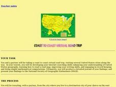
Coast to Coast Virtual Trip
Students complete a variety of exercises and activities as they plan a coast to coast trip across America. They keep a journal that includes where they went, what they did, what they saw, etc. They compare two cities they visited along...
Center for Innovation
Air Pollution: What's the Solution?
In this air pollution worksheet, students collect data for their county of residence as well as 10 surrounding counties including the total population and the county grade for the air. They use a map of their state and identify the 10...
Curated OER
The European Union
Ninth graders construct a timeline depicting the development of the European Union and label and color countries on a map belonging to it. They write essays about how the Union affects the United States.
Curated OER
Deserts
Students do various activities to explain where the United States' desert region lies in relationship to the state in which they live, become familiar with plants and animals in the Sonoran desert, and make a story map of Roadrunner...
Curated OER
Conflicting Views
Young scholars complete a Venn diagram comparing the United States and Afghanistan. They research the history of the Taliban and how they relate to the United States and its foreign policy. They write a paper on possible solutions.
Curated OER
Where Does It Come from?
Learners read articles about various agricultural products and create a map using the statistics in the article. In this agricultural statistics lesson, students look at the geography of the country and which products come from the...
Curated OER
Sense of Place Through the Eyes of an Inuit Children's Author
Students read books by Michael Arvaaluck Kusugak to explore life in the Artic Circle. After reading the books, students compare and contrast life in the Artic Circle to life in the United States. They write and illustrate a story about...
Curated OER
Cultural America
Seventh graders investigate the cultural differences that can be found in America. They discuss what it means to be called an American. The patterns of migration to America are discussed with the use of maps and geographical terms....
Curated OER
Integration of Education
High schoolers explore the history of Civil Rights and how the struggle for Civil Rights and the Second Reconstruction, transformed society and politics in the United States in the 1950s. Then they identify why American Schools are...
Curated OER
Plotting Earthquakes
In this earthquakes worksheet, learners access a website to gather information about the magnitude and location of earthquakes for 5 days. Then students complete 7 short answer questions.
Curated OER
Quarter Conservation
Students participate in a demonstration of what it means to "conserve" using a snack provided to them. They examine the California state quarter, John Muir, and the "conservation". They identify other things they can conserve.
Curated OER
Coal Production in the USA
Students arrange the states by alphabetical order, find the five top coal producing states and discover their total production levels. They then find all the states which begin with the letter "A" and whose coal production is less than...
Curated OER
Geography of the English Settlements
Third graders locate several important American colonial cities on a map and research how their proximity to water and nearby arable land affected the rate and success of settlement.
Defining US
Integration of Education and American Society
How did the struggle for Civil Rights during the 1950s transform American society and politics? Why are American schools integrated today? Class members explore these essential questions by examining a series of primary and secondary...


