Curated OER
Social Studies - State Riddle Lesson Plan
Young scholars make distinctions between the states, their cities, and capitals, and create riddles for classmates to solve.
Curated OER
Regions of the United States
Learners present a travelogue, an alternate format to preparing their writing, of a specific U.S. geographic region that includes the aspects of population, climate, landforms, economics, culture, famous people and places and natural...
Constitutional Rights Foundation
Refugees From Vietnam and Cambodia
The United States may have pulled its troops from the Vietnam War in 1973, but the conflict was far from over for the citizens living in Asia at the time. An informative resource lets learners know about the wave of over 220,000...
Curated OER
The Called Themselves the K.K.K.; The Birth of an American Terrorist Group
How did Ku Klux Klan develop and flourish in the US? How did the government respond to acts of terrorism conducted by the KKK following the Civil War? How does the government respond to acts of terrorism today? This resource launches a...
Curated OER
Language and Dialect
Practice listening skills while studying oral story tellers from different parts of Louisiana. Consider the regional dialects and insider language of folk groups with your class. Identify language as part of folk life and recognize that...
Curated OER
Arkansas State Rock
Here is a lesson which shows the value of a mineral called bauxite to Arkansas during the early 1900's. Learners relate the five themes of geography to the history of bauxite and aluminum production in Arkansas. For teachers of...
Curated OER
US: Western Region Map
In this U. S. Western Region outline map worksheet, students examine boundaries of each of the states and the placement of the capital cities. This map is not labeled.
Curated OER
Landforms and Resources of the United States and Canada
In this North American geography instructional activity, students read about the physical features and resources of the United States and Canada. Students take notes and answer 3 short answer comprehension questions as they read the...
Curated OER
Regions of the United States
Your learners practice writing ideas on paper and logically presenting them in an organized manner. They brainstorm ways to write down ideas while creating a travelogue about a particular U.S. geographic region. When they present...
Smithsonian Institution
We Have a Story to Tell: Native Peoples of the Chesapeake Region
How did colonial settlement and the establishment of the United States affect Native Americans in the Chesapeake region? Your young historians will analyze contemporary and historical maps, read informational texts, and work in groups to...
Curated OER
States and Capitals, Mountains and Rivers
Students identify geographical locations in the midwestern United States. In this geography lesson, students identify 12 states and capitals and geographical features in the region by using U.S. maps. Students use blank maps to fill in...
Curated OER
Fun With Pacific Northwest Cities and Towns
Intended for fun only, learners play with the names of cities common to their region or state. This lesson includes a list of cities in Oregon and not much else. What you and your class choose to do with your list of cities is up to you.
Curated OER
Touring the Regions of the United States
Fifth graders explore the regions of the United States. They use maps, research on the Internet and use measurements and estimations. Students create a presentation using spreadsheets and publishing software.
Curated OER
South US Region Map
In this United States regional outline map, learners examine the state boundaries of the states in the Southern Region. Capital cities are denoted with stars.
Advocates for Human Rights
Push and Pull Factors and Human Rights
What factors might make a person want to emigrate from their home country? What factors might make a person want to immigrate to a new country? Class members study the various waves of immigration to the US, looking at data about the...
Curated OER
Max Knows Mexicao, United States and Canada
Students utilize their map skills to explore the regions of North America. They explore the physical characteristics and climates of the regions. Students label their map and prepare a presentation of their findings.
Curated OER
Regions, Regions, Regions!
Students use regions to analyze the locational patterns of culture
groups at various scales. They discern the basics of region identity by discovering his/her "Home" Region through the examination of
criteria in his/her "backyard." In...
Curated OER
Settlement Patterns of the United States
Students examine the conditions that affected the way people settled in the United States. Using maps, they examine the topography and climate of different locations and determine the factors that do and do not allow settlement to occur....
Curated OER
Travelogs
Students make travelog journals to send to acquaintances in other states in order to receive mail in return. They make scrapbooks with the return mail they receive.
Curated OER
Nature and Place Names in Arkansas
Middle schoolers examine the way that many place names in Arkansas came to be. By looking at Arkansas highway maps, they find names that come from the characteristics of each of the state's six geographical divisions. This interesting...
Curated OER
Electronic Survey Activity
Fifth graders conduct a class survey and share the results with a class in another state via an electronic bulletin board. This technology-rich lesson is an ideal way to have learners practice communicating with others through the use of...
US Mint
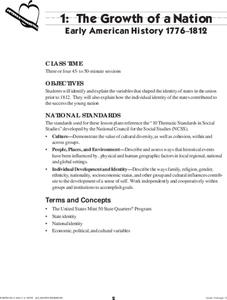
The Growth of a Nation
Young historians explore the identity of the early United States in this four-part instructional activity series. Working in groups of three, students research the political, economic, and cultural atmosphere of each member of the...
Curated OER
The 50 States
Fifth graders use maps and music to learn the 50 states. For this US Geography lesson, 5th graders map out a region of the United States and practice singing the song, The 50 States that Rhyme.
Curated OER
Virtual Vacation
Students are members of teams traveling and exploring the Pacific States Region of the United States via the Internet. Each team travels virtually to its destination to become experts on geography, history, tourism, nature, and economics.


