Curated OER
MAPPING THE BLACK ATLANTIC
Students examine the geographic characteristics of Western and Central Africa, the impact of geography on settlement patterns, cultural traits, and trade. They compare political, social, economic, and religious systems of...
Curated OER
Lewis Hine
Students define the term Industrialization. They use specific examples, discuss why and how industrialization grew during the early twentieth century in America. Students evaluate the contributions of technological advances, geography...
Curated OER
Social Studies: Cultural New Orleans
Students observe the PBS film, "New Orleans," to explore such topics as race relations, cultural history, and urbanization. After examining n interactive map displaying the city at various dates in its history, students role-play as...
Curated OER
Louisiana Purchase
Students use maps to locate and describe the area purchased by the Louisiana Purchase. In groups, they write a letter to Thomas Jefferson in which they evaluate the topography, climate and geography of the land. They determine the land's...
Curated OER
Biggest Muslim Cities Quiz
In this online interactive geography quiz worksheet, students respond to 34 identification questions about the largest Muslim cities. Students have 5 minutes to complete the quiz.
Curated OER
Southernmost Cities Quiz
In this online interactive geography quiz worksheet, students respond to 22 identification questions about cities in the world's southern hemisphere. Students have 5 minutes to complete the quiz.
Curated OER
Cities Near Water Quiz
In this online interactive geography quiz worksheet, students respond to 18 identification questions about world cities located near water. Students have 4 minutes to complete the quiz.
Curated OER
Northernmost Cities Quiz
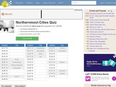
In this online interactive geography quiz learning exercise, students respond to 27 identification questions about world cities in the northern hemisphere. Students have 5 minutes to complete the quiz.
Curated OER
If You Build It, Will They Come?
Students examine the city of Duluth, Minnesota. In groups, they use the internet to discover its current state of urban geography. After their research, they create and plan their own redeveloping of the city. They share their results...
Curated OER
Can You Give Me Directions To the Game?
Learners become familiar with the use and capabilities of GIS and use it for research and mapping purposes. They heighten their ability to estimate travel times by incorporating distance, mode of travel and urban congestion into the...
Curated OER
Getting to Work
Students examine the modes of transportation people use to get to work in Canada. They examine how the methods chosen differ among provinces and among urban areas. They focus on the choices people make when selecting a method of getting...
Curated OER
Bringing Illinois into the Curriculum
Students of all ages are introduced to the geography of Illinois. Depending on the grade level, they participate in different activities which allow them to discover Illinois in the past and present. They examine the animals and...
Curated OER
A Sense of West Virginia
Students consider their perceptions of the world through their 5 senses while visiting the West Virginia State Museum. In this West Virginia history lesson plan, students discover how knowing about the past helps with their understanding...
Curated OER
Biggest Cities in the UK Quiz
In this online interactive geography quiz worksheet, learners respond to 20 identification questions about the biggest cities in the United Kingdom. Students have 4 minutes to complete the quiz.
Curated OER
Community Map of The Giver
Students read "The Giver" after finishing the unit on inventions and inventors. Using the information in the novel, they develop a geographic map illustrating the community in the story. They identify human and physical features and...
Curated OER
Understanding Growth of the Phoenix Area
Students study the growth of the Phoenix area using geographic images, maps, tables, and graphs. They study the idea of community.
Curated OER
What Can a Map Tell You?
Students investigate how maps can provide useful information about health issues. They study a map to draw conclusions about cholera death in London.
Curated OER
The High Cost of Chemical Dependency
Sixth graders explore, analyze and study the effect and impact that humans have on the environment based on their choices as individuals, businesses and governments. They assess the balance between human activities and aquatic pollution.
C-SPAN
Political Polarization
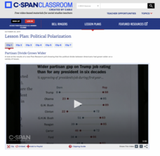
Dive into the political breach with pupils and explore the reasons for political polarization. Using clips from C-SPAN that include discussions from reporters and scholars, class members consider what is causing the political fault lines...
Curated OER
Growing in Character
Students explore how to build their character by respecting and appreciating various cultures. For this character education lesson, students read the book Seedfolks and answer questions based on the character's cultural backgrounds....
Curated OER
Create the Ideal City
Learners examine the significance of city planning. They analyze maps, develop a crossword puzzle using vocabulary terms, and create a diagram of an ideal city and describe the features that make it healthy for the economy, the...
Curated OER
Development on the Edge of a City
Learners explore and analyze examples of changing relationships between patterns of settlement and land use in the state of Minnesota. They view different avenues of transportation, cities, suburbs, city planners and suburbanization.
Curated OER
Analyzing the Job Market for Babysitting in Your Neighborhood
Students conduct research on a neighborhood in Canada. In this data analysis instructional activity, students use data from the 2006 Canadian census to draw conclusions about a population group.
Curated OER
Population and Productivity: Two P's in a Pod
Students investigate the link between countries' population growth rates and levels of industrialization. They observe that, over time, as a country becomes more industrialized, its population growth rate decreases.


