Curated OER
The United States and Canada: Climate and Vegetation
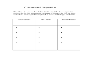
Display U.S. and Canadian climate and vegetation through this text-companion learning exercise. Learners read about the geography of these regions, take notes, and answer 3 comprehension questions as they read the selection. A graphic...
Curated OER
Physical Geography- Climate
Sixth graders explore different climates. In this compare and contrast lesson, 6th graders look at the differences in climates of America and Europe. Students use KWL charts and graphic organizers to record information about different...
Curated OER
New Hampshire and the Five Themes of Geography
Young scholars explore the location, place, human-environmental interactions, movement, and regions of the New Hampshire landscape through the use of visual representations.
Curated OER
Exploring our National Parks
Students utilize maps/Atlases to find key spatial information, locate U.S. National Parks, characterize the geography of a specific region, and create a National Park brochure.
Curated OER
Create Your Own Country Project
Young scholars demonstrate their knowledge of geography with this fun, collaborative social studies project. Working in small groups, students develop their very own countries, writing descriptions of their physical location, social...
Curated OER
Location of Cities 201
Students work in pairs to locate the ancient cities on a world atlas using the longitude and latitude measurements. They examine the physical and human futures that explain their locations.
Curated OER
Postcards from California: A Unit on Geography, Social Studies, History and California's Resources
Fourth graders examine patterns that influence population density in the various regions of California. The unit's three lessons utilize graphic organizers for the interpretation and presentation of data.
Curated OER
Physical Geography of Africa
Fifth graders investigate the topography of Africa. In this physical geography lesson, 5th graders research the six regions of Africa and complete a physical map. Students locate various landforms in Africa. Students use their...
Curated OER
Mapping South America
Students explore South America. For this South American lesson, students use their geography skills to create population, terrain, biomes/vegetation, and major exports maps. Students present their finished maps to their classmates and...
Curated OER
Deserts: How Do You Define One?
Second graders identify what constitutes as a desert by reading a habitat checklist. In this environment lesson, 2nd graders read a nature website to discover facts about the desert and where they are located. Students utilize art...
Curated OER
Tropical Regions/Mapping Biodiversity
Students use a world map to locate the country of Puerto Rico. In groups, they identify the various types of vegetation found on the island. They compare and contrast the biodiversity of the country to the United States. To end the...
Curated OER
California Regions
Students explore and compare and contrast the four main regions of California: mountains, coast, central valley, and desert. students use pictures and research to describe how regions vary in land use, vegetation, wildlife and climate.
Curated OER
Settlement Patterns of the United States
Students examine the conditions that affected the way people settled in the United States. Using maps, they examine the topography and climate of different locations and determine the factors that do and do not allow settlement to occur....
Curated OER
What if the Mormons had not come to Utah?
Fourth graders use critical thinking, evaluation, and geography skills to find alternative locations that Brigham Young could have taken the Mormons to settle.
Curated OER
U.S. Geography: The South
Young geographers complete a research project. They list the physical features found in the American South. They then discuss the economy, culture, and geography found in the South. They work in groups to research one of the five...
Curated OER
Kansas Land
Fourth graders discover the geographic regions of Kansas. In this geography lesson, 4th graders explore the different regions of Kansas and determine how the different geography affects daily life in Kansas.
Curated OER
Create a Travel Brochure
Students determine how geography affects how people live, work and play. They identify the different landforms in the three regions of Peru and create a travel brochure highlighting Peru's attractions.
Curated OER
Cartographer on Assignment: Creating a Physical Map of Africa
Students use geographic information to make an outline map of Africa, then demonstrate their understanding of the physical landscape of Africa by using a variety of materials to create a physical map of Africa
Curated OER
From Claws to Jaws: Atlantic Regions of the United States
Young scholars explore New England, Mid-Atlantic, and southeastern regions of the United States. In this social studies thematic unit, students research a state and make a regional quilt. Young scholars wrte a book report and read two...
Curated OER
Taiga
In this taiga worksheet, learners read a short article describing what a taiga is and then answer 10 multiple choice, true or false or short answer questions relating to the article.
Curated OER
'My Town' Brochure
Ninth graders use the internet to research a city or town on the "Walk Across Texas" route. They create a brochure or booklet advertising their assigned city or town.
Curated OER
What and Where is Puerto Rico?
Students explore Puerto Rico. They create K-W-L charts of their prior knowledge of Puerto Rico and observe maps of Puerto Rico. They code the map for measurements and land and water forms. They explore websites to gain background on...
Curated OER
Cultural Comparison
Students choose from a group of entries about the culture of Peru. In this Peruvian culture lesson, students understand the definition of culture. Students describe the culture of Peru researched in the entry and complete a worksheet.
Curated OER
Era of Self-Sufficiency - Pre-1890
Young scholars investigate the relationship between physical geography and Utah's settlement. In this Utah land lesson, students view a PowerPoint about Utah land and work in groups to answer questions about the uniqueness of Utah's...


