Curated OER
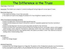
The Difference is the Truss
Students use a computer to simulate building and testing bridges with various types of trusses.
Curated OER
2 x 2
Middle schoolers work together to grid a 2 x 2 meter unit using the formula for the Pythagorean Theorem. After creating the grid, they identify the location of artifacts and create a map of their location. They develop a graph and table...
Curated OER
What a Site!
Fourth graders are introduced to how to properly create a grid site. In groups, they use Cartesian coordinates to establish the boundaries for the grid and photograph the location of artifacts. They exchange their photos with another...
Curated OER
Math: A Geometric Neighborhood
Pupils, as a final project, draw a picture of their ideal neighborhood on a sunny day. In addition to the sun, their drawings include homes, trees, streets, and selected objects. Each object in their drawing has a written description...
Curated OER
Mapping the Local Community
Students review the symbols and legends of a map. In groups, they follow a set of directions to create a map showing the route to a specific place. They present their map to the class and review the basic components of a community.
Curated OER
Student Weather Journal
Students recognize different types of cloud patterns and associate these patterns with certain types of weather. They predict the weather for the next 6 to 24 hours. They then improve their observation skills as they check on the weather...
Curated OER
Orientation of the Earth in Space
Students hypothesize the location of the sun in the sky at diferent times of day and at different latitudes. They perform several experiments to provide evidence for their hypothesis. Experiments including observing the sun's position at...
Curated OER
May We Present Planet Earth?
Students draw a map to scale. They illustrate knowledge of how to use DOGS TAILS on a map. Students identify the main parts of a map. They identify and illustrate the major features necessary for sustaining a quality of life for a society.
Curated OER
Waldseemuller's Map: World 1507
Seventh graders analyze various maps. In this Geography instructional activity, 7th graders create a large map as a whole class. Students write a letter to Mr. Waldseemuller.


