Curated OER
Isolines on a Weather Map
Ninth graders recognize isolines on a weather map and draw isolines based on temperature data on a weather map. They draw isotherms on a weather map to identify temperature patterns.
Curated OER
Isolines
For this isolines worksheet, students are given a series of numbers representing altitudes and they draw the isolines for 50 foot intervals. Students determine gradients between given points on the map.
Curated OER
Isolines on a Weather Map
Ninth graders explore weather by analyzing maps. In this temperature lesson, 9th graders view black and white weather maps of locations in which the weather changes often. Students identify the isolines used on the maps and utilize the...
Curated OER
Color Enhanced Maps
Students download or create maps with numerical weather data. They add isolines and color to create regions on their maps. They explore the visual properties of color palettes and create a visualization applying their knowledge.
Curated OER
Mapping a Temperature Field
Students measure and graph temperatures. In this temperature field activity students use a map to measure and plot field values and construct isolines and interpret the results.
Curated OER
Gilligan's Island
Students investigate topographical maps and match actual landforms to them. In this topographical maps lesson students create "Gilligan's Island" to scale then answer questions about it such as what the highest elevations is and what...
Curated OER
Introduction to Topographic Maps
Tenth graders create a topographic map and see how it represents different elevations. In this topographic maps lesson students read and interpret topographic maps.
Curated OER
Vocabulary for Dimensions of the Earth
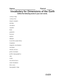
In this Earth dimensions learning exercise, students define 24 terms associated with contour maps, latitude, longitude, and time zones.
Curated OER
Energy Resources: Where Are They and How Do We Get Them?
Future energy engineers visit several stations, each one dedicated to a different alternative source of energy. They describe how solar energy is converted into other forms of energy, the patterns of distribution of energy resources in...
Curated OER
Weather's Outer Limits
Students make educated guesses and explain their reasoning and compile, graph, and map weather data. They then study environmental weather extremes on earth and discover that many variables determine climate.
Curated OER
Working With Electronic Topography Maps
Junior geologists examine topographic maps online and learn how to read them. they answer seven associated follow-up questions. This lesson plan is only a general outline and does not provide the details or the websites that you would...
Curated OER
Making Topographic Maps and Mountain Profiles
Students study how to mark inclines and construct a mountain profile. In this topographic map lesson plan students mark contour intervals and draw mountain profiles.
Curated OER
3-D Topographic Maps
Students create a 3-D topographic map. In this map building activity, students use cardboard to create a topographic map of the Catskills mountain region.
Curated OER
Weather Review
In this weather worksheet, students reviews terms associated with measuring different weather phenomena plus draw examples of different types of fronts on a weather map. This worksheet has 5 true or false, 15 matching, 21 multiple...
Other popular searches
- Topographic Maps Isolines
- Topographic Maps + Isolines
- Isolines and Contour Maps
- Isolines Contours
- Temperature Isolines
- Isolines Variable


