Living Rainforest
Finding the Rainforests
From Brazil to Indonesia, young scientists investigate the geography and climate of the world's tropical rain forests with this collection of worksheets.
Curated OER
Spherical Geometry: A Global Perspective
Students investigate spherical geometry using a globe and an apple. In this spherical geometry lesson plan, students translate Euclidean geometry terms to spherical geometry terms using a globe. They answer 3 questions about spherical...
Curated OER
Zoo's Clues!
Students determine the difference between major and minor details after researching animals and completing graphic organizers. They write descriptive paragraphs for classmates to guess what animal is being described.
Carolina K-12
Colonialism and American Foundations Sample Test Questions
What was the main cause of European colonization in America? How did Thomas Paine's Common Sense play a role in the establishment of the United States? What was the trans-Atlantic slave trade? These are just a few of the many questions...
Australian Government
The Great Artesian Basin
Covering 23% of the continent and holding 64,900 cubic kilometers of water, the Great Artesian Basin is the primary source of water for much of inland Australia. Using detailed student worksheets, experiments, and case studies, young...
NOAA
Plate Tectonics I
Young geologists get a glimpse beneath the earth's surface in this plate tectonics investigation. After first learning about the different layers of the earth and the constant movement of its plates, young geologists work in small groups...
Library of Congress
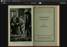
Treasure Island
For 30 years, Long John Silver has sailed the seas. An eBook version of Treasure Island introduces readers to the tales Long John Silver has to tell. This 1883 version of the text includes an introduction to encourage critical thinking...
Reading Through History
The Proclamation of 1763
The French and Indian War concluded with an important proclamation—that is, The Proclamation of 1763. Scholars read about the policies in the document and how the different sides of the French and Indian War reacted. Following, they...
Curated OER
Earth Matters
Students identify Earth's equator, prime meridian, lines of latitude, lines of longitude, parallels, and meridians.
Curated OER
China: Web Planner
In this China web planner graphic organizer, students fill the web graphic organizer as they plan a report, poster, or presentation about China. They write key areas of study on each of web spokes, and write facts and key words near the...
Curated OER
The Battle of Lexington
Students discover the Missouri River and its importance during the Civil War. In this U.S. history lesson, students examine a map of the great Battle of Lexington, and discuss why the Missouri River was a key element to the conflict....
Curated OER
Life Beyond the Fifty Yard Line -- An ecological look at our backyard
Students, in groups, stake out and rope off their study area, do population counts and density studies. They construct a map of the whole area, collect plants and insects, and mount and identify the organisms using keys.
Curated OER
The Geography of Renaissance
Students use the internet to research the geography of the Renaissance. Using maps of Europe, they identify at least three key cities during the time period and discuss the main types of transportation. They research the various customs...
Curated OER
Pablo Neruda
Eighth graders explore the life and works of Pablo Neruda. They complete an author map concerning his personal and professional life. Students identify the key components of an ode. They write an ode to a common object around their...
Curated OER
A Boy at War: A novel about Pearl Harbor by Harry Mazer
This A Boy At War PowerPoint introduces the historical context of the novel and information about the novel's author. Facts and trivia about Pearl Harbor that are relevant to the novel's plot are reviewed. Historical photos and a map of...
Curated OER
Scenic Attractions In Four Corners
Fourth graders find and list scenic attractions in SE Utah and the Four-Corners-region. They receive direct instruction and carry out activities in cooperative group settings. They combine their findings onto one large map at the end of...
Curated OER
Roller Coaster Mania
Fifth graders extend their knowledge of developing maps. They work in cooperative groups to develop an amusement park display and a brochure.
Curated OER
Kidsville USA
Second graders create an imaginary town using Kid Pix. They demonstrate their knowledge of specific vocabulary words and their knowledge and understanding of location by placing schools, stores, parks, etc. appropriately on their maps.
Curated OER
Whale Migrations
Students use whale migration patterns to determine sex and age of whales and determine where these whales can be located during different seasons. They use mapping skills to plot the migration patterns of four unknown whales.
Curated OER
Our State Road Trip
Students take a virtual tour of the country of China instead of a state. Using the Internet, they examine the differences between a political and physical map and use latitude and longitude to locate specific places. They also research...
Curated OER
Town Development
Students use a map of Kansas in the 1800s to discuss town development and issues related to slavery. They create fictitious towns to promote to outsiders.
Curated OER
Off to See the World!
Second graders use games that use the atlas and the globe. Students take a ride (journey). Students place their chairs as if they are riding in a car. The Teacher is the driver. As the students travel along they point out different sites...
Power Show
Colonial North America
This 54-slide PowerPoint outlines the significant events in the history of Colonial North America, beginning in 1603 with the ascendance of James I to the throne of England. Designed to accompany a lecture on this time period, the...
Curated OER
Plotting Earthquakes
In this earthquakes worksheet, students access a website to gather information about the magnitude and location of earthquakes for 5 days. Then students complete 7 short answer questions.
Other popular searches
- Map Key and Legend
- Map Legends
- Map Key Legend
- Map Keys and Legends
- Map Key Legend Activities
- Map Legends and Symbols
- Map Legends First Grade
- Interpreting Map Legends
- Reading Map Legends
- Creating Map Legends
- Using Map Legends
- Semantic Map Legends


