Curated OER
State to State Scavenger Hunt
In this states activity, students utilize the Internet to access one specific website to locate the answers to five fill in the blank statements about the states found on a United States map.
Curated OER
Do You Know Your 50 States?
Learners use the names and abbreviations of the 50 states to label a blank map of the United States.
Curated OER
United States Map- Rivers
Students learn about rivers. In this maps lesson, students describe rivers and what human activities take place in a river. Students use a map to locate the rivers in the United States.
Curated OER
United States Map Quiz
For this online interactive geography quiz worksheet, students respond to 50 identification questions about the shapes of countries shown. Students have 5 minutes to complete the quiz.
Curated OER
Lots of Lakes: Greater Than, Less Than
To set up this activity, your class explores Minnesota's nickname as the Land of 10,000 Lakes, and the back of the state quarter that features a Minnesota lake. Young mathematicians compare the number 1 to the number 10,000 with support...
Curated OER
Why Is A City Located Where It Is?
Students analyze how transportation influenced the development of Stillwater, Minnesota, They use the same techniques to analyze the impact of transportation on the origination and development of their own community.
Curated OER
State Nicknames Quiz
In this online interactive geography quiz worksheet, students examine the chart that includes the names of 49 states. Students identify the nicknames of the states in 6 minutes.
Curated OER
Water Features - Lesson 2 - U.S. Political Map Grade 4-5
Students locate water features on maps. In this geography lesson, students complete worksheets that require them to identify water features on a U. S. political map.
Curated OER
Social Studies: Area and Population Density
Math scholars of many ages examine the concept of population density and then discuss the significance of the population densities of Minnesota and China. They figure the population density of their school.
Curated OER
Mystery State #9
In this mystery state worksheet, students answer five clues to identify the state in question. They then locate that state on a map.
Curated OER
States in the USA Quiz
In this online interactive geography quiz worksheet, students respond to 50 identification questions about the states in the United States of America. Students have 4 minutes to complete the quiz.
Curated OER
Minnesota Floor Map
Students examine the physical geography of Minnesota, work cooperatively to design a map of Minnesota and develop spatial and relative location of Minnesota landmarks and physical characteristics.
Curated OER
Midwestern States
For this United States geography worksheet, students study the image of the Midwestern states. Student then label the states with the following choices: Missouri, Iowa, South Dakota, Minnesota, Nebraska, Illinois, North Dakota, Kansas,...
Curated OER
United States Map- Rivers
Students identify major rivers on a map of the United States. For this geography lesson, students discuss what a river is and use a map marker to identify the symbol of a river on a map.
Curated OER
Rivers, Maps, and Math
Students use maps to locate and label the major rivers of North and South America. Using the internet, they identify forests, grasslands, mountain ranges and other landforms on the continents as well. They compare and contrast the...
Curated OER
Minnesota
In this Minnesota activity, students analyze a simple unlabeled outline map of the state of Minnesota. Students may color the map or label it with cities or physical features.
Curated OER
Minnesota Ospreys and Migration
Students explore the route that Minnesota ospreys follow during spring and fall migration. They describe the important ecological characteristics of the places that ospreys pass through during their migration. They determine where...
Curated OER
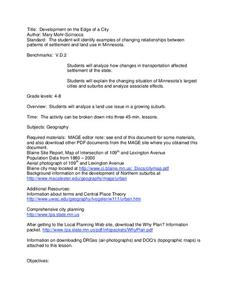
Development on the Edge of a City
Students explore and analyze examples of changing relationships between patterns of settlement and land use in the state of Minnesota. They view different avenues of transportation, cities, suburbs, city planners and suburbanization.
American Battlefield Trust
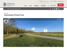
Gettysburg Virtual Tour
Step into one of the most iconic battlefields of the American Civil War with an educational interactive resource. Young historians learn about key moments, locations, soldiers, and turning points in the battle with a clickable map and...
Curated OER
Food For Thought: A Geography of Minnesota Agriculture
Students participate in hands-on activities and discussions about Minnesota's agriculture. They practice reading maps and locating where certain agricultural products are found throughout the state.
Curated OER
Social Studies: Great Circle Route
Students compare routes between Minnesota and China using a map and globe. Using the "great circle route" method, students find the shortest route between two points.
Curated OER
Minnesota Road Trip
Students plan a week-long trip around the state of Minnesota. They write a detailed itinerary for their trip and fill in a blank map of Minnesota with the places and routes listed in their itinerary.
Curated OER
Minnesota-China Connections:What Time Is It?
Learners calculate the time difference between Beijing, China and their local community. They discuss how time difference affects intercultural communication.
Curated OER
Comparing Neighbors
Students compare and contrast Minnesota to its Canadian neighbors. In this geography lesson, students work in groups to examine a map for their political division to Minnesota. Students compare and contrast information about Minnesota to...


