Curated OER
Travel Plan Project
You can use a travel plan project in the classroom to learn about budgets, maps, time management, and more.
Curated OER
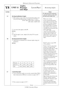
Angles, Bearings and Maps
Students review what they comprehend about angles. They name the differnt types of angles and define them. Students use their protractors to answer questions, the teacher walks around to look at the positioning of the protractors. ...
Curated OER
Weather Lesson Five
Young scholars define a weather forecast, make a forecast using a weather map, identify three prediction guidelines, and explain how computers help to make forecasts. Students make a 24-hour forecast for each of the thirteen states...
Curated OER
Word Association Poetry with Visual Thesaurus (or Not)
Young poets get inspiration and guidance for making word association poems with the Visual Thesaurus. Your class could complete this project with nothing more than a pencil and paper as well. A nice one-off for a substitute during your...
SeaWorld
Animal Migrations
Here is a fabulous set of activities for your young scientists. Each lesson contains map, hands-on, and game activities that will help the class understand why and how animals migrate from one place to another. First they'll examine the...
NASA
Erosion and Landslides
A professional-quality PowerPoint, which includes links to footage of actual landslides in action, opens this moving lesson. Viewers learn what conditions lead to erosion and land giving way. They simulate landslides with a variety of...
Curated OER
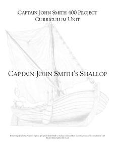
Captain John Smith's Shallop
Young explorers, all aboard the shallop to discover how early European explorers would navigate the American coastline to find resources, map terrain, and trade with Native American tribes.
Curated OER
Tracking Satellites Using Latitude and Longitude
Students, viewing an Internet site, plot the path of several satellites using latitude and longitude over the course of an hour. They learn the four basic types of satellites and their purpose.
Curated OER
Where in the Latitude Are You? A Longitude Here.
Students distinguish between latitude and longitude on the map. In this mapping lesson, students participate in mapping skills to recognize spatial relationships, and where to find natural resources on the map. Students create their own...
Curated OER
This Land Is Your Land, This Land Is My Land
Students review and evaluate the ways land is covered and used in their local community. They consider the environmental effects of the different types of land use. Students act as community planning engineers to determine where to place...
Curated OER
Earth Structure and Processes
Students classify different rocks according to their types. In this earth science lesson, students explain how plate tectonics created Earth's landforms. They explain the continental drift theory and sea floor spreading in their own words.
Curated OER
Mathematical Roadmaps
Second graders observe how a sample math problem is solved on the overhead. They work in small groups to develop a strategy for solving another problem using counters as well as a large sheet of paper to write down their explanation of...
Curated OER
Introduction to WorldWatcher: Coloring Temperature Maps
Students are introduced to the software program WorldWatcher. In groups, they discover the temperature variations throughout the world and color a map according to the temperatures. They also practice using visualization to communicate...
MENSA Education & Research Foundation
Peas in a Pod: Genetics
Can peas have grandparents? Learn about inherited traits and heredity with a set of activities focused on Mendelian genetics. As your class learns about the process of passing traits along in Punnett squares, they take on the role of...
Curated OER
Map It!
Fourth graders collect and explore different maps and their uses before using the program Pixie to create maps of geographic features, political features, and economic information for the state in which they live.
Curated OER
GIS Mapping: Special Instructions for Using Digital Orthophotos
Students practice cartography using GIS technology. They create a map of Austin using GIS and aerial photos.
Notion
Popplet
Add color to the mind-mapping process! Users double tap to create a bubble and everything flows quickly from there as they drag, draw, type, and more.
Mark Twain Media
Understanding Informational Text Features
Everything you need to know about informational text features can be found in this resource. Recognizing these types of text features and how they are used in text allows readers to better understand information. Teachers can use this as...
Alabama Learning Exchange
Triangle Congruence with Rigid Motion
Combine transformations and triangle congruence in a single lesson. Scholars learn to view congruent triangles as a rigid transformation. Using triangle congruence criteria, learners identify congruent triangles and the rigid...
Teach Engineering
Drawing Magnetic Fields
Class members use a compass and several points to map out the magnetic field of a magnet. Pairs trace the magnetic field lines produced by a permanent magnet by positioning the compass in numerous spots around the magnet to view the...
Curated OER
Plate Tectonics: Second Grade Lesson Plans and Activities
Second graders explore convection currents and how they relate to the movement of tectonic plates. Then, young geologists reconstruct Pangaea with a worksheet and pinpoint plate boundaries on a map using locations of earthquakes and...
Curated OER
George Winter Lesson Plan 3
Bring language arts and U.S. history together in this lesson plan, which prompts middle and high schoolers to gather biographical information about Abraham Lincoln. They compare and contrast information written about his childhood and...
Curated OER
Community Arts Projects
Youngsters learn about community through exploration of their own neighborhood.In this lesson about community, students create a community in their classroom. Students think about what their community looks like by making a map. Students...
Curated OER
Are We There Yet?
Students discover how to use maps and why they are important when using a map. They calculate distance using a map scale and time using travel speed and a map scale.


