Curated OER
2nd Grade - Act. 21: Me On the Map
Second graders read book, Me On the Map, and create map of their bedroom and of their house.
Curated OER
Maps Reinforcement
In this map worksheet, students complete 6 multiple choice questions and 5 short answer questions about 3 different map figures.
Curated OER
Understanding Latitude and Longitude
Teaching learners about latitude and longitude can get a little complicated. Present the concept by first representing it as a graph. Just like finding a location on a graph using the x and y-axis, learners will be able to locate items...
Curated OER
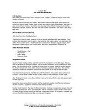
The Globe and World Map
Students explore how to use maps for travel. In this map skills lesson, students read the text, With Love from Gran and discuss the places the character traveled. Students list the names of each city and country on chart paper.
Curated OER
United States Map - Lesson 2 Introduction to Symbols
Students explore the United States using a map. In this map lesson, students discover how to use map symbols in order to read maps.
Curated OER
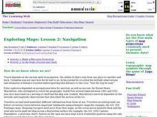
Exploring Maps: Navigation
Learners engage in a instructional activity that is concerned with the concept of navigation while research is conducted with the use of a variety of resources. The information is used to expand their perspective of the applications for...
Curated OER
Landscape Picture Map: Making a Map Grid
Students create a map grid system. In this map activity, students discuss how mapmakers use a grid system to make giving directions easier. Students learn how the grid system works and create a grid system on their landscape pictures.
Curated OER
Places in My World
Second graders explore where they are located on the globe. In this maps and globes lesson, 2nd graders use a map to show where they live and show the cardinal directions. Students identify characteristics of mountains, flat land,...
Curated OER
Chalkboard Challenge: Social Studies Online
If used as an independent review, this presentation could be a quick way for students to study U.S. History facts. Since it only presents a few simple facts, it would not be adequate for a comprehensive review, but a teacher could...
Curated OER
The Underground Railroad
Students explore the Underground Railroad routes. In this map skills and Civil War lesson, students use map and globe reading vocabulary and skills to track the routes the slaves followed from the Bahamas to the United States and from...
Curated OER
Some Things You Need to Know to Read a Map
Students study things the you need to know to read a map and explain location.
Curated OER
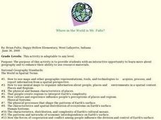
Where in the World is Mr. Fultz?
Students use maps and other geographic resources to learn about their world while problem solving. They read clues each day and use classroom resources to narrow down where the prize is located.
Curated OER
Welcome to My World!
Young scholars use maps to locate information. They read the story, "It Looked Like Spilt Milk", view images of the continents and discuss the various continents. Afterward, they make their own Atlas to record information that they can...
Curated OER
Mapmaking
Young scholars examine the craft of cartography and how the Lewis and Clark expedition created and used maps. They analyze maps, read a handout, create a map, participate in a mini expedition and map out a route based on travel...
Owl Teacher
Introduction to World Geography
Give your learners a thorough overview of what they will learn when studying geography, from the five themes of geography (location, place, environment, movement, and regions) to the tools of a geographer and parts of a map.
Curated OER
United States Map
Students access prior knowledge and locate the North and South Poles on the map. In this mapping lesson, students understand the position of the United States relative to the poles. Students answer questions about the globe.
Curated OER
Globe Skills Lesson 8 Dust Bowl Travelers
Students develop their globe and map skills, In this geography lesson plan, students examine the Dust Bowl as they complete an activity that requires them to plot latitude and longitude.
Curated OER
Globe Skills Lesson 3 Voyage to the New World
Young scholars explore the globe. In this globe skills lesson, students use their knowledge of latitude and longitude to respond to questions regarding Christopher Columbus's maiden voyage to the Americas.
Curated OER
Globe Skills Lesson 4 The Colonial Period
Students practice their map skills. In this Colonial geography lesson, students complete an activity that requires them to locate English colonial locations using latitude and longitude coordinates.
Curated OER
Globe Skills Lesson 1 Some Early American Cultures
Students apply their knowledge of geography. In this geography skills instructional activity, students read brief selections regarding early Americans. Students respond to the questions included in the self-guided map...
Curated OER
Globe Skills Lesson 5
In this map skills instructional activity, students read a text selection about locations during the American Revolution and then respond to 8 fill in the blank questions.
Curated OER
Underwater Mountains & Trenches
Students determine Earth's deepest trench, outline continents, major ocean mountains, and trenches on color-key map using Crayola Erasable Colored Pencils, identify oceans' geographic features, locate significant oceanic features around...
Curated OER
Using MY NASA DATA to Determine Volcanic Activity
Students explore how aerosols are used in science to indicate volcanic activity and how biomass burning affects global aerosol activity. Students access data and import into MS Excel using graphical data to make inferences and draw...
Curated OER
Compass Rose for the New Millennium
Sixth graders are introduced to the concepts of a compass rose and how it used in relationship to reading maps in geography. The lesson is meant to build upon prior knowledge and skills.


