Johns Hopkins University
The Johns Hopkins University: New Mexico State Maps
This site from The Johns Hopkins University Applied Physics Laboratory contains several New Mexico geographical maps. It is very informative. Use this site to view a historical perspective with the 1859 map.
Enchanted Learning
Enchanted Learning: New Mexico
This site has a colorful display of information about New Mexico. It contains a map, pictures, a list of state symbols, and links to related information.
Cayuse Canyon
The Us50: New Mexico
Offers comprehensive information regarding New Mexico history, famous people, cities, geography, state parks, tourism, and historic sites. A fact sheet of information and a quiz are also available.
A&E Television
History.com: The States
Learn unique facts about each American state. You can also read a more in-depth history of each state, watch videos and play a game about all the states.
Kidport
Kidport: United States of America Geography
This site contains a fun way to learn about the states within the United States. Click on the state that you want to learn more about and it provides facts, geographic landmarks, points of interest, major industries, a quiz and more.
CRW Flags
Flags of the World: Clickable Map of the United States
Includes both printable images and fascinating trivia behind the flag of each state. It includes alternate flags used in the past.
Other
Nmbgmr: Resources for Teachers
Locate a variety of maps on New Mexico's minerals and resources, read issues of "Lite Geology," take virtual tours of state sites, and find games, puzzles, and activities for young people.
Other
Nmbgmr: Resources for Teachers
Locate a variety of maps on New Mexico's minerals and resources, read issues of "Lite Geology," take virtual tours of state sites, and find games, puzzles, and activities for young people.
Other
Nmbgmr: Resources for Teachers
Locate a variety of maps on New Mexico's minerals and resources, read issues of "Lite Geology," take virtual tours of state sites, and find games, puzzles, and activities for young people.
Maps of Mexico
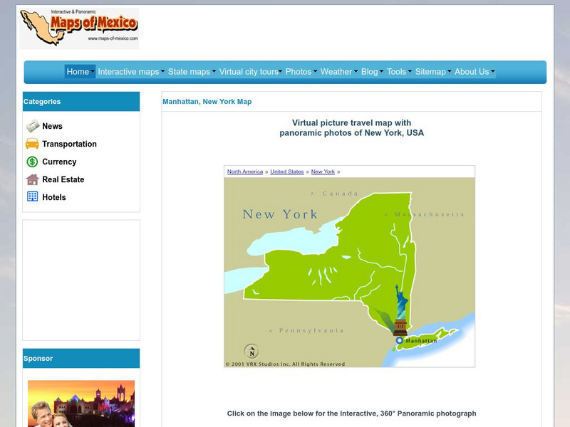
Virtual Picture Travel Map of New York
Click on New York and take a virtual tour of Manhattan. Visit places of interest such as Ellis Island, the Brooklyn Bridge, the Empire State Building, Times Square, Rockefeller Center and the Central Park Zoo. Uses popups.
University of Oregon
University of Oregon: Mapping History: Kansas Nebraska Act: 1854
Toggle back and forth on this interactive map to see how the Kansas-Nebraska Act of 1854 completely negated the Missouri Compromise. Click on the map to see where slavery was permitted before 1854 and then after. Be sure to click on the...
Curated OER
Educational Technology Clearinghouse: Maps Etc: New Mexico, 1904
"New Mexico was ceded to the United States in 1848.
Curated OER
Educational Technology Clearinghouse: Maps Etc: New Mexico, 1903
The Territory of New Mexico before it became a state showing counties, cities, rivers, mountain ranges, and railroads.
Other
Uintah Basin Tah Project: Dominguez and Escalante Expedition 1776
The Dominguez-Escalante Expedition of 1776 was tasked with finding a route overland from Santa Fe, New Mexico to a Spanish mission in northern California. This page provides biographies of the people on this journey as well as the maps...
Curated OER
Educational Technology Clearinghouse: Maps Etc: New Mexico, 1920
The state of Mexico and its counties.
Curated OER
Etc: Maps Etc: United States and the Slavery Prohibition Issue, 1850
A map of the United States and territories at the time of the slavery prohibition issue in 1850, after the Missouri Compromise of 1820. The map is color-coded to show the areas where slavery was prohibited by State Law, slavery was...
Curated OER
Etc: Maps Etc: Mexico and Western North America, 1845
A map of Mexico in 1845, prior to the ceding of the northern territories to the United States in 1846. The map shows the territories of Oregon, Texas, and Central America under Mexican control, and the frontiers of the Missouri and...
Curated OER
Educational Technology Clearinghouse: Maps Etc: Mexico and Texas, 1845 1848
A map of Mexico and Texas from the annexation of the Republic of Texas by the United States (1845) to the end of the Mexican-American War (1848). The map is color-coded to show the territory of Texas in 1845, the territory of dispute...
Curated OER
Etc: Maps Etc: Comparative Areas of the United States and Other Countries, 1872
A map from 1872 of the United States used to illustrate the comparative area sizes of the states to other countries in the world. The map shows state and territory boundaries at the time (Dakota, Montana, Washington, Idaho, Wyoming,...
Curated OER
Etc: The Territory of the United States, 1845 1886
A map from 1886 of the United States showing the territories ceded by Mexico and the acquisition of Alaska. The map is color-coded to show the possessions of the United States, Great Britain, and Mexico at the time, and the Mexican...
Curated OER
Educational Technology Clearinghouse: Maps Etc: The United States, 1890
A map from 1890 of the United States showing the territorial expansion from the original Thirteen Colonies to the states and territories of 1890. This map shows state capitals, railroads, lakes, and rivers. The map is color-coded to show...
Curated OER
Etc: Maps Etc: United States Expansion and the Railroads, 1880
A map of the United States and territories showing the expansion from the formation of the original states to 1880, and the railroad network in 1880. The map is color-coded to show the original states, the states admitted between 1791...


