Curated OER
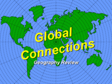
Global Connections Geography Review
In this beginning world geography PowerPoint, students answer basic questions about continents and oceans, as well as land and water that surround or can be found in the United States. Correct responses earn a mark on the interactive...
Curated OER
Geography Terms
In this PowerPoint, students review geography terms. Slides feature illustrations and facts about mountains, hills, islands, deserts, lakes, rivers, oceans, plains, valleys, and forests.
Core Knowledge Foundation
The United Kingdom
Scotland, Northern Ireland, Wales, and England are four countries united by more than a monarchy. Academics explore the geography of the nations that make up the United Kingdom. The resource is broken into six lessons focusing on the...
Curated OER
Map Puzzles
Students make puzzles from world maps, dramatizing how much of the globe is covered by ocean.
Curated OER
Conejito
Second graders investigate the geography, agriculture, and the climate of Panama using the book "Conejito." They listen to a lecture about Panama, listen to the story, and answer story comprehension questions. Students also complete a...
Curated OER
Chinese Jeopardy
Play Jeopardy with this primary level China PowerPoint. The questions are simple and focus on the geography, culture, animals, food, and Inventions of China. There are 5 point levels available for each category.
Curated OER
Where In the World?
In this where in the world worksheet, students determine locations of continents on a world map. In this cut and paste worksheet, students identify continents' locations on a world map.
Curated OER
Oh! The Places I CAN See!
Students explore landmarks around the world. In this world geography and technology lesson, students view world landmarks using a webcam. Students take a virtual field trip during which they zoom in and manipulate three dimensional...
Curated OER
Maps and Globes: Where in the World are We?
Students explore maps and globes. In this introduction to map and globe concepts lesson, students identify features of physical maps, political maps, and globes. Students locate land and water, and recite a poem about the names of the...
Curated OER
Arkansas History Lesson Plan
Students discover the history of their state by working in a group. In this U.S. history lesson, students investigate the state of Arkansas by reading their textbook and participating in art activities. Students discover the geography...
Curated OER
Maps Can Help Us
First graders explore the geography of Montana by analyzing geographic maps of the area. In this Native American reservation lesson, 1st graders discuss the similarities and differences between reservations in the state of Montana....
Curated OER
The 50 States and its Holidays
Though the format of this ELL lesson is confusing (the standards listed are for plate tectonics, yet the objectives are for American geography and holidays), a teacher could glean some ideas from the main idea. Here, pupils complete a...
Curated OER
The Globe and World Map
Students explore how to use maps for travel. In this map skills lesson, students read the text, With Love from Gran and discuss the places the character traveled. Students list the names of each city and country on chart paper.
Scholastic
Owl Moon Teaching Plan
Capture the engagement of young readers with this collection of activities based on Jane Yolen's book, Owl Moon. Following a shared reading of this children's story, the class explores the geography of the American Northeast, creates...
National Endowment for the Humanities
Hopi Place Names
What's in a name? Historians consider the question as they examine places important to the Hopi people and the meanings of their place names. Included worksheets include maps and charts to help class members examine the geography of Hopi...
Curated OER
Cross (Curricular) Fit
Get up and move with a set of cross-curricular activities designed for math, social studies, or science classes. Each physical education exercise is paired with a concept from a different discipline, including the geography of the Mali...
Ed Helper Clip Art
USA States
Looking for a map of the Unites States of America? Look no further than this printable map designed to accompany your geography instruction and to give map skills a boost.
Curated OER
World Map PDF
For this social studies worksheet, 1st graders practice creating the letter "J". They use the example in the lesson plan in order to draw the letters correctly.
Curated OER
U.S. Geography: The Northeast
Students investigate U.S. Geography by creating a map in class. In this natural resource lesson, students create a map of the United States and research the Northeast based on their resources and recyclable materials. Students utilize...
Curated OER
How to Teach Geography with KidPix II
Students use the computer program KidPix II to color a map of the world. For this world map lesson plan, students fill in different colors for different continents that are told to them on the program KidPix II.
Curated OER
How to Teach Geography with KidPix 1
Students create a compass rose. In this geography activity, students create a compass rose using the computer program KidPix 1.
Curated OER
Using the Landscape Picture Map to Develop Social Studies Skills
Enhance your class' geography skills using this resource. Explore a variety of concepts including production and distribution, and people and the environment. Learners make predictions and identify locations on maps. This is a creative...
Curated OER
Our States, My State
Here is a very nice lesson on the shape of the United States, and the shapes of the individual states for your young geographers. They utilize worksheets embedded in the plan to color in a variety of states and to become familiar with...
Curated OER
Where Do Canadians Live?
Students investigate Canadian people by researching the geography of the country. In this world geography instructional activity, students identify locations within Canada with large populations based on their access to waterways....
Other popular searches
- Five Themes of Geography
- U.s. Geography
- China Geography
- Africa Geography
- Mexico Geography
- Canada Geography
- Asia Geography
- France Geography
- Japan Geography
- World Map
- Ireland Geography
- Geography Studies


