Anti-Defamation League
8 Ideas for Teaching National Hispanic Heritage Month
Here are eight ideas to celebrate National Hispanic Month! Scholars have the opportunity to read and discuss literature, include people and events in history, examine art, watch and discuss films, listen to and dance to music, explore...
University of Kansas
Newspaper in the Classroom
Newspapers aren't only for reading—they're for learning skills, too! A journalism unit provides three lessons each for primary, intermediate, and secondary grades. Lessons include objectives, materials, vocabulary, and procedure, and...
Montana State University
Ice in Action
Make your own bite-size glacier! A resource teaches about the formation and melting of ice. Activities include videos, a hands-on activity where your pupils build glaciers, and a photographic analysis to teach individuals the chilling...
Montana State University
Sea Floor to Summit
Who knew that mountain formation could be so entertaining? Leanr how mountains form with a resource on Mount Everest. Activities to guide learning include a simulation, project, videos, coloring activities, and worksheets.
Montana State University
What's the Weather?
How many jackets do you need to stay warm and climb Mount Everest? An informatie resource covers the topic of Mount Everest, the resource helps young scientists discover the difference between climate and weather. Activities include...
NOAA
A Moving Crust
Young scientists piece together the geological puzzle that is the earth in the third and final instructional activity of this earth science series. With the help of numerous multimedia resources and a series of engaging hands-on...
Curated OER
Learn the States and Postal Abbreviations
If you are preparing to cover the 50 states with your class, you don't want to miss this resource. It includes an excellent set of worksheets through which learners practice identifying states from their abbreviations and placing those...
Super Teacher Worksheets
United States of America
Here is the perfect assessment to test your young learners on labeling the 50 states! Each state is given a number on a blank map of the United States, and a second page lists the numbers in order for learners to identify.
Super Teacher Worksheets
State Capital Bingo
Your youngsters will be so excited to learn the capitals of the 50 states with this fun game of bingo!
AGSSS
World Regions
Help your learners to visualize where historical events have taken place around the globe with a map that details the major regions of the seven continents.
SeaWorld
Animal Migrations
Here is a fabulous set of activities for your young scientists. Each instructional activity contains map, hands-on, and game activities that will help the class understand why and how animals migrate from one place to another. First...
Perkins School for the Blind
Beginning Map Skills
Maps can be so much fun, they help you understand spatial relationships, distance between objects, and can foster direction skills. Budding cartographers with visual impairments use the Wheatley Tactile Diagramming Kit to create their...
SeaWorld
Marvelous Manatees
Here is an interesting lesson plan on the manatee for your upper graders or middle schoolers. A game is played where learners work together to complete a successful manatee migration. It's a board game, and all of the game components are...
Desert Discoveries
The Sonoran Desert
Elementary schoolers study the geographic location of the Sonoran Desert. They pay close attention to the characteristics of the plants and animals found in this desert environment. The student handouts embedded in this plan are...
Curated OER
England: Discover a World of Culture and History
England is a very interesting country full of cultural and historical geography. Here is an impressive collection of lessons that will familiarize your students with England's cultural and historical geography. The activities presented...
Curated OER
Map Exploration
Are you looking for a terrific lesson on map activities for your second graders? Then, this resource is for you! The activities range from decoding, to fill-in-the-blank, to read-and-search. There is a website activity related to maps...
Curated OER
Scaling it Down: Caves Have Maps, Too
Measurement and map skills are the focus of this lesson, where students crawl through a "cave" made out of boxes, desks and chairs, observing the dimensions. Your young geographers measure various aspects of the cave and practice math...
Curated OER
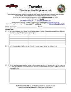
Traveler: Webelos Activity Workbook
This three-page instructional activity is designed to be used by the Weblos of Boy Scouts of America. They are given 13 choices of academic activities that involve the use of maps, geography, math, and money. They must complete five of...
Curated OER
A World of Information
Students analyze data and statistics about countries around the world. They read graphs and charts, color a world map to illustrate the top ten statistics about the world, and write a paragraph to summarize their information.
Curated OER
Great Lakes Homepage for Kids
Here are some outstanding lessons on the geology and history of the Great Lakes. These lessons are divided into Grade 4 -6, and Grade 7 - 8 activities. The activities all use the background information, maps, graphs, data, and Great...
Curated OER
You Are Here
Students map local places and learn to use scale and distance. In this mapping lesson, students map their school and a favorite place. Students recreate their maps showing distance and scale sizes. Students locate their location on a...
Curated OER
The Bear Facts
Students explore various kinds of bears and gather information about them. In this research and habitats lesson, students chart their bear information on large posters with illustrations of their bears. Students map the locations where...
Curated OER
Simulated Air Trip to Seoul, Korea
Students become acquainted with the geography and culture of Korea. In this Korean trip lesson, students view a video about Korea and read about the country. Students sample snacks and possibly learn a Korean phrase as they participate...
Curated OER
Recreate the Race
Learners research and find the route of the Alaskan dog sled race.In this Iditarod race instructional activity students find the checkpoints for the Iditarod on a map. Learners research information in pairs about each one of the...


