Curated OER
Canada, O Canada
Students study the similarities and differences between Canada and the United State in this unit. They examine geography, government and culture as they "travel" through Canada.
Curated OER
Canada: A Land Rich in Beauty and Culture
Third graders in groups research the different regions of Canada. They create a timeline to put the major events of Canada's history in order.
Curated OER
Canada, Our Neighbor to the North
Students obtain knowledge of Canadian geography and history. Students work in groups gathering information to create a brochure on Canada. Students discover how French and British history helped shape Canada as a nation.
Curated OER
Max Knows Mexicao, United States and Canada
Students utilize their map skills to explore the regions of North America. They explore the physical characteristics and climates of the regions. Students label their map and prepare a presentation of their findings.
Curated OER
Who Lives in the Arctic North?
Young scholars study the Arctic North. In this Canada history lesson, small groups of students research and then teach the class about either the plants, animals, humans, or geography in relation to the Arctic North. Young scholars make...
Curated OER
Polar Day: Comparing My Community to a Northern Community
Third graders practice their geography skills. For this Polar Day-themed lesson, 3rd graders use their research skills to compare and contrast the place, regions, and human systems in their community to a Canadian northern polar region...
Curated OER
Nina Bonita: Culture and Beauty
Students read Nina Bonita by Ana Maria Machado. For this reading comprehension/ geography lesson, students recall various parts of the story and create a map of where the rabbit traveled throughout the story. They participate in group...
Curated OER
Nunavut, Our Communities
Students locate the communities of Nanavut on a territorial map and identify community characteristics. They research the online Atlas of Canada
Curated OER
Journey on the Underground Railroad
Students use Indiana and Michigan state road maps to trace a route to Canada from Madison, IN. with the many possible stops along the way. They make a picture book that depicts a runaway slave's journey on UCR.
Curated OER
If These Walls Could Talk: Seeing a Culture Through Human Features
Students read Talking Walls and discuss the walls presented and their importance to the culture. In this geography lesson, students locate and label each country/continent discussed in the book on a world map. Students take a walk and...
Curated OER
Memorable Maps
Students draw an assigned map from memory about the United States or any other region they are studying. In this maps lesson plan, students draw a map from their memory at the beginning of the year, and do the same assignment at the end...
Curated OER
Nunavut, Our Communities
Students research the Online Atlas of Canada to locate the communities of Nunavut. Students examine the geographic area and characteristics of the communities.
Curated OER
Lori Schmidt's Lovely Lesson
Young scholars color code a world map by region to show the different amphibians and reptiles that live there. They discuss the Nile Crocodile, Snapping Turtle, Komodo Dragon, Indian Python, and Lacertidae. When completed, they create a...
Curated OER
Searching the States (or Provinces) Scavenger Hunt
Learners examine information on a particular state or province. Groups of students use the internet to locate facts about an assigned state. They research information such as capital, state song, and major crops. learners report their...
Curated OER
Lights On ! Lights Off! Exploring Human Settlement Patterns
Third graders write informational paragraphs based on the settlement patterns of the United States. In this settlement lesson plan, 3rd graders read about population and how it affects where people settle next.
Curated OER
Cultures of the Continent
Students explore the various cultures of North America. They examine the differences and similarities between an immigrant's homeland and the culture of Central Kentucky. Students discuss strategies to make the transition easier for...
Curated OER
Map Skills: Explorers, Continents, and Oceans
Third graders use a software program to make and label a map of the world. On the map, they locate the seven continents, oceans and the countries of Europe. They also draw the routes of Christopher Columbus, Juan Ponce de Leon and...
Other
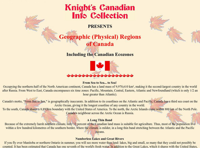
Knight's Canadian Info Collection: Geographic Regions of Canada
Canada is divided into distinct regions, each with a very different landscape and climate. Geographic and ecozone maps as well as text information is included.
Other
Canadian Centre for Energy Information: Canada Fueled by Resources [Pdf]
In this teaching unit for Grades 4 and 5, students learn about Canada's petroleum resources, the impact on the environment from our use of them, and how the geography Of Canada affects things like population distribution and regional...
Other
Polar Continental Shelf Project for Kids!
Visit this resource to learn about the geography, wild life, plants and people of Polar Continental Shelf in Canada's Arctic. Students can take a quiz to see how much they have learned.


![Canadian Centre for Energy Information: Canada Fueled by Resources [Pdf] eBook Canadian Centre for Energy Information: Canada Fueled by Resources [Pdf] eBook](https://d15y2dacu3jp90.cloudfront.net/images/attachment_defaults/resource/large/FPO-knovation.png)
