Curated OER
An Audio Travel Album
Students interview someone who has recently visited a country that students are studying. They use iPod and voice recorder to record the interview and use iPhoto to review and orgainze the interviewee's photos of the trip as well as any...
Curated OER
How Do We Make Wise Decisions In Our World?
Third graders participate in a case study and use their problem solving skills to address the solution to a given situation. They consider how to survive in a foreign country, make economic decisions, and determine wise decisions for...
Curated OER
Urban and Rural Communities
Students discuss similarities and differences of urban and rural communities. In this urban and rural communities lesson, students compare urban and rural communities using a Venn Diagram. Students examine maps of each type...
Curated OER
Maps In Our Everyday Lives
Young scholars break into groups and complete a chart about information on maps of their hometown.
Curated OER
Thematic Unit on Cats
Students discover in which climates the cats of the world live in. They review the different climates of the world and use maps and globes to help them locate continents.
Curated OER
Max Knows Mexicao, United States and Canada
Students utilize their map skills to explore the regions of North America. They explore the physical characteristics and climates of the regions. Students label their map and prepare a presentation of their findings.
Curated OER
Lesson Design Archaeology- U.S. Map
Students examine the U.S. map and identify cultural areas. In this archaeology lesson, students locate cultural areas on the U.S. map and fill in the proper locations.
Curated OER
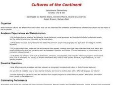
Cultures of the Continent
Students explore the various cultures of North America. They examine the differences and similarities between an immigrant's homeland and the culture of Central Kentucky. Students discuss strategies to make the transition easier for...
Curated OER
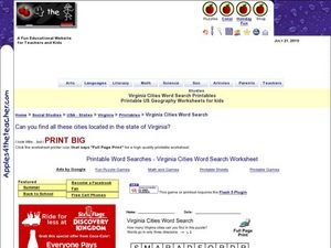
Virginia Cities Word Search
For this Virginia cities worksheet, students read the names of ten cities in the state of Virginia. Students find the city names in a word search puzzle.
Curated OER
Organization of a Territory, Map Elements
Third graders compare printed and online maps and use proper geographic terminology to answer questions.
Curated OER
Origami Paper Fun
Students explore the art of Origami. They listen to various stories about Japan, create Origami shapes by following step-by-step directions, sing Japanese songs, locate Japan on a map, and take a quiz.
Curated OER
Read a Transportation Story
Third graders research the building of a transcontinental road. In this railroad history lesson plan, 3rd graders discuss past and present transportation. Students look at historical photos and compare and contrast photos from today.
Curated OER
Comparing Three Religions: Islam, Judaism, and Christianity
Students work together in groups to research either Judaism, Christianity, or Islam. Once the research is complete, they share their information with the other groups in the class. They complete a worksheet on rituals and holidays in...
Curated OER
Jambo Means Hello: An Introduction To Swahili
Students gain an appreciation for Swahili as a language spoken in many parts of Africa. They share and illustrate words from their own culture using English and Swahili and others to create a word quilt.
Curated OER
HUMAN/ENVIRONMENT INTERACTIONS: CLIMATE
Students explore the various global climates and apply cultural adaptations of the peoples in various zones due to climate.
Curated OER
Human Features of Our Community
Students investigate the human factors that create a community. They conduct research using a variety of sources. Students then create dioramas that depict a typical scene found in a community.
Curated OER
Haiku
Pupils study various forms of poetry and the culture of Japan. They are introduced to a haiku- a traditional form of poetry and an art form in the Japanese culture. They write a haiku and create a student haiku booklet with the classes...
Curated OER
Where Is That Place?
Learners choose a school in their state to compare their weather to. They also describe the differences between country, state, and a city. They can make flashcards to help them remember the important terms and concepts.
Curated OER
Children in the United States and Japan
Students locate Japan on a map or globe and describe the relative location of Japan. They use the Internet to investigate cultural characteristics of children in the United States and in Japan. They use a Venn Diagram as an...
Curated OER
Discovering Dinosaurs: Planning your Summer Vacation
Students utilize the features of the Atlas of Canada website to plan an imaginary vacation from Victoria, British Columbia to Drumheller, Alberta.
Curated OER
Our State Road Trip
Students take a virtual tour of the country of China instead of a state. Using the Internet, they examine the differences between a political and physical map and use latitude and longitude to locate specific places. They also research...
Curated OER
The Silk Roads Big Map
Pupils generate oversized rendition of the Silk Roads from Europe to East Asia, apply elements such as political and topographic features, the Silk Roads, products of the regions, and the routes of key travelers.
Curated OER
Understanding Treaties: Students Explore the Lives of Yakama People Before and After Treaties
Students role play positions in the Walla Walla treaty negotiations. They identify the significance of the Sacred Circle and other beliefs of the Native Americans. They discover the complications the tribes faced after the treaties...
Curated OER
Geological Development of Indiana and the Movement of Peoples Across the State
Students are introduced to the geological development of the state of Indiana. Using the internet, they visit the U.S. Geological Survey and locate the earthquake zones in the state. In groups, they locate and identify the energy...
