Curated OER
Things That Stick Out Or: How To Find Your Way Around on a Map
Students explain the meaning of and recognize the map outlines of a peninsula, an isthmus, and a cape.
Curated OER
What's In a Name?
Students examine the origins of the names of U.S. states, focusing on names that were derived from Native American words. They are provided with lists of the names of the 50 states, and then research online or in library resources the...
Curated OER
Using Different Kinds of Maps
Third graders explore the landforms and population diversity. They read maps and examine geographic terms. Students create their own map of the United States and answer questions about the location of people. After exploring the map, 3rd...
Curated OER
Port Portrait
Students research and identify exciting places to visit and plan an imaginary cruise, using maps, to study other languages, climates and geography and draw scenes from your trip. They make a portrait of your group waiting to leave one...
Curated OER
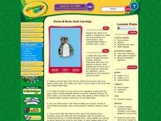
Stone & Bone Inuit Carvings
Students research information about Canadian Inuit history, geography, and culture. They study many forms of art created by the Inuit, including sculpture with stone, animal bones or teeth, and other items found in their northern Canada...
Curated OER
Masks of Africa
Students explain the purpose of masks to various cultures in Africa. They recognize the conceptual patterns used to create African masks and illustrate their understanding by creating their own masks
Weston Wood
Joseph Had a Little Overcoat
Create a cross-curricular learning experience based on the children's book Joseph Had a Little Overcoat with this collection of learning activities. Starting with a class reading of the story, children go on to learn about the...
Curated OER
Exploring and Comparing Other Communities
Third graders search TDC database for images of physical geography maps, weather maps, natural resources maps, and old travel brochures. They create a new travel brochure of an area of their choice using the information they gathered.
Curated OER
Identifying Continents and Oceans
Students locate and identify the four major oceans and the seven continents on a world map. They use an unlabeled world map and compass rose to describe relative locations of the continents and oceans.
Curated OER
Come With Me To Africa
Students are introduced to the geography of the continent of Africa. They conduct Internet research, explore maps and identify animal species and a variety of human cultures for a sampling of African countries. Students create graphs,...
Curated OER
Creative Expressions: Making Puppets
Students are introduced to the very basic geography of Indonesia. In groups, they examine the different types of puppets and decide on which one to make. They travel between various stations to complete their puppet in which they use...
Curated OER
Moving Voices
Students create films in which they depict to others what they want them to know about their community or school. They create films with different themes including social studies, geography and government. They work together to produce...
Curated OER
Bringing Illinois into the Curriculum
Students of all ages are introduced to the geography of Illinois. Depending on the grade level, they participate in different activities which allow them to discover Illinois in the past and present. They examine the animals and...
Curated OER
State Your Mission
Students explore state history and geography that correspond with classroom lessons.
Curated OER
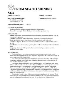
FROM SEA TO SHINING SEA
Identify agricultural products grown in each region of the country.
Discuss how geography affects what is grown or raised in a particular area.1. Hand out a copy of the two activity sheets "Food From Sea to Shining Sea" to each student....
Curated OER
Around the World in 17 Days
Students examine geography while studying the 2006 Winter Olympics. Students keep track of the winners of each Olympic event by finding the results using the Internet or by reviewing the newspaper and discuss the country the medalist...
Curated OER
Communities
Students examine the similarities and differences between rural, suburban, and urban communities. They read about type of community in their social studies textbook, analyze the differences between Tokyo and Chicago, and complete a chart...
Curated OER
Egypt: Ancient Culture
Students access a variety of Internet resources regarding Ancient Egyptian culture, society, and geography. They view photos and timelines, take a virtual tour of the Nile, play interactive games,and watch video clips about modern Egypt.
Curated OER
Japan and Art
Students discuss the art of Japan as it relates to Japanese culture and geography and then create individual postcards reflecting the information learned from the instructional activity. This instructional activity includes possible...
Curated OER
Desert Postcards
Students research characteristics of deserts. They present their findings in small groups to the class. Students utilize information learned about desert biomes, geography of the route of the Niger, and expeditions in their writing.
Curated OER
Candidate Debate; Making Informed Voting Decisions
Students study the concept of what it means to be an informed voter who makes conscientious voting decisions based on significant information. In this making informed voting decisions lesson plan, students are introduces...
Curated OER
State Research
Students apply previous knowledge of the United States to label a classroom map and then work independently to complete an online scavenger hunt. This lesson is intended for an upper-elementary classroom studying American History and/or...
Curated OER
Country/State Flip-Book
Students produce books on a chosen state or country. The pages are cut to be the shape of the area being studied, and students creatively design each page to reflect the information being presented.
Curated OER
Quick-Sketch Artist Tips on Mind Mapping the Urban Landscape
Students interpret maps. They also create mental maps of regions in which they are studying. Students then explain the historical or cultural significance of map features orally or in written form. Students take a walking field trip...
Other popular searches
- World Geography Studies
- Geography Studies the Sea
- Geography Studies Rocks
- Elementary Geography Studies
- Geography Studies Cd Rom
- Social Studies Geography
- Social Studies Us Geography
- Social Studies and Geography
- Social Studies Maps Geography
