Curated OER
Mapping the Most Common U.S. City Names
Students discuss the most common U.S. place names. They map the locations of U.S. cities with the most common names and use an atlas, or an online map tool such as MapQuest or Yahoo Maps.
Curated OER
North Dakota Vocabulary Word Jumble
In this online interactive North Dakota worksheet, students examine 20 state-related words in a word bank. Students use the word bank to unscramble 20 sets of letters. This worksheet may also be printed for classroom use.
Curated OER
Ohio Cities Word Jumble
In this online interactive Ohio worksheet, students examine 10 cities in a word bank. Students use the word bank to unscramble 10 sets of letters. This worksheet may also be printed for classroom use.
Curated OER
Rhode Island Word Jumble
In this Rhode Island worksheet, students unscramble words that represent Rhode Island landmarks and history. Students unscramble 20 words.
Curated OER
You Can Find It!
Pupils locate different places including U.S. cities using longitude and latitude coordinates. In this longitude and latitude lesson plan, students locate 10 different locations.
Curated OER
Then and Now in Las Vegas
Third graders examine the history of Las Vegas. In this Las Vegas lesson, 3rd graders learn about the history of the city as they listen to a lecture. Students then create a Las Vegas timeline and acrostic poem.
Curated OER
Seas, Gulfs and Bays
Students define gulf, bay, and sea. In this bodies of water mapping instructional activity, students locate seas, gulfs and bays and explain how they knew which body of water it was.
Curated OER
Iowa Cities Word Jumble
In this Iowa worksheet, students unscramble the letters in ten words to spell the names of cities in Iowa. There is a word bank to help.
Curated OER
Be a Viking!
Students research the history and culture of the Vikings. Students complete a variety of lessons in which they use maps, discussion, lecture, vocabulary lists, worksheets and quizzes to investigate the culture and traditions of the Vikings.
Curated OER
Virginia: The Land and its First Inhabitants
Young scholars review the five geographical regions of the state of Virginia. Using a map, they locate and label Virginia, surrounding states and the crops grown in the area. They present their map to the class and complete a worksheet...
Curated OER
Lesson Design Archaeology- U.S. Map
Students examine the U.S. map and identify cultural areas. In this archaeology lesson, students locate cultural areas on the U.S. map and fill in the proper locations.
Curated OER
Colorado
Third graders complete a variety of activities to increase their knowledge of Colorado. They make leafprints, read and listen to stories, write fiction, make collages, participate in discussions and invite their parents to come and see...
Curated OER
Journey on the Underground Railroad
Students use Indiana and Michigan state road maps to trace a route to Canada from Madison, IN. with the many possible stops along the way. They make a picture book that depicts a runaway slave's journey on UCR.
Curated OER
Our Native Americans
Students complete a unit of lessons on Native Americans. They label maps, list resources the Native Americans used in their daily lives, create an original short story, define key vocabulary, and develop a model of something that...
Curated OER
Antarctica
Third graders become familiar with Antarctica, the Earth's southernmost continent, by researching its environment and inhabitants. They reference maps, conduct Internet research, identify animals, create graphs and write reports.
Curated OER
Using the Four Main Directions in the Classroom
Students utilize a compass to determine where North is in the classroom. In this direction lesson, students label the four main directions. Students locate features in the classroom and describe the directions to get to them. Students...
Curated OER
Virginia Cities Word Search
For this Virginia cities worksheet, students read the names of ten cities in the state of Virginia. Students find the city names in a word search puzzle.
Curated OER
Maps In Our Everyday Lives
Young scholars break into groups and complete a chart about information on maps of their hometown.
Curated OER
This Land is Your Land - Delaware
Learners determine how land was divided and marked for boundaries in the early days of settlement in Delaware. Students mark out land on the playground according to the methods used by the early settlers. Learners write a description of...
Curated OER
George Washington Teaches Map Directions
Learners follow teacher given directions, either oral or written to plot points on a grid to create a profile of George Washington. They apply cardinal and ordinal directions to find the points on the grid.
Curated OER
Walking on Maps
Students are introduced to the various types of maps and their functions. As a class, they play a game similar to twister to review map concepts. They answer questions about the map and use the internet to view larger maps of the world.
Curated OER
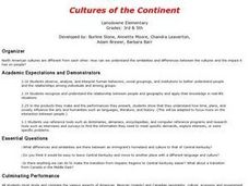
Cultures of the Continent
Students explore the various cultures of North America. They examine the differences and similarities between an immigrant's homeland and the culture of Central Kentucky. Students discuss strategies to make the transition easier for...
Curated OER
All About Me Museum
Learners investigate the concept of self-esteem and image with the creation of a personal display of items of significance. They put together a project composed of pictures and writings to describe themselves and are assessed according...
Curated OER
I Can Compass, Can You?
Young scholars discover how to use geographic tools. In this compass lesson, students identify cardinal directions by appropriately using compasses along with a number of various maps.
Other popular searches
- World Geography Studies
- Geography Studies the Sea
- Geography Studies Rocks
- Elementary Geography Studies
- Geography Studies Cd Rom
- Social Studies Geography
- Social Studies Us Geography
- Social Studies and Geography
- Social Studies Maps Geography

