Curated OER
Origami Paper Fun
Students explore the art of Origami. They listen to various stories about Japan, create Origami shapes by following step-by-step directions, sing Japanese songs, locate Japan on a map, and take a quiz.
Curated OER
The Plains Indians
Students have a better understanding of another culture other than their own. This help them to see that there were other people living in this region before us.
Curated OER
Continent Adventure
Students review or learn information regarding the 7 continents on our planet. It is also a fun movement and fitness activity.
Curated OER
Rhythmic Travel Around the World
Students explore and play rhythm sticks while listening to songs from around the world. They locate the countries of origin on a map, and tap their rhythm sticks to the beat of the music.
Curated OER
Organization of a Territory, Map Elements
Third graders compare printed and online maps and use proper geographic terminology to answer questions.
Curated OER
"Where in the World is my School?"
Students learn new vocabulary and discuss what GPS is and does. They locate their school using the equipment.
Curated OER
Thematic Unit on Cats
Students discover in which climates the cats of the world live in. They review the different climates of the world and use maps and globes to help them locate continents.
Curated OER
The Lorax and Forest Park
Students read The Lorax by Dr. Seuss and identify situations where there is a risk to the community. During a class discussion, students predict types of liter they will find in a park. Students take a field trip to the park to collect...
Curated OER
Environmental Issues in the Polar Regions
Young scholars list environmental problems they are familiar with and check the ones they think affect the polar regions, and they research and answer questions about environmental issues affecting the polar regions. Students discuss...
Curated OER
Where Should We Put a Store?
Students analyze population data. They convert population data into simple density maps to help make decisions about their world. They select the best location for a school store based on population density. They present their maps...
Curated OER
Soneka's Village
Students read a letter about the characteristics of the Maasai culture. After identifying them, they discuss how to live a pastoralist way of life. In groups, they discuss the roles of men and women in the country and what it might be...
Curated OER
Four Main Directions
Students describe directions using a globe for north, east, south and west. In this mapping lesson students identify the north and south pole. Students understand the importance of the equator and the Prime Meridian. Students explain how...
Curated OER
Resources and Trade Flow
Students plan for a service project. In this service lesson, students determine the materials they will need to complete their service project. Students discuss possible trade flows into the United States.
Curated OER
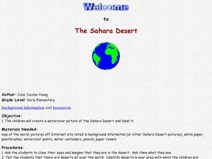
Welcome to the Sahara Desert
Students explore their artistic skills. For this Sahara Desert lesson, students use the Internet to research the Sahara and paint a watercolor picture depicting the desert.
Curated OER
Iowa State Quarter
In this Iowa worksheet, learners are given the state quarter of Iowa and answer questions about its symbols. Students answer 4 questions about the symbols.
Curated OER
Maryland word jumble
In this Maryland worksheet, students unscramble the words that represent Maryland's history. Students unscramble 20 words that represent the state of Maryland.
Curated OER
Massachusetts word jumble
In this Massachusetts worksheet, students unscramble words that have to do with Massachusetts history. Students unscramble 20 words.
Curated OER
Michigan Quarter Worksheet
In this online interactive Michigan quarter instructional activity, students examine a Michigan quarter picture and answer 4 questions regarding it. This instructional activity may be printed for classroom use.
Curated OER
Missouri State Quarter Printable
In this online interactive Missouri quarter worksheet, students examine a Missouri quarter picture and answer 4 questions regarding it. This worksheet may be printed for classroom use.
Curated OER
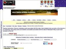
Nebraska Vocabulary Word Jumble
In this online interactive Nebraska activity, students examine 20 state-related words in a word bank. Students use the word bank to unscramble 20 sets of letters to match the terms in the word bank. This activity may also be printed for...
Curated OER
South Carolina State Quarter
For this South Carolina worksheet, students analyze a picture of the state quarter for South Carolina. Students use the information on the coin to answer five questions.
Curated OER
Utah State Quarter
In this online interactive Utah quarter worksheet, students examine a Utah quarter picture and answer 4 questions regarding it. This worksheet may be printed for classroom use.
Curated OER
Read a Transportation Story
Third graders research the building of a transcontinental road. In this railroad history lesson plan, 3rd graders discuss past and present transportation. Students look at historical photos and compare and contrast photos from today.
Curated OER
Mapping It Out
This PowerPoint provides information about maps. Students discover the functions of legends, compasses, indexes, and scales on maps. Two resources links are provided, however one of them is broken.
Other popular searches
- World Geography Studies
- Geography Studies the Sea
- Geography Studies Rocks
- Elementary Geography Studies
- Geography Studies Cd Rom
- Social Studies Geography
- Social Studies Us Geography
- Social Studies and Geography
- Social Studies Maps Geography


