Curated OER
Rivers Run Through It
Using a relief map of New York State, learners answer questions about the distance between different cities, identify bodies of water, and more. First, they discuss vocabulary related to the Hudson River area. Then, they complete a...
Curated OER
Aquatic Ecosystems
Students study the diversity of marine life and their habitats. In this aquatic ecosystems lesson students complete a lab activity and experiment.
Curated OER
Veni, Vidi, Vici
Students participate in a Roman festival to complete a unit on Roman Civilization. In this Roman Civilization lesson plan, students learn about Cleopatra, Julius Caesar, the Mediterranean Region, and more. Students share what they...
Curated OER
Nunavut, Our Communities
Students locate the communities of Nanavut on a territorial map and identify community characteristics. They research the online Atlas of Canada
Curated OER
Edible Resource Maps
Third graders work in groups to create an edible resource map showing locations of at least five resources in the United States. Students research on the internet different regions and the resources that are found in those areas. They...
Curated OER
Africa: Its People And Places
Students plan a pretend trip to the African continent choosing from several prominent places such as the Nile Delta, Mount Kilimanjaro or the Sahara Desert . In small groups, they form transportation, accommodation, packing, itinerary...
Curated OER
Rome Comes to Third Grade
Students explore the world of Ancient Rome in this thirteen lessons unit. the rise and fall of the Roman Empire is probed. The ideals that inspired the people's sense of purpose are developed in these lessons.
Curated OER
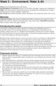
Environment: Water & Air
The introduction to the instructional activity mentions a sailor's limited capacity to store drinking water on his ship. Pupils then set up an overnight experiment to remove freshwater from salt water by distillation. There is a math and...
Curated OER
Mountain Magic: Identifying the Basic Physical Characteristics of Mountains
Students read about and identify on maps the physical characteristics of mountains. For this mountains lesson plan, students also write about the characteristics using personification.
Curated OER
Lights On ! Lights Off! Exploring Human Settlement Patterns
Third graders write informational paragraphs based on the settlement patterns of the United States. In this settlement lesson plan, 3rd graders read about population and how it affects where people settle next.
Curated OER
Leapin' Landmarks: Locating 10 Man-made Landmarks Around the World
Third graders label continents, oceans, and major mountain ranges on maps and use the maps to write an informational report about landmarks. In this landmarks lesson plan, 3rd graders write about 1 major landmark.
Curated OER
Kid Maps: Reading and Creating Maps with Human Characteristics
Young scholars look at maps. In this map lesson, students listen to the book My Map Book by Sara Fanelli and they see the difference between human characteristics (buildings, etc.) and natural characteristics (rivers, etc.)....
Curated OER
Appreciating The World By Learning About Landforms
Children can learn about the Earth's landforms and develop a greater appreciation of our world.
Digital Dialects
Digital Dialects: Geography Games: Oceans and Seas
Study a labeled world map showing the oceans and seas, and then try to match their names to their locations on a blank map.


