Curated OER
World Map and Globe-Equator, North Pole, and South Pole
Students identify the Equator, North Pole, and South Pole on a map. In this geography lesson, students use a world map and circle the North and South Pole. Students locate the Equator on a globe and use a map marker to highlight it.
Curated OER
World Map and Globe - Four Main Directions
Students study the four main directions on a map. In this map lesson, students locate the North and South pole, and learn the four cardinal directions. They use the compass rose on a map to help with the directions. (Map is not included...
Curated OER
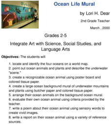
Ocean Life Mural
How many oceans can you name? First, have learners try to name as many oceans as they can, and then have them locate and identify the oceans on a world map. They create a recognizable ocean animal using poster board and tissue paper....
Curated OER
Establishing Borders: The Expansion of the United States 1846-48
Students investigate how the United States acquired land after the Revolutionary War ended. In this establishing borders lesson, students use maps to identify territories acquired by the US and the states that later developed. Students...
Curated OER
Geography at Home: Buildings We See Around Us
Students explore architecture. In this architecture lesson, students examine photographs of buildings in their communities. Students collaborate to discuss their observations regarding the buildings. Students record their observations in...
Curated OER
Mary Todd Tours the World
Pupils analyze how distinguishing another culture encourages us to respect each other. They research culture and all its avenues, recognizing and comprehending the relationship between people and geography. Ultimately, they can apply...
Curated OER
Symbols of Our State: Arkansas
Here are a series of lessons designed to assist early elementary learners to discover the symbols of Arkansas. They learn about the state flag, insect, state seal, state bird, flower, tree, and gem. A booklet (emedded in the plan), is...
Curated OER
N is for Natural State
For any pupils who live in the state of Arkansas, this would be a fabulous educational experience to help them get to know their state better. Through the use of activities in literature, art, mathematics, science, social studies, and...
Midnight Martian
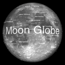
Moon Globe
Not just a simple globe of the moon, this interactive version allows you to choose lighting according to the location of the sun, views from different positions on Earth, and more! Satellite images and topographic data have been combined...
Curated OER
Abigail Adams: Integrating Social Studies and Language Arts
Third graders increase reading strategies while learning about Abigail Adams and her role in history. In this Abigail Adams instructional activity, 3rd graders read about the American Revolution and Abigail Adams using all the balanced...
Curated OER
People Change the Landscape
Students examine ways in which humans have brought change to the natural environment. In this ecology and literacy lesson, students listen to the book Island Boy by Barbara Cooney. Students observe and define map-reading vocabulary as...
Curated OER
Virtual Vacation
Students are members of teams traveling and exploring the Pacific States Region of the United States via the Internet. Each team travels virtually to its destination to become experts on geography, history, tourism, nature, and economics.
Curated OER
U.S. States - The Midwest States
In this geography and math worksheet, students complete the simple addition equations and match the sums to the colors. Students then color the Midwest States by the color code.
Curated OER
Geography Matters
Learners understand that elements of the geography curriculum are important aspects of certain jobs. In this geography/career lesson plan, students discuss how geography can be useful in certain jobs, listen to guest speakers whose...
Curated OER
Maps that Teach
Students study maps to locate the states and capital on the US map. Students locate continents, major world physical features and historical monuments. Students locate the provinces and territories of Canada.
Curated OER
US Geography, The Blues
This instructional activity enables teachers to use blues styles and performers to think about various geographical regions of the United States. By studying different blues styles from the Mississippi Delta, Texas, and the Piedmont...
Curated OER
The Last Great Race
Third graders identify and discover why the Iditarod race is done each year. They explore the historical significance of the Iditarod. Students also use web sites to research related topics, i.e. diseases (diptheria), geography of...
Curated OER
Chinese Lion Dance
Students celebrate the Chinese New Year and listen to the story behind the Chinese Lion Dance. In this Chinese New Year lesson, students research the geography and culture of China. Students create puppets, dance the Lion...
Curated OER
Paper Mosaics
Third graders read the story "Pompeii...Buried Alive." They locate Italy on a world map and define the term artifact. Students conduct an artifact dig on the playground. Students study the characteristics of mosaics and their...
Curated OER
My Important Place
The story of Chief Joseph and the Nez Perce Indians of Oregon is told here. Pupils are shown pictures of the ancestral lands of the Nez Perce, and they learn about how they were forced to leave it. Students complete an essay which...
Curated OER
A Tale of Two Quarters
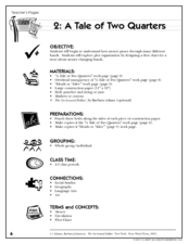
Have your class use the life of a quarter to understand and design plot and flow charts. They read the book, The Go-Around Dollar, think about how their teacher got her quarters that day, then create a flow chart. They have to show how...
Curated OER
Internet Fact Hunt at the "Fact Monster" Web Site- May #4
In this Internet fact hunt worksheet, students access the "Fact Monster" web site to answer 5 multiple choice questions. They answer US history, science, literature, and geography questions.
Curated OER
Canada, O Canada
Students study the similarities and differences between Canada and the United State in this unit. They examine geography, government and culture as they "travel" through Canada.
Curated OER
Linkages
Learners identify examples of linkages between places. They explain that communication and transportation are forms of movement and know that most of the goods and products in our daily lives are produced and manufactured in places...
Other popular searches
- Us Geography
- Canada Geography Land Use
- Us and Canada Geography
- Us Geography Climate
- Us Geography Skills
- Usa Geography Map Skills
- Us Geography Pdf
- Us Geography Scavenger Hunt
- Us Geography Northeast
- Us Geography Activity
- Us Geography Slavery
- Us Cultural Geography


